To this day, no one really knows where the Vallum began. . . .
This massive ditch formed a buffer zone to the south of Hadrian’s Wall. Like the Wall, the Vallum was built running east to west, but it did not occupy the space between Pons Aelius and Segedunum — a later extension of the Wall.
This what Collingwood-Bruce said about the start of the Vallum:
“The Vallum is supposed to have proceeded from the southern rampart of the station of PONS AELII, and to have run up Westgate Hill parallel with the Wall. In the days of author’s youth it was to be seen at the back of the houses on the left hand of the road, about half way up the hill.”
Handbook to the Roman Wall (1863)
Central Newcastle has been so heavily built on over so many centuries that the course of the Wall and its features are always going to remain something of a mystery in this principal area.
Collingwood-Bruce’s supposition of the Vallum extending directly from the fort, where the Keep stands today, may not be accurate given the precipitous and defensible geography of what would have been a promontory in ancient times. What if the Vallum started a little west of the Roman fort, even someway up Westgate Hill, as he saw it?
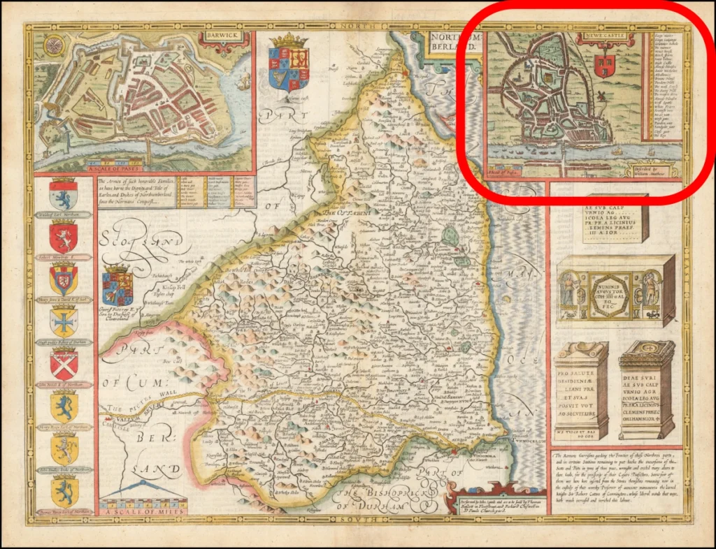
John Speed’s Plan of Newe Castle As Described by William Matthew (1611)
Looking at the oldest map of Newcastle might provide a tantalising clue as to where the Vallum actually began.
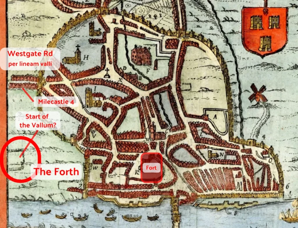
The Forth
The Forth was an 11-acre stretch of common that occupied the space outside the town wall between Westgate Road and the river. It was where where people would meet and mingle and where various sports were played. It must have been a very pleasant spot, but inevtably it became built over as the town expaned and the railway industry thrived.
The Speed Map above shows the area before it was enclosed by a fence in 1654 and later by a stone wall in 1681.
In medieval times the Forth was probably, given its name (frythe), largely wooded. When the trees were cleared to create the common, perhaps the ditch of the Vallum was so boggy and inaccesible that it was fenced off and left alone, as we see it enclosed on the map.
Where Is This Spot Today?
Approximately between Forth Street and the Centre for Life. That is, near the western end of Central Station and directly south of Milecastle 4 — where the Newcastle Arts Centre is located. Basically a little west of the location of the Whitefriars Tower.
Never miss an article. Enter your email or give our FB page a like
No air-built castles, and no fairy bowers,
But thou, fair Tynemouth, and thy well-known towers,
Now bid th’ historic muse explore the maze
Of long past years, and tales of other days.
Pride of Northumbria!—from thy crowded port,
Where Europe’s brave commercial sons resort,
Her boasted mines send forth their sable stores,
To buy the varied wealth of distant shores.
Here the tall lighthouse, bold in spiral height,
Glads with its welcome beam the seaman’s sight.
Here, too, the firm redoubt, the rampart’s length,
The death-fraught cannon, and the bastion’s strength,
Hang frowning o’er the briny deep below,
To guard the coast against th’ invading foe.
Here health salubrious spreads her balmy wings,
And woos the sufferer to her saline springs;
And, here the antiquarian strays around
The ruin’d abbey, and its sacred ground.
Jane Harvey
From ‘The Castle of Tynemouth. A Tale’ (1806)
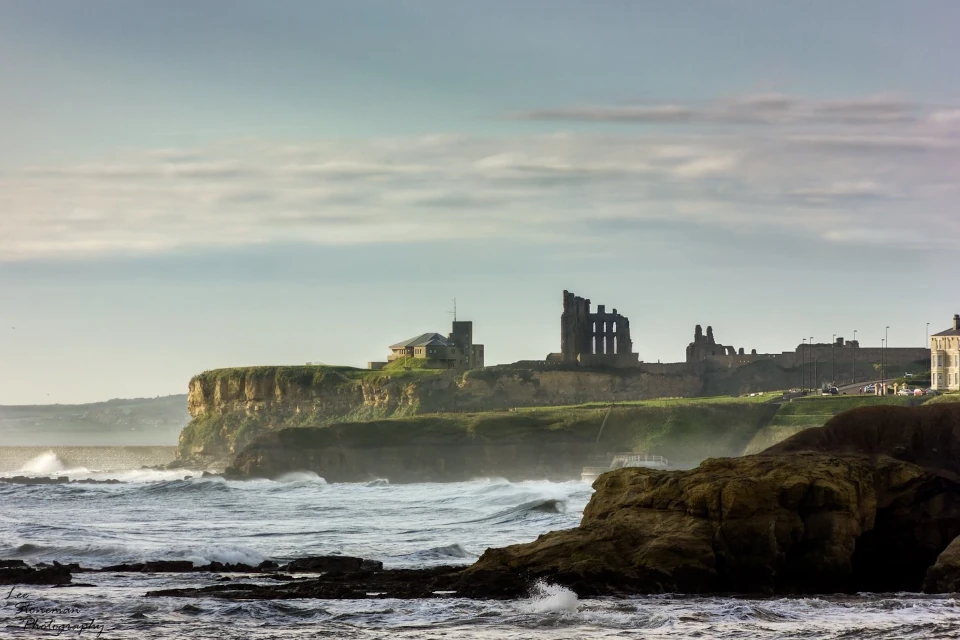
Photograph: Lee Stoneman
Photograph: Lee Stoneman
No air-built castles, and no fairy bowers,
But thou, fair Tynemouth, and thy well-known towers,
Now bid th’ historic muse explore the maze
Of long past years, and tales of other days.
Pride of Northumbria!—from thy crowded port,
Where Europe’s brave commercial sons resort,
Her boasted mines send forth their sable stores,
To buy the varied wealth of distant shores.
Here the tall lighthouse, bold in spiral height,
Glads with its welcome beam the seaman’s sight.
Here, too, the firm redoubt, the rampart’s length,
The death-fraught cannon, and the bastion’s strength,
Hang frowning o’er the briny deep below,
To guard the coast against th’ invading foe.
Here health salubrious spreads her balmy wings,
And woos the sufferer to her saline springs;
And, here the antiquarian strays around
The ruin’d abbey, and its sacred ground.
Jane Harvey
From ‘The Castle of Tynemouth. A Tale’ (1806)