Jack Crawford: From Press Gang to Hero of Camperdown

Few Sunderland heroes have a story as extraordinary as Jack Crawford. As HMS Venerable was pounded by enemy fire at the Battle of Camperdown in 1797 and her colours were shot away, Crawford climbed into the rigging to raise the flag once more, rallying the fleet and helping secure one of the Royal Navy’s greatest victories.
George Washington’s Noble North East Lineage
George Washington’s ancestors lived for centuries at Washington in County Durham, before one branch emigrated to Virginia, ultimately giving rise to the man who led the American Revolution.
Craster Harbour Loading Bins — A Forgotten Feat of Engineering

When most people think of Craster they picture kippers, the harbour and Dunstanburgh Castle. Few realise that for many years it was also a thriving industrial port exporting thousands of tons of whinstone to help build Britain’s roads.
The History of Shipbuilding in Sunderland and its Wartime Zenith
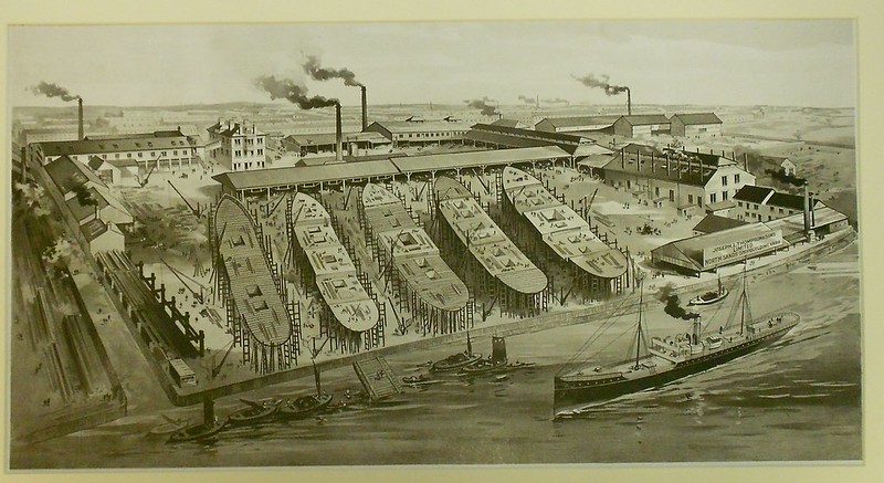
As the Victorian age came to its end, Sunderland was internationally recognised for the quality and the technical advancement of its ships. Its industrial capability would prove crucial in the wars that were to come.