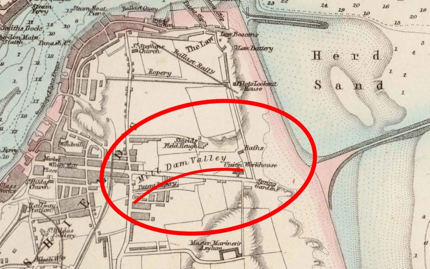
Beneath the busy modern landscape of South Shields lies a forgotten natural feature: a river called the Mill Dam Creek but also known as the Branin River. This creek flowed from Mill Dam, next to Customs House today, out to the sea near North Marine Park and the Pier Head. This effectively made the Lawe an island until the creek became clogged up, dried out and eventually built over.
The Mill Dam Creek served as a southern boundary for South Shields. It’s clear that both the Romans and the early-medieval Anglo-Saxons valued the defensive nature of the creek, building one of the most important forts in the country as well as one of the first monasteries within its bounds.
The channel played a vital role in the development of the town, both as a waterway and a habour, and once it was dammed with ballast, the Mill Dam formed a bridge between the north and south reaches of the early town that clung to the riverside and clustered around the Market Square.
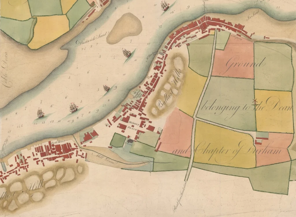
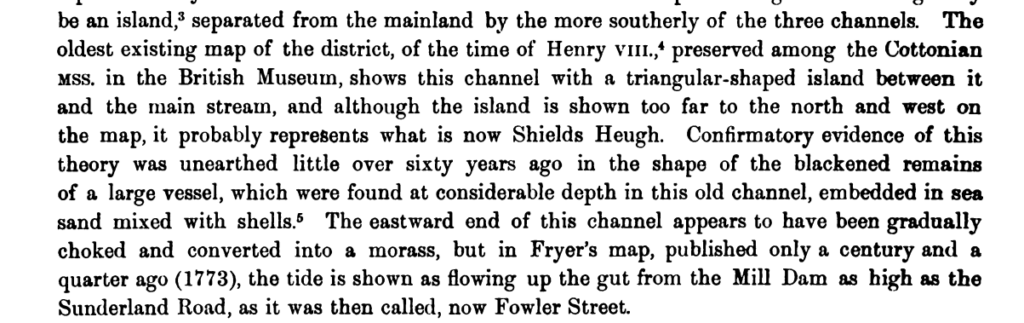
You can see from the 1773 Fryer Map that the creek doesn’t extend to the thoroughfare of Fowler Street. A second bridge point is shown from St Hilda’s churchland, closing off a tidal pool which may have served as a fish weir. The Mill Dam Creek was also, as the name suggests, used for powering two mills and this must be why it was called the Branin River, as its main purpose was the grinding of grain into bran and flour.
So important then, was the creek as a resource that it forms the base of the first industrial activity in South Shields, with coal mining also evident on the south bank where the pit wheel now stands above Asda carpark.
If you stand on the long sloping escalator when exiting Asda and look out across the huge carpark, you really get a feel for the valley nature of the Mill Dam Pond. Imagine what it must have looked like all those centuries ago…
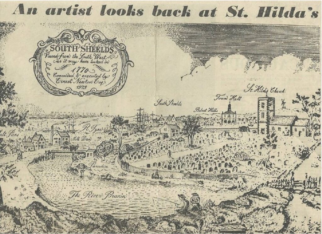
Remarkably, this second image printed in Shields Gazette in 1973, depicts exactly the same era as the Fryer Map.
The Mill Dam Creek disappeared prior to industrial times, backfilled in 1816 by unemployed troops following the Napoleonic Wars apparently at the behest of the Corporation of Newcastle. Where they asserting control over a potentially rival port?
Maybe the filling up was ordered because the creek became too foul. It would have been an easy place to dump waste to be washed out by the tide. In Newcastle, from the 1500s to the 1800s we see from Sandhill to High Bridge the gradual filling in of the Lort Burn, the town’s key medieval artery, as it posed too great a hazard as an open sewer.
Maybe the Mill Dam Pool was not fouled up at all and was a pastoral place, but expansion and ballast simply enveloped it, leaving St Hilda’s as its own little island among the bustling growth of the town.
At any rate, deltas of big rivers do habitually silt up, and this too occurred in the main Tyne channel particularly at two points forming the treacherous sand bars at the entrance, but also at shoals such as the Dortwick Sand visible on the map. The enormous Herd Sands that today constitute the Littlehaven Beach but back then linked to the Sandhaven, not only partially choked the Tyne entrance, but probably duned and covered much of the seaward outlet of the Mill Dam Creek, and this had likely been the case for much of history.
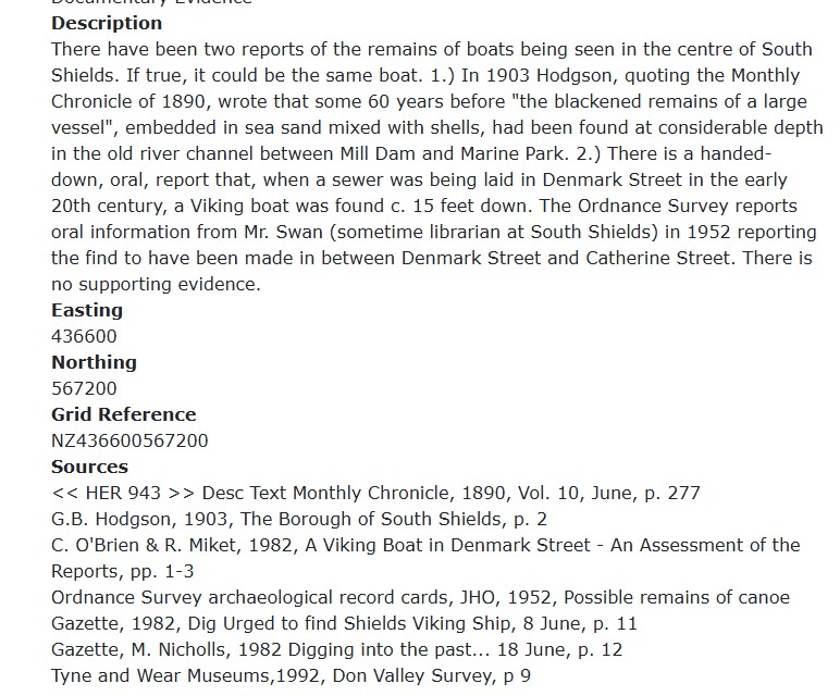
Another fascinating fact about the Mill Dam Creek is that in the 19th century much of the eastern end of the creek was covered by Denmark Street, where the Denmark Centre is today. In the 1830s, while building the street, a Viking longboat was discovered on or beside what was originally the river bed. The creek clearly went further inland than is shown on the Fryer Map.
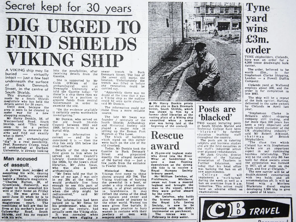
A further twist in the story! From Janice Blower on X:
“The story emerging that it’s actually under the site of the old multi-storey car park in Mile End Rd (now the Jobcentre). It’s said it was found during construction of the car park in the 1960s… and fragments of it were taken to the Town Hall for storage but were subsequently lost.”
Do you know any more about this lost river that was so important to the early growth of South Shields?
Never miss an article. Enter your email or give our FB page a like
No air-built castles, and no fairy bowers,
But thou, fair Tynemouth, and thy well-known towers,
Now bid th’ historic muse explore the maze
Of long past years, and tales of other days.
Pride of Northumbria!—from thy crowded port,
Where Europe’s brave commercial sons resort,
Her boasted mines send forth their sable stores,
To buy the varied wealth of distant shores.
Here the tall lighthouse, bold in spiral height,
Glads with its welcome beam the seaman’s sight.
Here, too, the firm redoubt, the rampart’s length,
The death-fraught cannon, and the bastion’s strength,
Hang frowning o’er the briny deep below,
To guard the coast against th’ invading foe.
Here health salubrious spreads her balmy wings,
And woos the sufferer to her saline springs;
And, here the antiquarian strays around
The ruin’d abbey, and its sacred ground.
Jane Harvey
From ‘The Castle of Tynemouth. A Tale’ (1806)
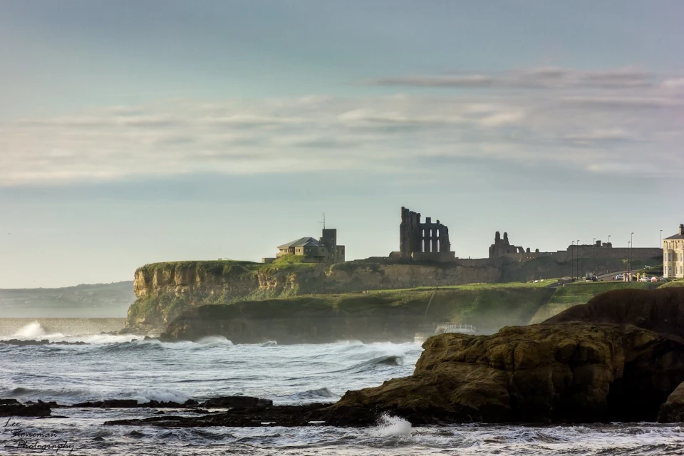
Photograph: Lee Stoneman
Photograph: Lee Stoneman
No air-built castles, and no fairy bowers,
But thou, fair Tynemouth, and thy well-known towers,
Now bid th’ historic muse explore the maze
Of long past years, and tales of other days.
Pride of Northumbria!—from thy crowded port,
Where Europe’s brave commercial sons resort,
Her boasted mines send forth their sable stores,
To buy the varied wealth of distant shores.
Here the tall lighthouse, bold in spiral height,
Glads with its welcome beam the seaman’s sight.
Here, too, the firm redoubt, the rampart’s length,
The death-fraught cannon, and the bastion’s strength,
Hang frowning o’er the briny deep below,
To guard the coast against th’ invading foe.
Here health salubrious spreads her balmy wings,
And woos the sufferer to her saline springs;
And, here the antiquarian strays around
The ruin’d abbey, and its sacred ground.
Jane Harvey
From ‘The Castle of Tynemouth. A Tale’ (1806)