By Crasterfarian
This site has many posts about various Roman remains in Northumberland. I think it;s important to help put some of this into context within the wider Roman Empire, its province of Britannia and us unruly Northumbrian radgies.
Most know that Hadrian’s Wall was built under direct instruction of the Emperor himself between Newcastle (it didn’t end at Wallsend for another 8 years) and Bowness-on-Solway, after Hadrian’s visit to Britannia at around 120 AD. There are lots of theories about why it was built, but only one written record. This came from Hadrian’s writer at the time. The great man was supposed to have said it was built ‘to separate the Romans from the Barbarians’.

Pretty straightforward stuff and there are pages of info on the web about it: the legions, centurial stones, dedications of sections of Wall, which cohorts were stationed where, who built what bit, associated temples and deities, when it was burned, re-built and refurbished, etc. All this information blinds and confuses people and the ordinary individual gets swamped and bogged doon like a chariot wheel in clarts on Haltwhistle Moor. Personally, I lose interest because at the age of 52, I don’t have the time or the space in my heed to retain all that INFO.
Amongst all those dates, long names and bloody Roman numerals, a lot of people miss the events and construction projects that matter. Once you understand some of the context, then it all becomes clearer. You can, if you wish, add the boring bits later so you can impress ya mates in the local mansio while you’re eating ya packet of otters’ noses, drinking mead and hoying pilum at a board on the wall. Hey, I know! Let’s call it darts…
Anyway, long before Hadrian set a hobnailed sandal in Britannia, there existed another frontier across Northumberland.
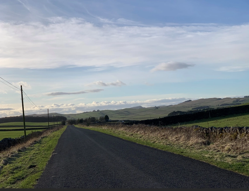
The Road as It Is Today
Stanegate is an old Northumbrian word meaning ‘stone gate’ or ‘stone road’. The Romans will have had another name for it, but that, as far as we know, has been lost to the mists of time. This demarcation line was laid down by possibly one of the greatest military minds in history, some say even better than Caesar himself, a man most have never heard of.
Gnaeus Julius Agricola
He was the man who decided to draw a line over the northern part of the country and divide the Romans from the Barbarians. Well, when I say Barbarians, I mean us lot.
He commissioned the road to be built between the brand spanking new fort at Corstopitum (Corbridge) all the way over to where Carlisle Castle now sits, atop the Roman fort of Luguvalium.
‘Hang on Crasterfarian, are you saying that a demarcation line across the country wasn’t Hadrian’s idea?’
Aye, that’s exactly what I’m saying. Forty years before Hadrian’s bright idea, Agricola had done it.
There were forts along the length of this road, 10 in total, some large, some just fortlets. Some of these you will have heard of and may even have visited, like Vindolanda or Magnis at Greenhead. There are theories that it reached as far as Wrekenton where it branched off Cades Road, which runs up from the Humber and linked the forts on that side of the country like Concangis (Chester le Street), Arbeia (South Shields) and Pons Aelius (Newcastle).
The Stanegate was designed as a rapid deployment route for troops and cavalry. They would spill from the forts and fortlets and use the road to get stuck right in to any local uprising.
When Hadrian’s Wall was designed and built, the forts were deemed not necessary, yet they added them after, in some cases while the Wall was still being constructed. Bits of newly built Wall, turrets, and in some cases, milecastles, were demolished to make way for the forts. I bet that stung the Roman sense of OCD as it buggered up the milecastle-turret-turret-milecastle format.
Exploring the Route
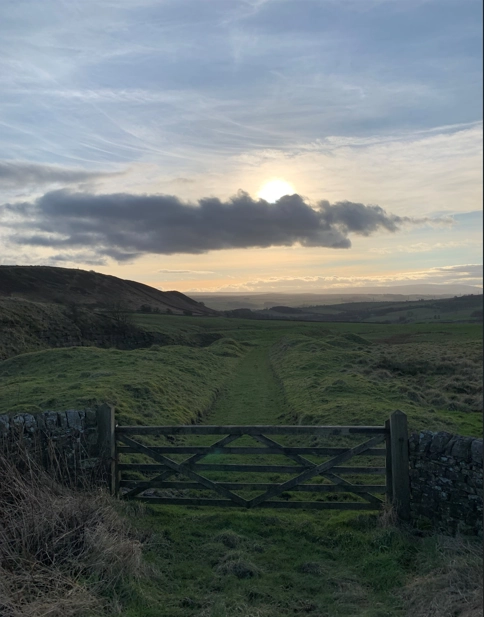
If you drive along the A69 in Northumberland from Newcastle, when you get to the turn off for Fourstones, just past Hexham, head up that way and follow the road to Newbrough, and you are on this most ancient of roads. Almost 2000 years of whatever mode of transport was in at the time, have picked their way along this route. You then traverse Northumberland along a limestone ridge just south of the Military Road where you can literally follow the trails of the legions and share the vision of the man who saw this road in the moss and heather, Agricola.
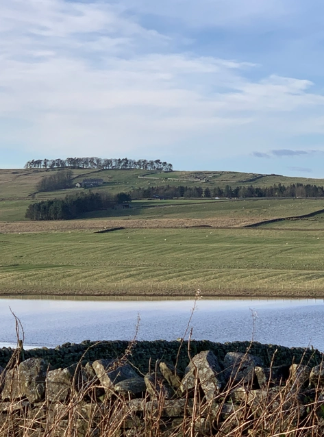
You’ll pass Grindon Lough on the right, one of several fresh water lakes in this area of the county and also a protected Site of Special Scientific Interest. Take note as you pass, you can see Housesteads up on the Whin Sill ridge.
Eventually you reach Crindledykes Lime Kiln on the right-hand side. If you follow that road down, it leads you to the Military Road. The Stanegate continued and dropped down into Vindolanda.
The lime kilns are here for one reason alone, well apart from making lime, they are situated on the Roman road for easy access, as these roads would have been vital after the Roman occupation.
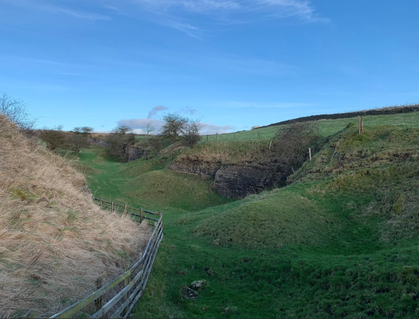
Here, the quarries the legionaries used to build Hadrian’s Wall exposed the limestone and did most of the initial hard work. You can see in the pictures above where the latter-day lime makers cut a waggonway down the hill to make dragging the stone up to the kiln easier.
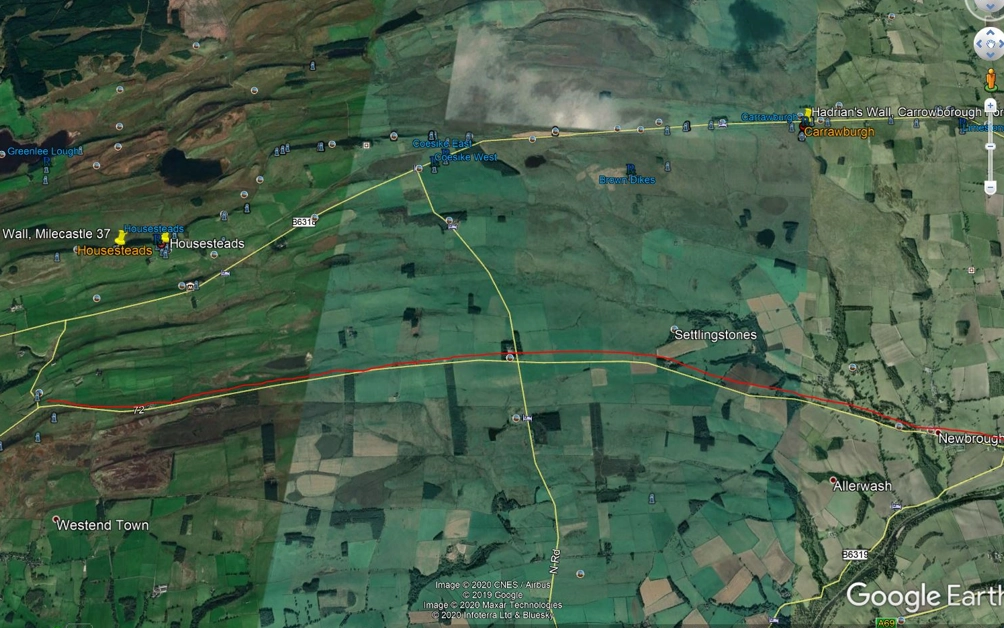
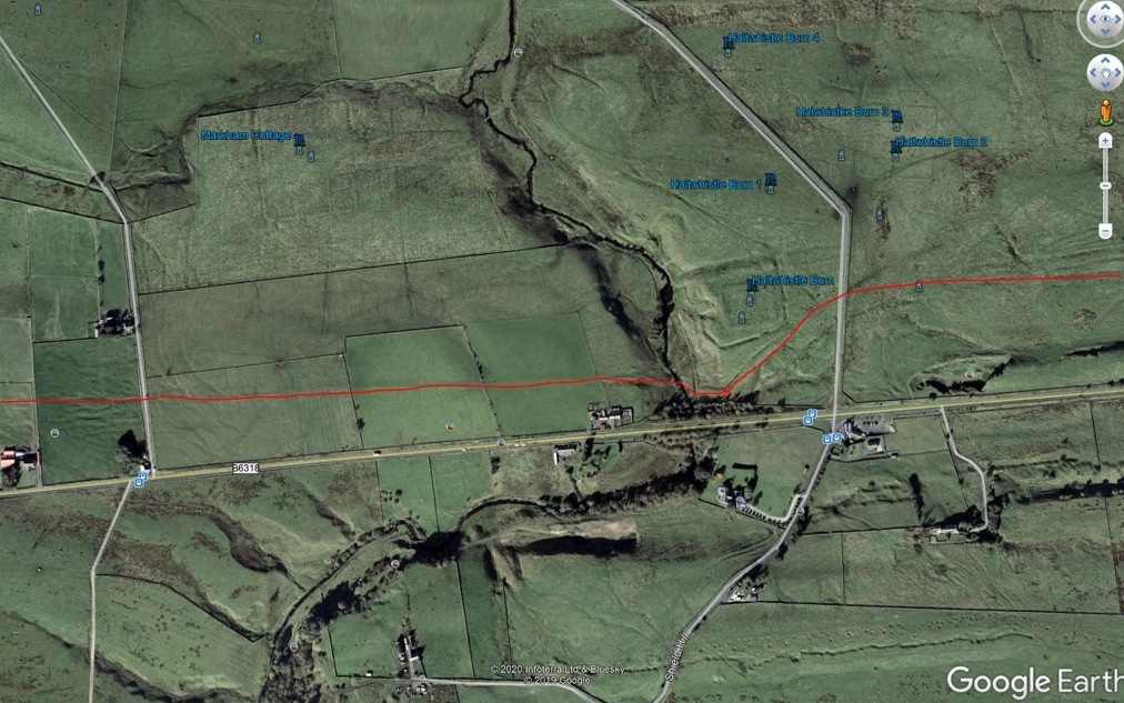
The image below shows how the Stanegate continues further to the west near the Milecastle Inn at the Cawfields Quarry turnoff. You can clearly see it crossing the Haltwhistle Burn and the little fortlet that guarded this crossing point. On Google Earth you can follow it pretty much all the way from Fourstones across to Magnis Fort (Carvoran), which is where Agricola struck out from in 80-81 AD to take on the tribes from the Highlands of Scotland at the battle of Mons Grapius. But that’s for another day…
So now you know why and when the Stanegate was built.
To recap, a brief timeline:
- 43 AD Claudian invasion.
- 60-61 AD Boudica hoyed her dummy oot her chariot and burned Colchester and St Albans to the groond and ended up getting a right howking off the legions.
- Mid-to-late 70s AD Stanegate built.
- ~81 AD Agricola hands the northern tribes their own backsides on a plate at the fabled battle of Mons Grapius, somewhere up near the fort of Inchtuthil in Scotland.
- ~108 AD The 9th Legion gan missing, probably in Northumberland, almost certainly wiped out while they tried to steal stottie cakes and sheep from the lads at either Rothbury, Alnwick or Wooler.
- 122 AD Hadrian’s Wall was started.
That will do for now as it’s enough to take in for one post.
With love from the Crasterfarian xx
Also likely that, as with many of the key Roman arteries, the Stanegate eixsted in pre-Roman times as a cross-country route used by cattle drovers.