By Crasterfarian
I mek nee wonder people get lost up here, mind, it’s a canny place to lose yourself. But howay, three places that sound almost identical, what’s that all aboot?
Ellingham, Eglingham, Edlingham
In Northumberland we’re good at driving past history without really noticing it, and the bits we do notice, like Edlingham Castle, are the standout features. However, these places are often far older than the visible remains. In the case of the three similar sounding villages, we’re going to discuss, the clue is in the name.
Beautiful villages in their own right, familiar names on road signs, rarely given a second thought as we pass by.
Yet all three sit within ten miles of one another. All share the same ending. And all belong to a very specific moment in time.
That shared suffix, ‘ingham’. Coincidence? Ah divvn’t think sei.
These places are not Viking. Not Norman.
They are early Anglo-Saxon, rooted firmly in the age when Bernicia was still being carved out of the land by Germanic settlers in the fifth and sixth centuries. These western Europeans arrived gradually into a landscape where Roman political authority had collapsed in the early fifth century.
I say collapsed, rather than “when the legions left Albion”, because I genuinely believe many Roman soldiers remained here after imperial administration withdrew. By the early fifth century plenty will have been locally born, with families in and around the forts and towns of Britannia.
Some of the Arthurian legend, in my mind, may echo one such Romano-British cavalry officer who raised a warband to protect his people from incoming groups. I talk about that in. ‘The Banna Theory: Arthur, the Last Roman Warlord’
Anyway, back to my point.
The Old English construction of these place names is simple but powerful. The syllables tell their own tale.
Ingas meant the people of, or the followers of, a named ancestor.
Ham meant a homestead, estate, or settlement.
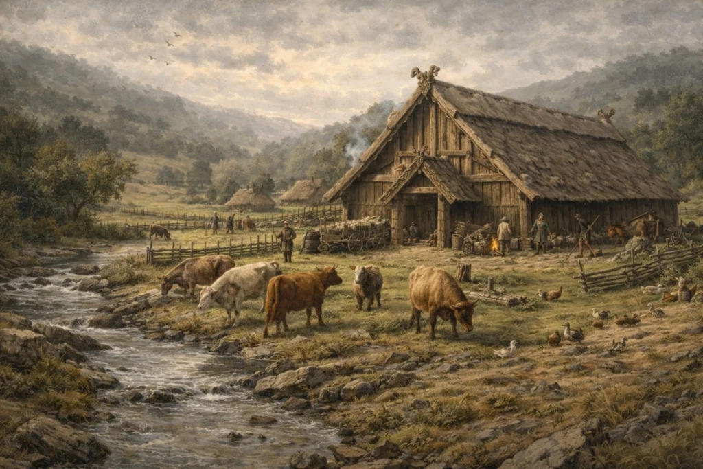
So Ellingham, Eglingham and Edlingham are not just places, they are communities, extended kin groups clustered around a hall. They would have carved out a living from fertile land and rivers full of fish.
Each was likely the home of a named group, the people of Ælla, Ecgla, and Eadl. The exact roots are debated by place name scholars, but all are personal names of early Anglo-Saxon type. They would have been bound to a local lord and ultimately to the Bernician king.
These names point us to the late sixth and early seventh centuries, the period just before and during Northumbria’s so called golden age.
They call it a golden age. In some ways it was. But if you read the history, it was also a time of upheaval for ordinary folk, warrior kings, shifting alliances, and backstabbing that was sometimes quite literal.
They must have heard tales of Roman times around the fire from the scops, pronounced “shops”, meaning bards, and wondered how Britannia had once been united under one rule.
Maybe it’s simple. Without the heel of the Roman sandal and the control of the legions, regional powers filled the gap. Small farming communities became armed communities, protecting what they worked.
Looking back, it’s rare for more than a few peaceful years to pass without some warlord like Penda of Mercia or Cadwallon ap Cadfan trying to take what others had built, forcing men into the most brutal conflicts.
The Big Picture
When we think of early Northumbria in modern terms on the tourist routes, we think of the big bits, the places people talk about all the time like Bamburgh, Lindisfarne, Ad Gefrin, kings and saints, battles, glory, a battle between a new Christian God and Thunor, but a lot of the ordinary folk, like us, are forgotten. It’s not that they aren’t important enough to discuss, it’s just there is very little to see and all tourists are visual.
I want to look beyond the modern and see what was there before.
Northumbrian, Bernician royal power did not rest only on the coast or at the grand summer palace of Ad Gefrin.
Families were sustained inland too, on good farming land, by communities capable of feeding themselves and providing men when called to the fyrd (the local warband) by their king.
Built alongside the old roads of the Romans, many of which have still to be discovered or have long since been ploughed out over the centuries.
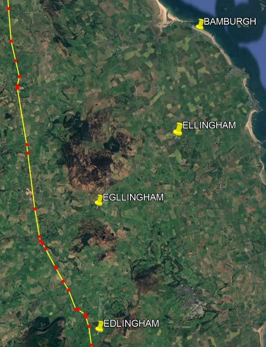
In the first image at the top of this piece, you can see where the Devil’s Causeway crosses Northumbria, detailed in yellow.
There will have been link roads to the coast from this to provide access for the Romans and the farmers.
Taxes of grain were a vital part of the Roman protection racket and having link roads to the coast would have allowed the easy passage of corn to the ships of the Classis Britannica.
There is a curious direction change in the Devil’s Causeway road due west of Bamburgh where it is possible a road struck out to the coast.
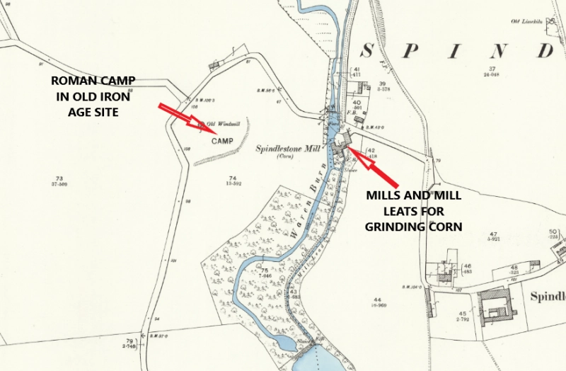
Buddle Bay will have provided shallow drafted vessels access far inland, much further than we can imagine today and based on continuation of use, the more modern mills at Waren Mill, Spindlestone and Bradford may have been mills in Roman times.
Let’s also not forget that post ice age, Bradford Kaims to the west of Bamburgh was a glacial esker ridge, a long narrow gravel ridge left by meltwater beneath an ice sheet. A Neolithic causeway was discovered just to the east of the main east coast railway line. It’s thought that the lower areas of land here will have resembled the Norfolk Fenlands.
There are also thought to be Roman remains between Outchester, even the name is Roman in origin, and Spindlestone. The partial Roman settlement is still visible at Spindlestone. The Roman Classis Britannica (navy) wanted to have a port here as the site was already in use as a dock and port by the Bronze and Iron Age.
The Road to Hell at Heavenfield
Ellingham, Eglingham and Edlingham, all Saxon names, sit exactly where you would expect such estates to be, inland, in the hinterland to the fortress at Bebbanburg.
They would have been undoubtedly linked to the fortress by a road or track network.
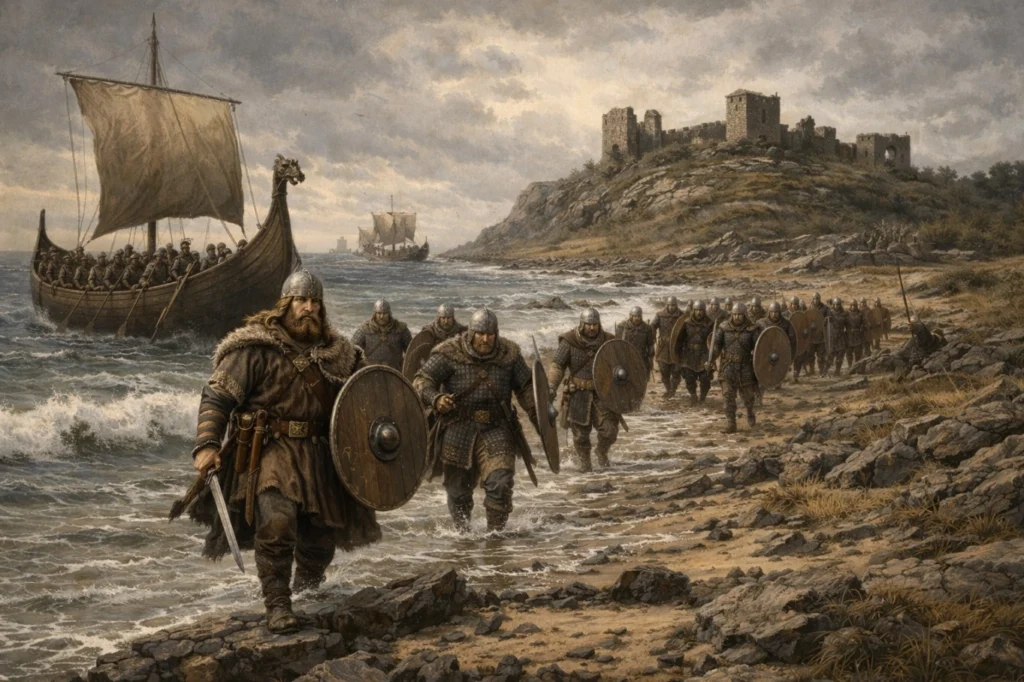
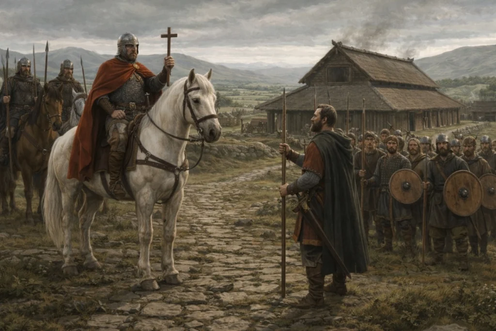
The army of Oswald of Northumbria would have marched along this route, passing through the villages, picking up more men for the fyrd to fight at the Battle of Heavenfield.
They were not isolated farmsteads but organised and productive kin territories quietly underpinning royal authority.
Edlingham
Edlingham is the key piece of the puzzle.
The village lies almost directly on the line of the Devil’s Causeway, the Roman road that branched off Dere Street just north of the Port Gate at Hadrian’s Wall and headed northeast towards the Tweed estuary and the ancient ford there.
The Saxons did not build roads in the north.
They inherited them, walked them, fought along them and ruled from them. They provided avenues for armies to meet in days before communication. Without using the roads they may have wandered around for weeks looking for each other to have a scrap.
The Devil’s Causeway would have been a military artery, a royal route and a mustering line.
Edlingham is exactly the sort of place where men could be gathered to answer the call of the fyrd.
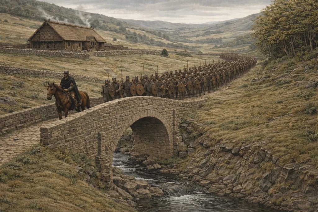
Edlingham would also have been roughly a day’s march from Bamburgh. Oswald’s army may have stopped there on its first night as it marched from the fortress at Bebbanburg, supplied and moved quickly.
I also believe the Romans had a bridge here. There is a ford but also, further upstream, what could be the remains of a Roman bridge over the Edlingham Burn allowing easy crossing for an army.
Roman infrastructure beneath the feet. A Saxon kin estate layered on top. A later medieval castle and church anchoring the same ground. Power rarely relocates far, it accumulates. The castle does not erase the Saxon estate, it replaces it. The Saxon estate does not ignore the Roman road, it depends upon it.
When Oswald marched south in 634 to face Cadwallon he did not command a standing army. He had his hearth warriors and his oath sworn thegns who would have also brought their own warriors, but in the wider context of an army that had to be raised, maybe even on the march.
He relied on the fyrd, free men, farmers and small landholders. Some would have possessed byrnie mail shirts, helms and perhaps even long seaxes, but many would have been unarmoured, carrying spears, shields and whatever tools could serve as weapons, billhooks, axes and other farm implements pressed into service.
Places like Ellingham, Eglingham and Edlingham are exactly the sort of communities that would have answered that call. They would have provided spearmen and shieldmen, food and livestock, men fighting not for abstraction but for land, kin and survival.
Drawn together along inherited Roman roads, these local forces could be concentrated and directed with speed.
Ellingham, Eglingham and Edlingham are not sleepy backwaters with quaint names.
They remind us that Northumbria’s golden age was not built only by kings and saints, but by ordinary gadgies fighting for their very survival, bound by kinship, walking ancient roads and answering the call to arms to protect all they had. Losing meant death and the rape and murder of their families by the invading army: genocide.
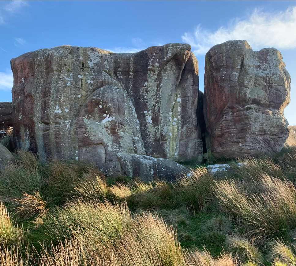
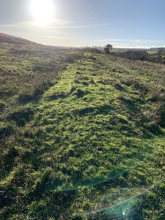
Caller Crag and the Devils Causeway caught in the autumnal sun
The story of our earliest Northumbrian forebears is still out there.
It’s in the land and the names of places.
Their story runs in all our veins, veins like the roads the Romans left behind, the strands and sinews that join us all together. We are tough, hard working people whey kna how to scrap when the call comes. Every village in the county, no matter the size, has a war memorial that graphically represents that toughness and the will to do our duty.
Just gan have a look man, it’s all out there under our very feet. People lived, fought, loved and died on these very lands.
Mek a flask and a few sarnies. Gan walk up to Caller Crag and have a sit. Look down at Edlingham and the Roman road as it tips itself owa the side of Rimside Moor and careers doon into the valley to the burn and onward to the Tweed.
With Love from the Crasterfarian XX
super articles
Yet another fabulous and fascinating article, many thanks for sharing your thoughts