By Crasterfarian

No matter where you grow up, there are placenames that are synonymous with the area. Some are correct to the OS mapping, but some are local names.
As you grow, you just accept them as they are; your parents and grandparents called these sites by that name, so you do too, and it’s not very often you question them, or I hadn’t until very recently…
The Reason
About a month ago someone posted an aerial view of the coastline between Craster and Dunstanburgh Castle. I commented and said, “That inlet closest to the camera is called Liverpool Hole,” and thought nothing more of it until someone replied to my comment and said, “Why is it called Liverpool Hole when it is so far from there?”
With that in mind, I went down a rabbit hole… not Liverpool Hole, but a real journey into the origins of these names. It also reminded me of the infamous beach party at the Cushat, pronounced locally as the Cusha, one August bank holiday weekend in the late 1980s. After drinks in the Jolly, we headed along to Nova Scotia for a bonfire. Wor Michael staggered home in the wee small hours and walked off the edge into Liverpool Hole; when the path veered right, he just kept going.
The irony was that his fitha, the legendary Lesley Crate, then in the Coastguard, had to rescue his own son. I got the blame, of course, as he had been drinking with me. We went out at 11am on the Saturday, and he did not get home until the Wednesday, in a plaster cast. Anyway… back to the rabbit hole.
They are names we have grown up with, walked past, fished besides, jumped off, swam in and probably almost killed ourselves doing. Names repeated without ever really asking what they mean.
But placenames are rarely meaningless.
They are scraps of an older landscape: words left behind by farmers, fishermen, sailors and generations of people who knew every rock, hill, field and hollow along this coast.
Walk north from Craster towards Dunstanburgh and you are effectively walking through a fossilised Northumbrian vocabulary.
Liverpool Hole
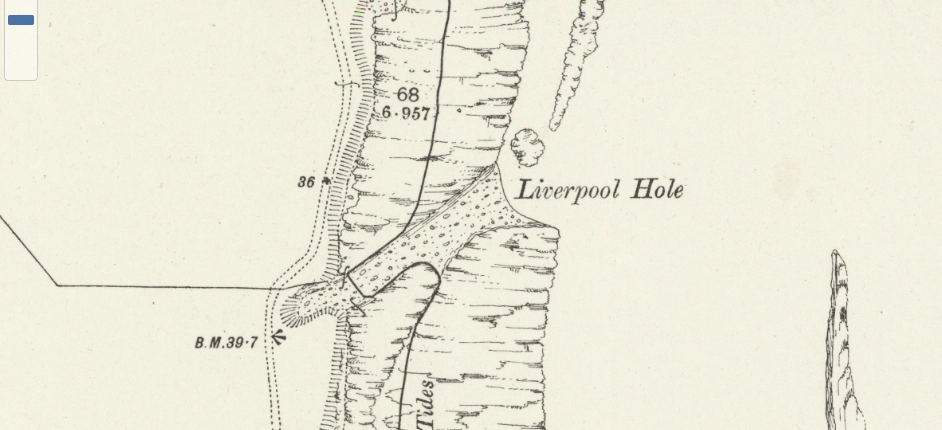
Liverpool Hole, the closest to Craster in the first image of this piece, is a gaping chasm in the Whin Sill, one that interrupts the straight-ish line of the coastal path. I’m sure some geologist will tell me what type of feature it is; I’m guessing a fault line that’s been eroded by millions of years of pounding by the North Sea.
Its strange name has puzzled me for some time. Why Liverpool? Surely it must now be changed to Cratey’s Snare, or Micky’s Leap, Crate’s Cataclysm…
The strongest possibility is that the name preserves the memory of a vessel associated with Liverpool that was wrecked here. Coastal features were very often named after wrecks, vessels, people or events remembered locally long after the details themselves had disappeared.
It would explain why a tiny rocky inlet on the Northumberland coast should carry the name of a city more than 150 miles away.
The exact vessel which gave Liverpool Hole its name still needs to be nailed down, but the name itself may be the last surviving memorial to a wreck and an event once well known in the village.
Update, this may be the wreck in question:
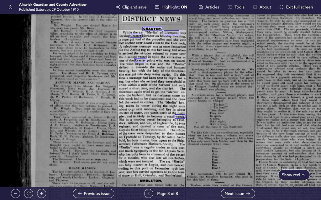
Further update: The plot thickens… Liverpool Hole is on the OS six inch map surveyed in 1861, so it can’t be from that ship.
The Heugh
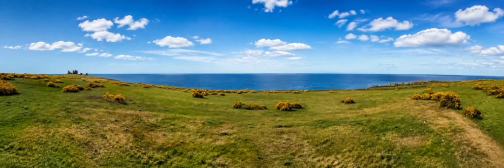
The Heugh was our playground as kids. It ran both sides of the village and was wide, open and covered in whinny bushes that would tear at bare-legged kids in shorts. I used to marvel at the rabbit tracks through them and wondered how they managed against all the spikes.
As you can see, it provides a spectacular vista; you can see the Farnes to the north and the power station at Ellington to the south.
The definition I can find for a heugh is a steep bank, cliff, crag or elevated piece of ground, particularly one overlooking the sea or a river, so it is named perfectly.
It comes from an old northern word with deep roots in Old English and Scots and survives in placenames across Northumberland and the Borders. To outsiders it may sound mysterious; I can always remember people’s faces when I gave them my address: ‘And how do you say that?’ To generations of Craster people, however, it needed no translation. The Heugh was simply the Heugh.
Scrog Hill
Scrog, or scrogg, is another old northern word.
It refers to scrub, brushwood, stunted trees or thorny vegetation, which is perfectly apt considering the amount of whinny bushes on it.
It also has the honour of having been seeded with land mines during WW2 by the Royal Engineers to defend the northern approach to the Chain Home Low Station that sat on the top of the crags.
Scrog Hill can therefore be understood quite literally as something like “the scrub-covered hill”.
But the hill itself is far older than its name.
The landscape around Dunstanburgh is littered with evidence of occupation stretching back thousands of years, and seemingly ordinary names can sit upon places whose human history is extraordinarily deep.
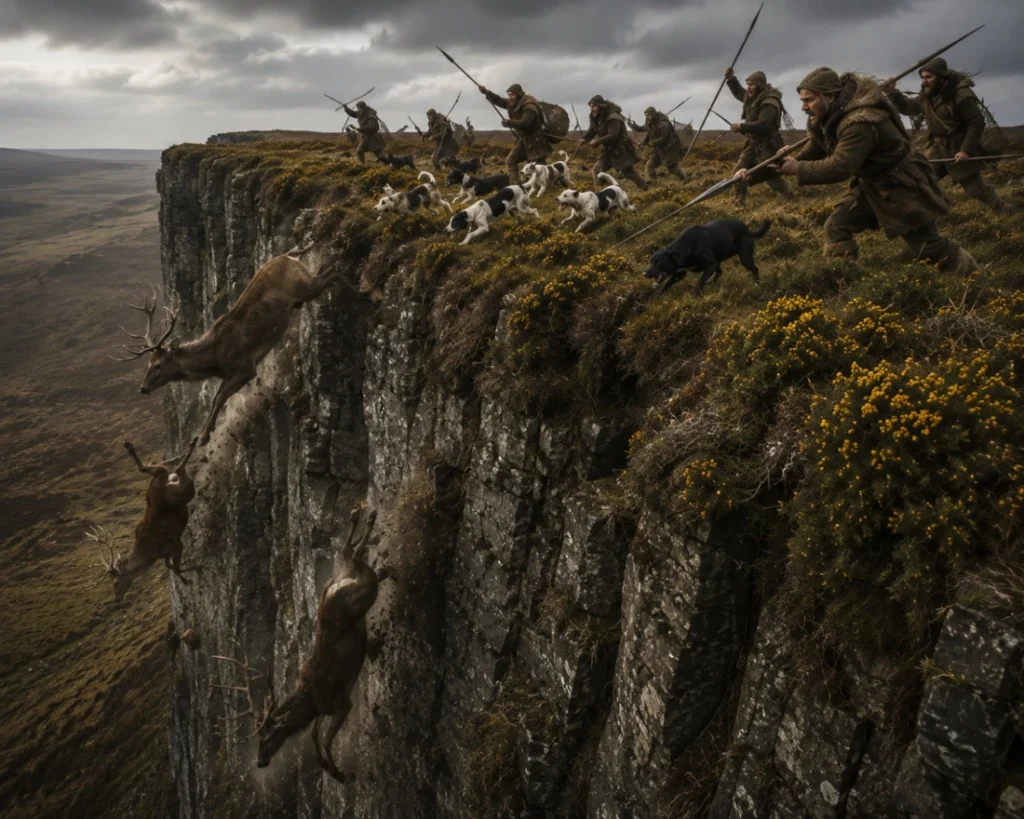
Who knows what the Saxons, the Romans or the hunter-gatherers called it? Perhaps this part of Northumberland was used by them to drive animals off the cliffs to their deaths for meat… Similar ‘game-drive’ hunting has been proposed at other sites in Europe, most famously La Cotte de St Brelade in Jersey, where mammoth remains were once interpreted as evidence of animals being driven over cliffs. More recent research has challenged that interpretation, however, so it is best treated with caution.
That is something which keeps cropping up along this stretch of coast, a comparatively modern farming or fishing name sitting on top of a landscape used since prehistory.
Cushat Knock
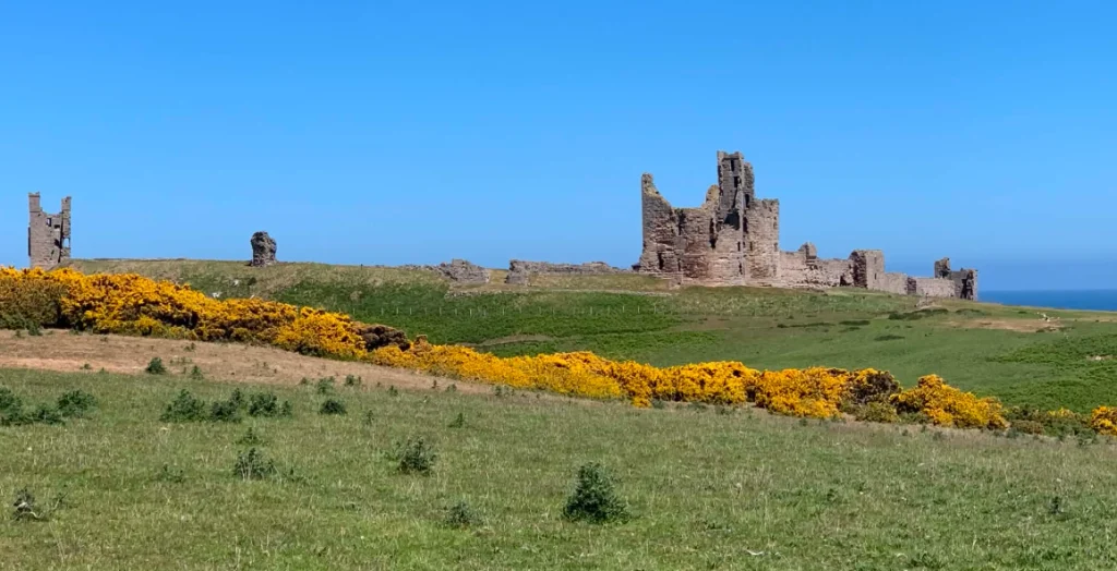
This is perhaps one of the easiest names to unravel.
Cushat is the old northern and Scots word for the wood pigeon. A knock is a small, rounded hill or hillock, from Gaelic cnoc and its use in Scots.
So Cushat Knock is essentially: “The pigeon hill”. There were cushats on the hill. It has a cliff to the northern side as at Scrogg Hill, so maybe they nested there in great numbers.
It is a lovely example of a name which probably began as nothing more complicated than people describing what they saw.
Given that the Height to the south of Craster was inhabited by the village’s pigeon fanciers and their duckets, it’s quite apt. They have now all gone, sadly.
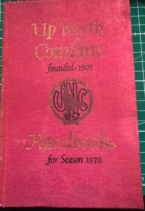
The Thursday-night anticipation in the Nissen hut, where all the men and women brought their chosen birds: they were ringed and boxed, the racing clocks all set and synchronised, and the drawer for the clocked bands was sealed with wire and a little lead tag crimped over. Then the birds were made ready for the journey in the ‘Up North Combine’ truck that picked them up on the Friday morning at the Shop corner and whisked them off to places as far away as France.
Then, on a Saturday afternoon, the anticipation: sitting with Uncle George in the little lean-to beside his ducket waiting for the birds to return, Newcastle United commentary on the age-old Fidelity radio that used to hang by a piece of yellow and green earth cable that replaced the long-broken handle, suspended from a nail knocked in the wooden crossbeam, munching on the pigeon corn and drinking tea from a thermos and the odd tongue sarnie made by Auntie Choice.
All are days now sadly long gone. I’d love to spend one more afternoon in there with him; there was always a story from his days at the quarry, and the dust that finally killed him.
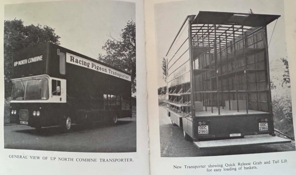
Sorry, I digressed. Anyway it became known as Cushat Knock. This area too was mined during World War II in the defence of our nation from possible invasion by the Wehrmacht. I always wonder if they got all the mines up after the war; it’s a big place and I’m always a little wary walking on here or Scrog Hill.
Cushat Stiel
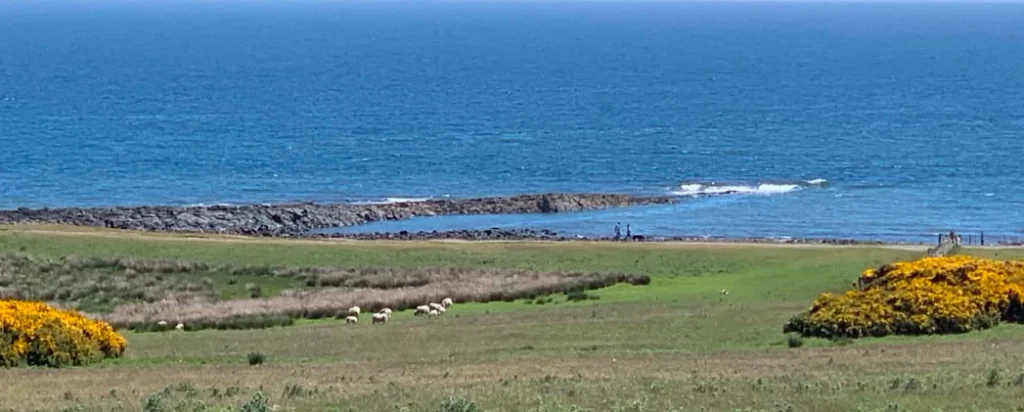
Cushat appears again in Cushat Stiel, a great fishing spot from both land and sea. Lobsters and crabs inhabit the rocky ground of the Whin Sill as it plunges into the North Sea. Codling and pollock can be hooked, and I once was onboard Thomas H when a ling, the size of which I’d never seen before or since, was pulled up by one of the lads on the fishing trip, it var nigh broke his rod and his back getting the monstrous thing up…
The second part of the name is more intriguing though.
Stiel is more difficult. Related northern forms such as stell, stelle and steil, were used for fishing places in rivers or estuaries where nets were worked. Given the location, a fishing connection is likely. Maybe nets were strung between the point and the shore, or rowed over at high tide hemming the fish into nets as the salmon men used to do at Berwick.
Exactly what the name, stiel, originally meant is difficult to pin down. Whether it referred to fishing, the shape of the rocks, the water channel or something else is impossible to say.
What is clear is that Cushat Stiel preserves another piece of vocabulary which has largely vanished from everyday speech.
Oxberry Law and Oxberrylaw Holes
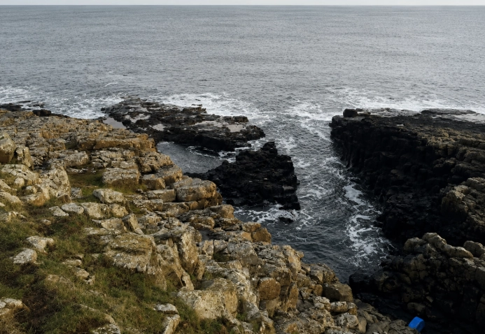
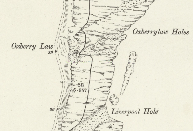
We never knew them by these names. In true Craster tongue-in-cheek simplicity, the Law was called ‘the Big Hill’ and the natural swimming pool there was called ‘the Big Pool’.
Again, we have an old landscape word that is used on maps.
A ‘law’ in Northumberland and southern Scotland is a hill or prominent rise, deriving from Old English hlāw.
Originally the word could also describe a mound, including an artificial or burial mound, although over time it became widely used simply for hills. In this case a mound is literally all this is; it’s a lump in the Whinstone, and beneath that it has weathered down to almost bare rock.
Other places use the same name, as in Traprain Law, North Berwick Law and numerous smaller ‘laws’ across the Borders and Northumberland.
The Oxberry part is harder.
- It may preserve an old personal name.
- It could be a description of blackthorn bushes that grow locally producing sloes, bastardised into something else, like the Slay Bushes at Howick, which I’m convinced is just the word ‘sloes’ with a north-Northumbrian twang added before it was finally written down.
- Maybe it is named after oxen or other livestock.
- Or it may have an earlier form which has been altered through centuries of speech and heavy phonetics.
Immediately below the Law are the Oxberrylaw Holes, but as previously mentioned we never knew them as such. We used to swim here, jump off the cliffs into the sea. I can remember drawing straws to see who would jump first to make sure the tide was far enough in so we wouldn’t break our legs!
Nights after the Jolly, we would go along there, sit round a little fire with cans and a guitar, and sing along to tunes from the Rocky Horror Picture Show. I also remember the night we all agreed to jump into the Big Pool. Down we went, stripped off, and stood round the edge: three… two… one… spladoosh. I was the only one that had jumped, much to the amusement of the others.
Nova Scotia
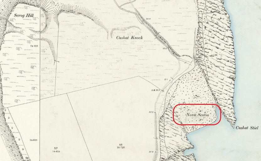
Then there is perhaps the strangest name of all: Nova Scotia.
Why should a little piece of the Craster coast carry the Latin name for “New Scotland”?
One possibility is that the name preserves the memory of Scottish incomers who settled or worked around this part of the coast.
From the later eighteenth century onwards, enormous numbers of Highland families were displaced by economic upheaval and the Highland Clearances, with many moving elsewhere in Britain while thousands crossed the Atlantic to Nova Scotia itself.
Could a group or family arriving on this coast have led local people to nickname their little settlement or patch of shore Nova Scotia — “New Scotland”?
There is even the more romantic possibility that the name reflects an older movement of Scots following the upheaval of the Jacobite rebellions and the Battle of Culloden in 1746, when families were scattered, estates forfeited and people fled or were displaced.
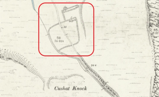
What makes the name so tantalising is that it feels unusually specific. People generally did not give a tiny piece of coastline a name like Nova Scotia for no reason.
Perhaps these people inhabited the enclosure that sits below the castle, ringed in the picture above. Escapees from battle or maybe the Clearances, we may never know.
There must be some forgotten association with Scotland. Perhaps a family, a group of workers, fishermen or migrants may lie behind it, eking out a living from the land and the sea.
The Arval
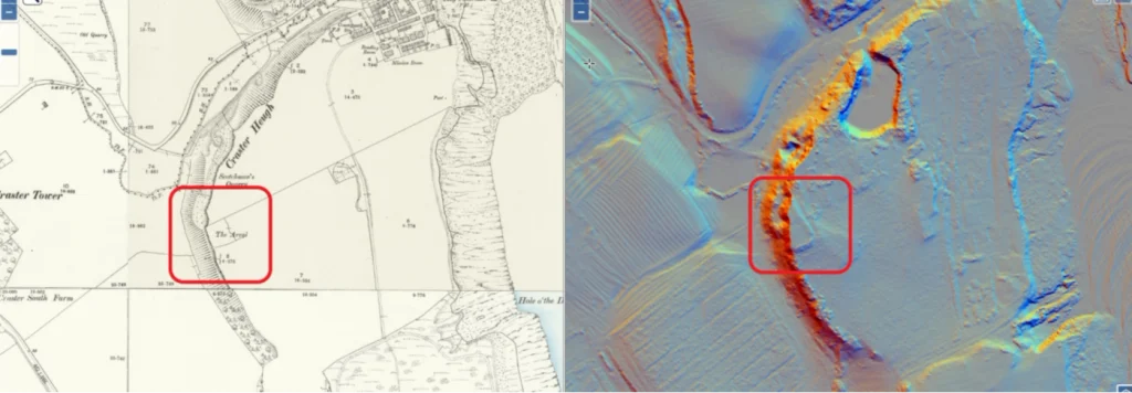
Now we come to The Arval.
Or, as we always knew it locally: “The Head Arval”.
That little addition, Head Arval, is important because spoken local names can preserve forms and meanings which never appear on maps.
The word arval is an ancient one, and the local name I find the most intriguing and utterly fascinating.
In northern England and Scotland, an arval or arvel could mean a funeral feast, particularly the meal held following a burial. The word has very deep northern roots and is derived from Norse vocabulary.
That immediately makes a place called The Arval tantalising. The Arval is not simply an anonymous hill.
There is archaeological evidence of occupation there, including what has been interpreted as a fortified or defended site, with later Roman activity in the surrounding landscape. The site, to me, looks square, with one corner truncated by later quarrying.
None of this proves that the name Arval refers to ancient burial or funeral ceremony but, howay, imagine… Neolithic hunter-gatherers eventually putting down roots here, it becoming a Bronze Age enclosure and taken over by the Romans; then it makes sense that the Vikings used it… Longships in the haven at Craster, sheltered by Muckle and Little Carr, a wounded Viking king dying after battle and a funeral pyre on the Arval. Aye, OK, it’s a stretch, but you never know.
Names can migrate and change, but they stick, and continuation of use is a huge aspect in the naming of a lot of places.
When an ancient northern word associated with death, burial and funeral feasting survives beside a place already marked by ancient occupation, it deserves attention.
And the old spoken form “the Head Arval” may preserve another fragment which maps alone cannot give us, where names become the thread of archaeology, one to be pulled on.
Archaeology does not only survive underground. Sometimes it survives in speech, in the names we have all used forever and a day and taken for granted…
Cushat. Scrog. Stiel. Heugh. Law. Arval.
Words which once formed part of ordinary conversation have slowly disappeared from everyday use, yet remain pinned to the landscape and memory.
Other names, Liverpool Hole and Nova Scotia, may preserve actual events or people whose stories have otherwise been completely forgotten.
A shipwreck.
A group of Scottish incomers.
A patch of scrub.
A hill covered in pigeons.
Perhaps even an ancient place associated with funeral rites and remembrance.
Individually they are just names on a map.
Put them together and they begin to form something else, a surviving vocabulary of the people who lived, worked, farmed, fished, fought, buried their dead and told stories along this coast for centuries.
And once you start looking at them that way, the walk from Craster to Dunstanburgh becomes much more than a walk along the shore.
It becomes a walk through language and the mists of time itself.
With love from the Crasterfarian XX

This is fascinating, thank you for sharing!