By Crasterfarian
For as long as I can remember I’ve trotted up and doon the Coast Road, either for pleasure or for work.
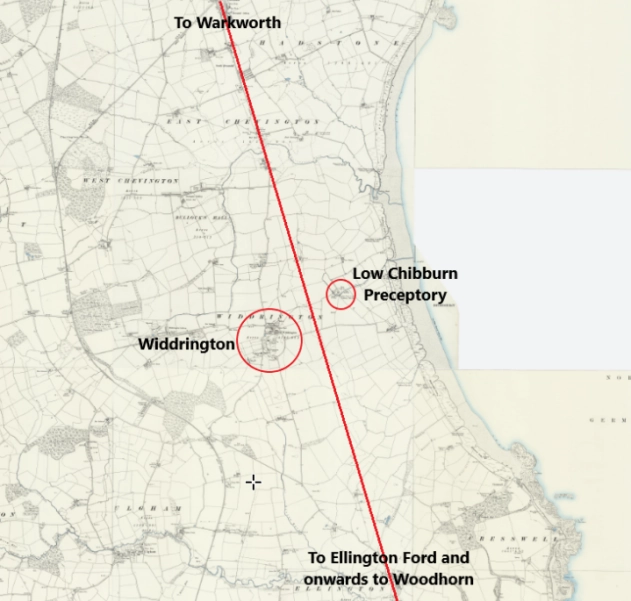
As I’ve headed south along the Coastal Road doon from REED GRAGH (if you know, you know) [Ed. The village of ‘Red Row’, spoken in the endangered Northumbrian Burr], the North Sea stretched out to the east and the low Northumberland Plain opened inland. A land scarred by industry and mining, both deep shaft and opencast.
Time and again, one place began to assert itself, and it’s not just the thought of a pint or a bite to eat in the Widdy Inn at the roundabout there.
As you approach heading south, you can see that the land is elevated here, and to my mind that would mean history.
Up-a-height means safety and a clear view around, so you can keep your peepers peeled for any ne’er-do-wells approaching to chore your kye or guffies [Ed. ‘Cows and pigs’ for those unitiated in the Northumbrian dialect].
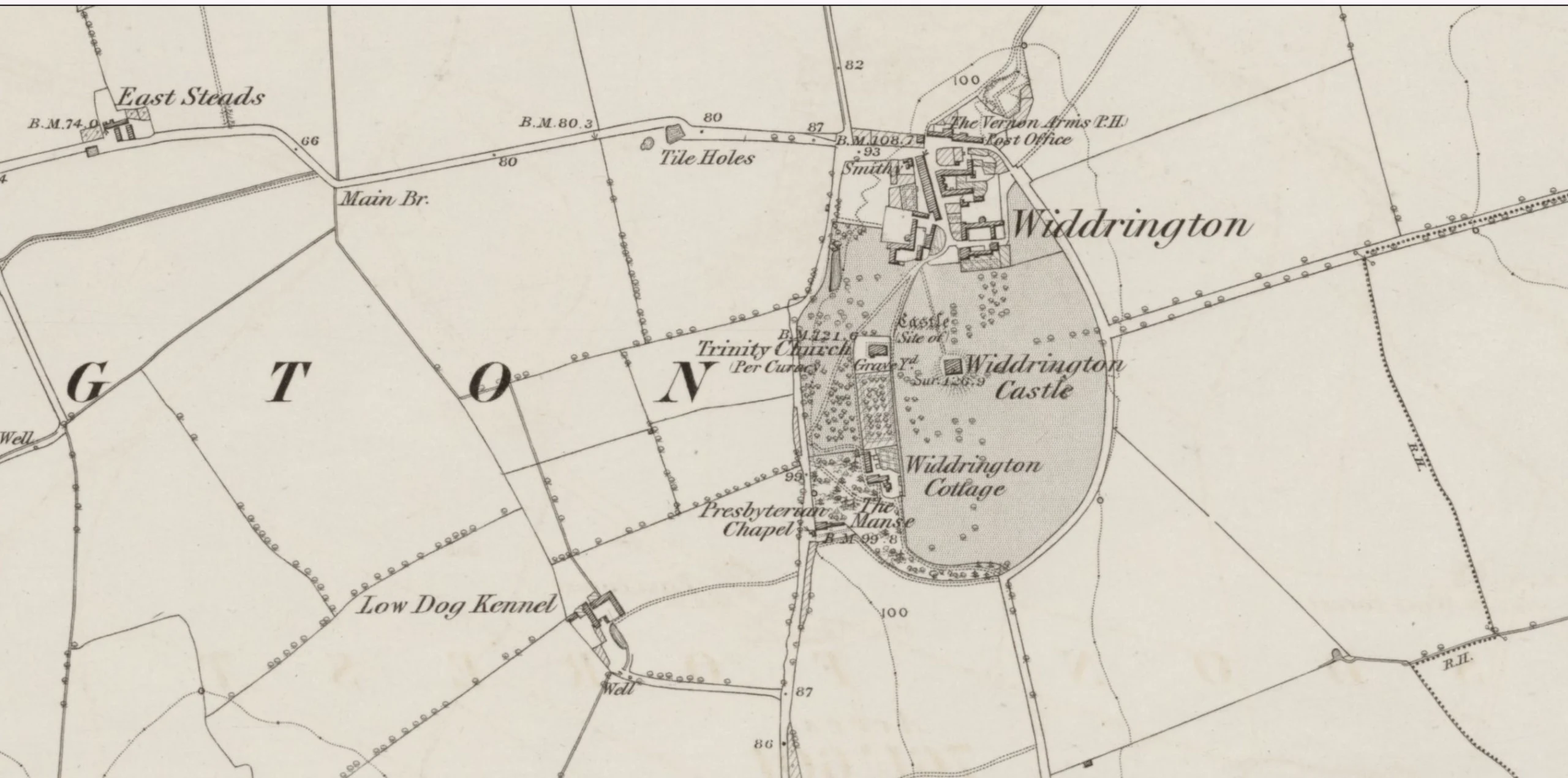
The site rises just enough from the surrounding landscape to command views inland and towards Druridge Bay.
It is not dramatic high ground, but it is decisive high ground, dry, visible, defensible, and well placed.
Repeated journeys sharpen perception, and I’m a right nosy bugger, so the more often I passed through, the more it felt like a place whose importance reached far beyond the medieval castle that dominates its written history.
Landscapes that matter tend to be reused, reworked, and reinterpreted rather than abandoned.
Across Britain, slight elevations close to the coast were favoured from at least the Bronze Age onward, and I can see this site being no exception, maybe a Saxon lord’s hall crowned the top, following an older Roman route or a Romano-British farmstead.
These tiny advantages were highlighted during World War I in Flanders, where small rises in elevation, maybe only several metres, became the subject of fervent battles for control of superior ground. As they say, it’s not the size, but what you do with it that matters.
Such locations offered protection from flooding, access to both land and sea resources, and control over movement along natural corridors.
Widdrington fits this pattern precisely. It overlooks a long, accessible bay while remaining set back from direct exposure to the sea.
Although no formally identified prehistoric enclosure or hillfort has yet been recorded here, the absence of surviving earthworks should not be overstated.
Agricultural improvement, coal mining, and later development have erased many early features across the coastal plain.
What remains is the geographical logic of continued use. A bit of common sense needs to prevail sometimes, also a little Crasterfarian imagination. I do often wish my mind would switch off and gan for a fortnight in Benidorm, but it’s a noisy bugger that keeps me awake a lot.
Wor Widdra
The name Widdrington itself hints at this continuity.
Widdrington is an Old English place-name, possibly derived from a personal name, as many places were. It might have started out as Wīddra, combined with tūn, meaning an enclosure or settlement.
In simple terms, it may have meant “Wīddra’s settlement”.
Names of this type tend to reflect ownership and permanence rather than novelty. Not only that, they are old, maybe very old, older than the current name and history would suggest. The name records who held it, not why it mattered, often a sign that the importance of the place was already taken for granted. “Here, yee lot, my name is Wīddra and this area belongs to me.”
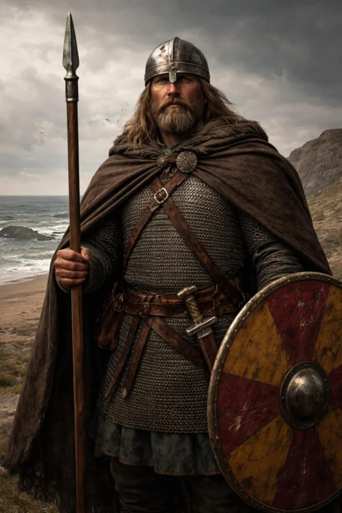
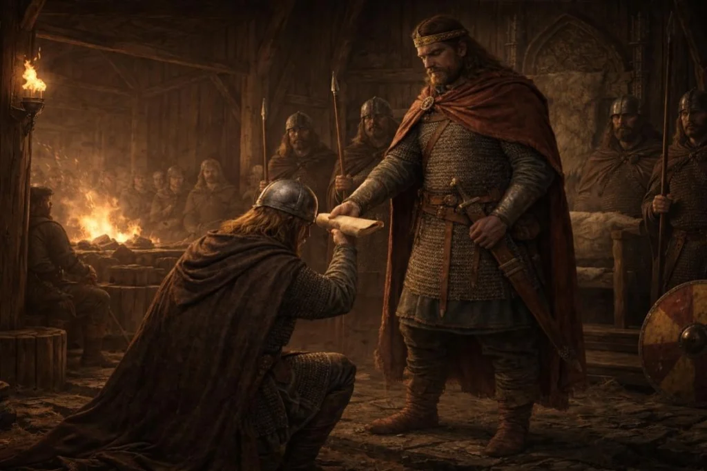
It is tempting, therefore, to place Wīddra within the world of early Northumbrian lordship, a local thegn or landholder whose authority rested on control of land, people, and routes. Such men did not exist in isolation. They were bound by oath and obligation to a king, and in the early seventh century that King was Oswald.
Oswald’s rise depended on the loyalty of local leaders who supplied warriors drawn from their own territories. It is entirely plausible, though unprovable, that a figure such as Wīddra was sworn to him, and that men from this landscape marched south as part of Oswald’s host.
When Oswald confronted Cadwallon in 633 at Heavenfield, victory depended not on numbers but on leadership, terrain, and cohesion.
Those who stood with him were men accustomed to reading ground and understanding movement. Perhaps wor Wīddra was gifted this land for his derring-do in the battles against the Welsh hordes by the King of Bernicia himself.
Maybe that’s why it’s called Wīddra’s land.
Landscapes like Widdrington shaped such men.
While the name cannot place Wīddra in the shield wall with any certainty, it’s certainly a possibility. Well, it is in my fertile mind.
The Old OLD Coast Road
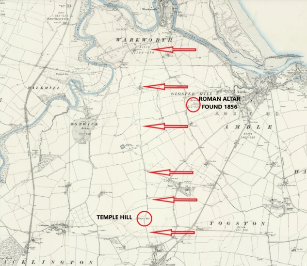
Can you remember my article on my postulated Roman road between Woodhorn and Warkworth? Check out The Pagan Path Beneath Our Feet.
Whey, wadda ye kna, as coincidence would have it, that same road could slip neatly between Widdy and Low Chibburn Preceptory on its way to Woodhorn, via the ford that would have been over the Lyne Burn at Ellington, its most easterly fordable point.
In that article we discussed the possibility of Roman or Romano-British movement along the coast, running north from the Woodhorn area towards the Coquet crossing at Warkworth and heading north up the east coast to the known Roman settlement at Howick and beyond.
Strong evidence of a Roman transport road network in this area of the north-east coastal plain is sketchy at best, but using maps, a little imagination, and following existing roads and trackways it makes sense, well it does to me.
If such a coastal corridor existed, Widdrington would sit slap bang in the middle of it as a natural staging point, a canny place to stop for the night, a glass of foaming mead or a night in the sack with a ‘bed thrall’ [Ed. a þræll was a person of servitude in early medieval times, i.e. a slave], and maybe an early version of a Maccy D’s. Courtesy to travellers wasn’t just expected, it was a necessity.
The site is elevated, well-watered, defensible, and close to, but not exposed on, the shoreline.
Such use would leave little archaeological trace, particularly where later occupation reused the same ground. Add to that the endless mining and opencasting of the site to the north and I can maybe swing it as a theory.
The Knights Hospitaller
The importance of this landscape becomes clearer still at Low Chibburn. Dee yourselves a favour and gan have a look doon there, you can almost get to it by car.
Built around 1313, around the same date construction began at Dunstanburgh Castle, you think it’s hard to get a good builder these days. Back then the lads must have been stacked oot wi graft.
At first glance, the preceptory associated with the Knights Hospitaller appears oddly isolated, lacking an obvious medieval town or market centre. To cut a long story short, it’s in the middle of bloody nowhere.
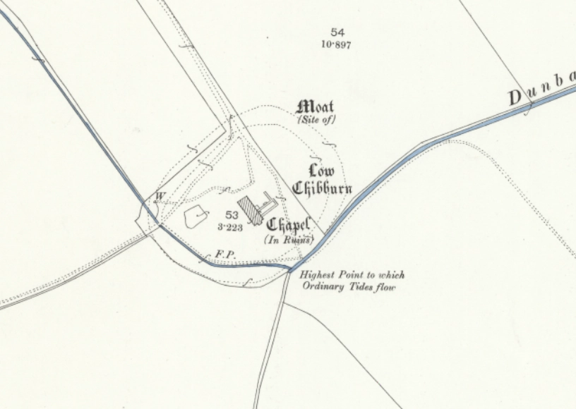
Historic mapping, however, reveals a crucial detail.
The Dunbar Burn, which conveniently curves around the site, was tidal up to the preceptory itself in past times, with the highest reach of ordinary tides marked adjacent to the buildings.
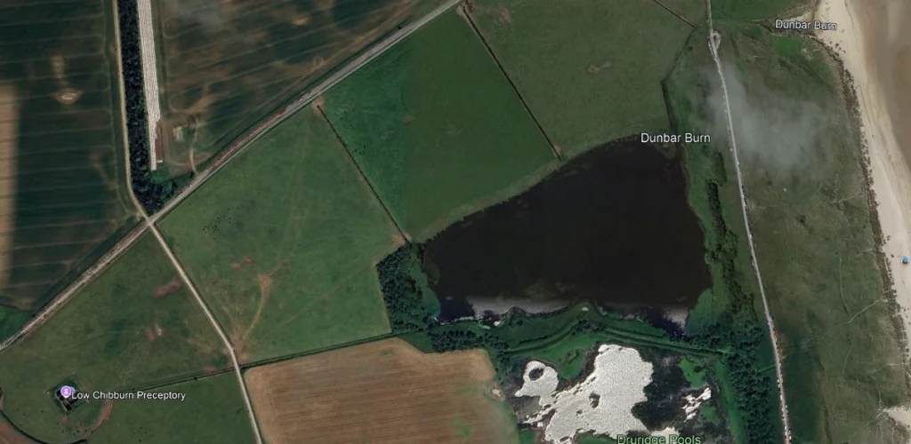
The modern route of the waterway eastwards has clearly been altered by the hand of man. It’s straight as a die and leads into a wide basin, mere, or pond. This was due to opencast mining that took place here in the mid 20th century. This would have eradicated any archaeology to support my road theory, but hey ho, we needed coal.
This tidal stream would have allowed small boats to penetrate inland right up to the moat that was dug around the site, linking it directly to shipping at anchor in the bay.
Low Chibburn was also moated, and the proximity of tidal water raises the strong possibility that the moat was deliberately replenished using tidal flow, perhaps through a controlled inlet or sluice.
Such systems are known elsewhere and would have kept the moat deep, fresh, and defensible with minimal effort.
Seen this way, Low Chibburn is not an isolated foundation but a carefully chosen site at the head of tidal reach, where land routes, water access, and defence converged.
The Hospitallers were not solely a military order, but a medical one.
Their preceptories formed part of a wider network providing care, shelter, and treatment to travellers, the sick, and the injured.
In this light, Low Chibburn can be understood as a strategically placed centre of medical care and logistical support, serving both coastal and inland movement. Its role was as social as it was strategic. I bet the queues at casualty were shorter back then.
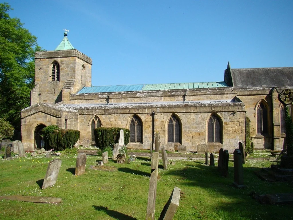
Widdrington Castle
By the later Middle Ages, in the 14th century, a fortified residence reflecting the power of the Widdrington family was built on the top of the hill, along with the church at St Mary the Virgin.
Despite the site sitting on what is called “Castle Mound”, an obvious man-made feature, the site was not a Norman motte-and-bailey castle.
This formed part of a single planned landscape. The church is a large one, hinting at grander communities from the wider hinterland before the Industrial Revolution, when farms were the factories of the countryside.
In Border Country, castle and church went hand in hand, one asserting secular power, the other spiritual authority.
Together they anchored lordship, community, and defence, reinforcing the Widdrington family’s control over land and people.
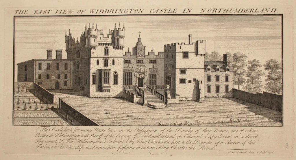
There are no images I can find of the early castle. All I can find is the 1728 engraving by Samuel and Nathaniel Buck.
In the 18th Century the site, as shown in the engraving, was reimagined as a gothic mansion, an ambitious expression of lineage and fashion, before a muckle yaggy [Ed. ‘angry’] fire burned it to the ground.
The damage was so severe it lay and rotted for many years.
The buildings declined and were never rebuilt. They were eventually demolished and all trace has now gone. However, the strategic value of the surrounding ground did not.
World War II
That value reasserted itself during the Second World War.
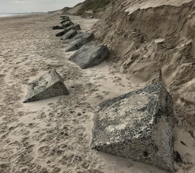
Druridge Bay, with its long, flat sands and multiple exits inland, was identified as a likely invasion beach.
Concrete pillboxes commanded the exits, anti-tank obstacles were laid on the beaches, and the wider landscape was adapted for defence.
Low Chibburn was once again drawn into the system, with a pillbox constructed within the preceptory itself, embedding modern concrete defences into medieval stonework. These have long since been removed.
At Widdrington, field boundary walls were pierced with loopholes, turning ordinary agricultural features into components of a layered defensive network. I wonder how many old warhorses from World War I, who made up the majority of the Home Guard, spent freezing, damp nights in positions along the coast.
The bay also played a role in the air war.
Druridge was used as a strafing range for mobile targets, with Spitfires and P-51 Mustangs operating from nearby airfields at Eshott and Acklington.
Hardened observation bunkers oversaw these exercises, adding air power to a landscape already shaped by centuries of military logic.
What emerges is not a series of disconnected episodes, but a remarkable continuity washing back into the earliest days of Northumbria and Bernicia.
Across thousands of years, people repeatedly selected the same elevated ground, the same watercourses, and the same inland-coastal interface.
From possible prehistoric settlement, through Roman movement, early Northumbrian lordship, medieval medical care, post-medieval ambition, modern total war, and opencast strip mining, Widdrington and Low Chibburn form part of a landscape repeatedly recognised as strategically, economically, and socially important.
There may yet be no single artefact that anchors the earliest phase of occupation, but just because it hasn’t been found yet doesn’t mean it isn’t there, or was erased by the machinations of those who came later.
We simply will never know, but we can have a little skip through the tulips in my mind and think.
With love from the Crasterfarian XX
Really enjoyed this piece – it is clear you are feeling your way through the material with curiosity rather than trying to force it into a fixed story, which is exactly how local history should be done.
One small observation from the name side, offered very much in the same spirit. When “Widdy” or Wīddra is treated as a person, it feels less like someone we have evidence for and more like a solution introduced to tidy up a linguistic pattern. In a lot of -ing-tūn names the “person” is doing explanatory work rather than being independently attested.
What nudged me is the local context. Nearby names like Woodhorn are plainly descriptive and functional – wood plus a horn-shaped spur of land – and do not represent people at all. That makes a wood-associated reading for Widdrington feel quite natural in its own landscape layer. The early spellings leaning towards wud-/wid- sit comfortably with that.
Warkworth is interesting too, because it shows the same temptation in reverse. There, as here, a personal name is often proposed to make sense of the form, but without independent evidence it may just be a convenient placeholder rather than a recoverable individual.
None of this undermines the story you are exploring. It just suggests that geography and function might be doing more of the heavy lifting than biography at this stage, and that the human figure may be emerging from the explanation rather than preceding it. I mention it only because the local naming landscape already gives us plenty of good, non-personal parallels to work with.
If the name is proposed as a solution to a linguistic problem, but is not historically attested, then evemerism takes over. Assumptions built on assumptions. It can then become reciprocal evidence. This is what I think has commonly occurred in the past when historians have been making sense of linguistics. Geographical words and functional words were common – epithets for functions, became names of people and gods, and before long history is populated by a host of people that may be phantoms of evemerism. A god has many epithets for example in the old European tradition. When epithets become later names of other characters, it gets messy. It is then tempting to place them in older frameworks, such as religious ones and see evidence for associated historical characters such as Oswald who has a lot of hagiographic baggage attached by Bede.
I prefer to consider such possible assumptions. They stand equally together when we theorize about our past. They do not disprove each other, but they do become graded as what is most and least likely.
If the least likely dominates and becomes foundational, it becomes probable that we will drift away from evidence. Again, a proposed theory does not require total proof. We cannot know for sure that Widdy did not exist, nor that Widuhere was not a named person. But where did the uhere go? The widdr and ing tun is there as a likely explanation without the need to make a man. The woody Germanic derived association, the farmstead settlement and the ings that were ‘of it’.
Conversely, a man’s lineage and associated inheritance linguistically may be exactly how it all came about 🙂
All the best
Ivan
It’s very common for places in England to be named after Anglo-Saxon chieftans.
Possibly. Or possibly, based on minute morsels of evidence, it has been assumed that many such chieftains existed at all. For similar reasons I provided above. Many such assumed chieftains have been derived from etymological assumptions, where the evidence is largely absent – Redda’s People – but no attested Redda. Please do not dismiss revisions of history by simply asserting repeated consensus that is being challenged. That smacks of dogmatism.
One line rebuttals are open-ended and lack the data and detail to support them. Sorry is my responses are long and detailed (actually under-detailed at times) – but that is what is required to evidence a claim.
If you wish to simply repeat Bede as truth because he matches a belief in the Holiness of the Church, then say so.
But can we agree that one line put downs are not the way to debate?
There is no mention of Bede, so you’re making irrational remarks here, which I’m a bit uncomfortable with as a moderator of this site.
You write about evidencing a claim, but you haven’t done that. You’ve provided no evidence to refute the observation of English places being named after indiviuals. You’ve provided no counter-theories for such places. You have just cast doubt on the concept as a whole.
No one is forcing you to believe that many place names derive from individuals, but at the same time, it is not in the least bit controversial as a theory. All it does is reflect early land ownership as well as family and clan territories.
“But can we agree that one line put downs are not the way to debate?”
Rather than complain about the shortness of a response, maybe you ought to consider the veracity of the response itself and respond to that.
I think that this is an excellent piece. Yes it contains conjectures but very often a conjecture leads to mote detailed investigation which may confirm the conjecture or point the researcher in a different direction entirely. Whatever the outcome the conjecture has resulted in better knowledge. Thank you for an excellent contribution