By Gary Holland
The rivers Tyne and Wear will forever be associated with the coal trade. Both have an illustrious maritime heritage related to shipbuilding and the like, but it is coal from which these industries were born.
As early as the 14th century, Newcastle was one of the wealthiest towns in Britain owing to the export of coal. In the present day, with the imperative move towards clean energy, it may be possible to forget, at least temporarily, the huge impact of coal on our county.
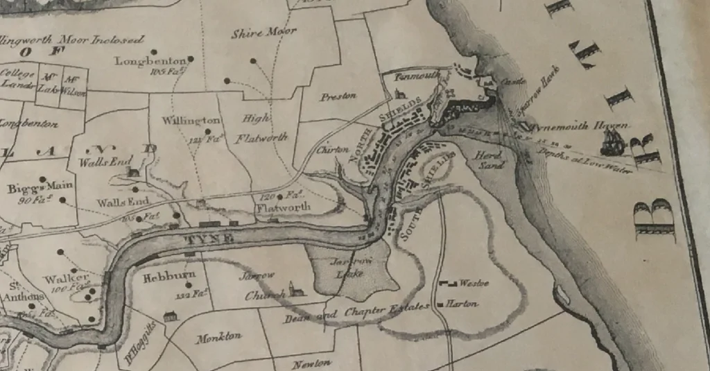
Some readers will remember the machinery of the collieries, the spoil heaps and the myriad of rail lines crossing the borough. All of this has now gone, other than the odd relic here and there, kept for current and future generations, such as the remains of Wallsend Colliery B Pit at the Segedunum site, as well as in some local place names like Percy Main, the ‘main’ referring to the largest coal seam being worked in the area.
This featured document is a survey and overview of the coalfields of the rivers Tyne and Wear in 1801. Titled ‘Plan of the Rivers Tyne and Wear’, the map also shows the major towns and rivers at the time, as well as important infrastructure such as waggonways (in dotted lines) and staithes. This was before the 1847 railway had been built connecting Newcastle to North Shields.
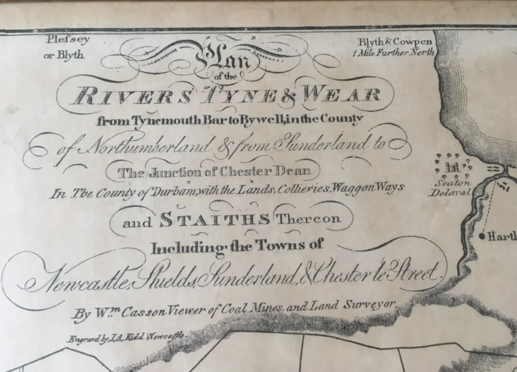
of the
Rivers Tyne & Wear
From Tynemouth Bar to Bywell, in the County
Of Northumberland & from Sunderland to
The Junction of Chester Dean
In The County of Durham, with the Lands, Collieries, Waggon Ways
And STAITHS Thereon
Including the Towns of
Newcastle, Shields, Sunderland & Chester le Street
By Wm. Casson Viewer of Coal Mines and Land Surveyor,
Engraved by I.A. Kidd Newcastle
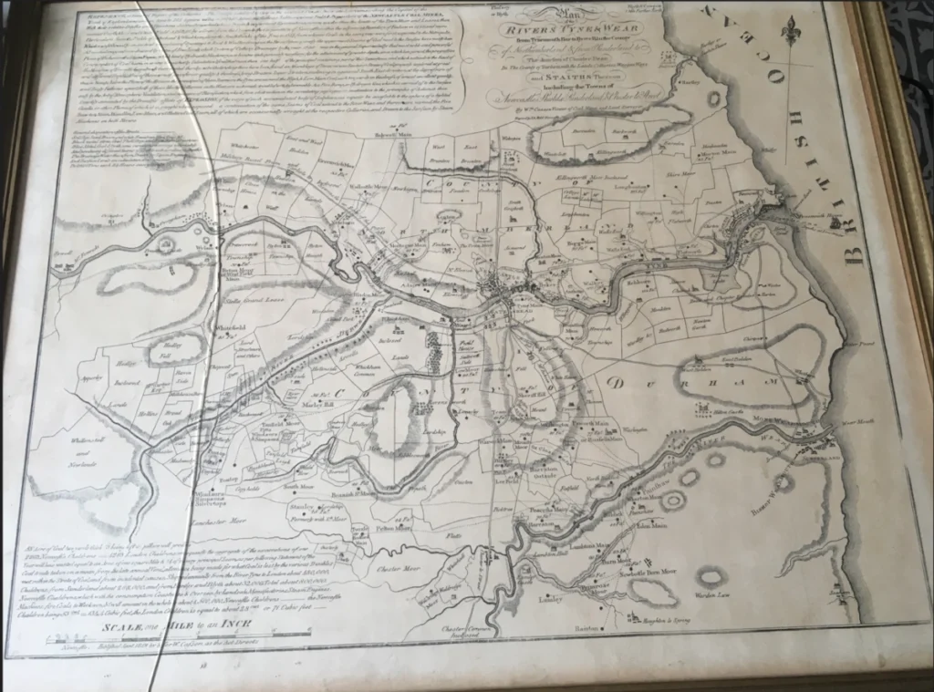
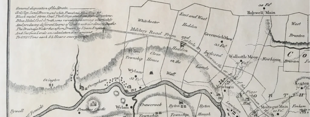
As with most old maps, there are some interesting items to discover in the detail, including places of possibly ancient origin, such as Whitchester and Greenwich Moor.
The map is based upon a mine survey, carried out by William Casson. Little information could be found by the author when researching Casson. What we do know is that he was, at least in part, a ‘viewer of coal fields and land surveyor’ in the late 18th and early 19th century. This map is fairly large at 26” x 21” and this particular map, although rare, is likely a reproduction. The map was engraved by I.A. Kidd of Newcastle – likely in copper and subsequently printed.
The large body of text in the upper left hand corner of the map, which only contains one full stop, reads as follows:
Reference or General Report of the Collieries. The country exhibited to view in the annexed [illegible], Circumscribing the Capital of the North of England [illegible] Area to 282 square miles, or 180, 482 Acres, the famous Subterraneons [illegible] Repository of the NEWCASTLE COAL MINES, With their relative Depths and Situations distinctly marked, whose Origins & important Excavations, comm [illegible] within the limits of the Town Moor and Leases, then named Castle Moor and Castle Field AD 1240 by a Grant from the Crown to the Corporation of Newcastle within the adjoining Boundary of Fenham in 1440 and more Particular from the Fields of Gateshead & Whickam, along the South Banks of the Tyne in 1357 from whence Coals in the same year were first exported to the Metropolis, Which was, [illegible] by an instant succession of Openings to East & West, bordering on the River, Consequently the uppermost Seams of Coal next to the Surface have mostly been All worked away and were drained by virtue of Free Levels, which System of Colliery Drainage by the year 1730 was in the general Superseded by that most noble and powerful Piece of Mechanisms the Steam Engine, which kind of Hydraulic Machinery, now became indispensably necessary for the attainment of greater depths, since which late period, the progressive Consumption of Coal has been so very Great, that by Calculation I find that more than one half of the principal containing part of this Superficies, and which extends to the East of the Meridian of Newcastle has already been wasted thereby, notwithstanding there have been found and Assemblage of Seven various Seams or Strata of Coal, properly explored at great and different Depth [illegible] of these are of inferior quality and thickness, lying Stratum Super Stratum, inclining in a general South East direction, at the depression of One, in Twenty, below the plane of the Horizon. the principal of these Seams on the Tyne, are named the High and Low Main Coal, each two yards in thickness, of a most excellent quality, and Sixty Fathoms apart, both of these like the Collieries on the Wear, are extremely troubled with Inflammable Air, Fire Damp, or Hydrogen Gas, which is carried off to the Surface only by the Art of Atmospheric Ventilation, and measure of Rare faction, which from obstruction in the circulating passages, or inattention to the principals of Action, is then quickly succeeded by the effects of EXPLOSION, if the verge of such accumulated body of Sulphureous vapour be accessible to the sphere of a lighted Candle of other Flame, of which it is caught when exposed a continuation of the same Seams of Coal extend to the River Wear, and there are named the, the Five quarter, Main, Mindlim[?], Low Main, and Hutton Coal Seam, all of which are occasionally wrought at the respective Collieries, and Drawn to the Surface by Steam Machines on both Rivers.

Further References
The export of coal from the Tyne to the ‘Metropolis’ (London) had been going on for over 500 years and had turned Newcastle into an industrial powerhouse. These two links explore the origins of that trade:
A previous Penbal post discussed the wagonways, which were effectively the first railways in the world, and a video also uncovers the railway remains in Northumberland Park.
Never miss an article. Enter your email or give our FB page a like
No air-built castles, and no fairy bowers,
But thou, fair Tynemouth, and thy well-known towers,
Now bid th’ historic muse explore the maze
Of long past years, and tales of other days.
Pride of Northumbria!—from thy crowded port,
Where Europe’s brave commercial sons resort,
Her boasted mines send forth their sable stores,
To buy the varied wealth of distant shores.
Here the tall lighthouse, bold in spiral height,
Glads with its welcome beam the seaman’s sight.
Here, too, the firm redoubt, the rampart’s length,
The death-fraught cannon, and the bastion’s strength,
Hang frowning o’er the briny deep below,
To guard the coast against th’ invading foe.
Here health salubrious spreads her balmy wings,
And woos the sufferer to her saline springs;
And, here the antiquarian strays around
The ruin’d abbey, and its sacred ground.
Jane Harvey
From ‘The Castle of Tynemouth. A Tale’ (1806)
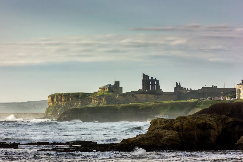
Photograph: Lee Stoneman
Photograph: Lee Stoneman
No air-built castles, and no fairy bowers,
But thou, fair Tynemouth, and thy well-known towers,
Now bid th’ historic muse explore the maze
Of long past years, and tales of other days.
Pride of Northumbria!—from thy crowded port,
Where Europe’s brave commercial sons resort,
Her boasted mines send forth their sable stores,
To buy the varied wealth of distant shores.
Here the tall lighthouse, bold in spiral height,
Glads with its welcome beam the seaman’s sight.
Here, too, the firm redoubt, the rampart’s length,
The death-fraught cannon, and the bastion’s strength,
Hang frowning o’er the briny deep below,
To guard the coast against th’ invading foe.
Here health salubrious spreads her balmy wings,
And woos the sufferer to her saline springs;
And, here the antiquarian strays around
The ruin’d abbey, and its sacred ground.
Jane Harvey
From ‘The Castle of Tynemouth. A Tale’ (1806)