By Luan Hanratty
Of course, we all know Hadrian’s Wall ended at Segedunum, but we’ve wrritten loads in these pages on what filled the gap between there and the sea, including the elusive fort at Blake Chesters and a possible milecastle at Adrian’s Mound where Tynemouth Road crosses Northumberland Park today.
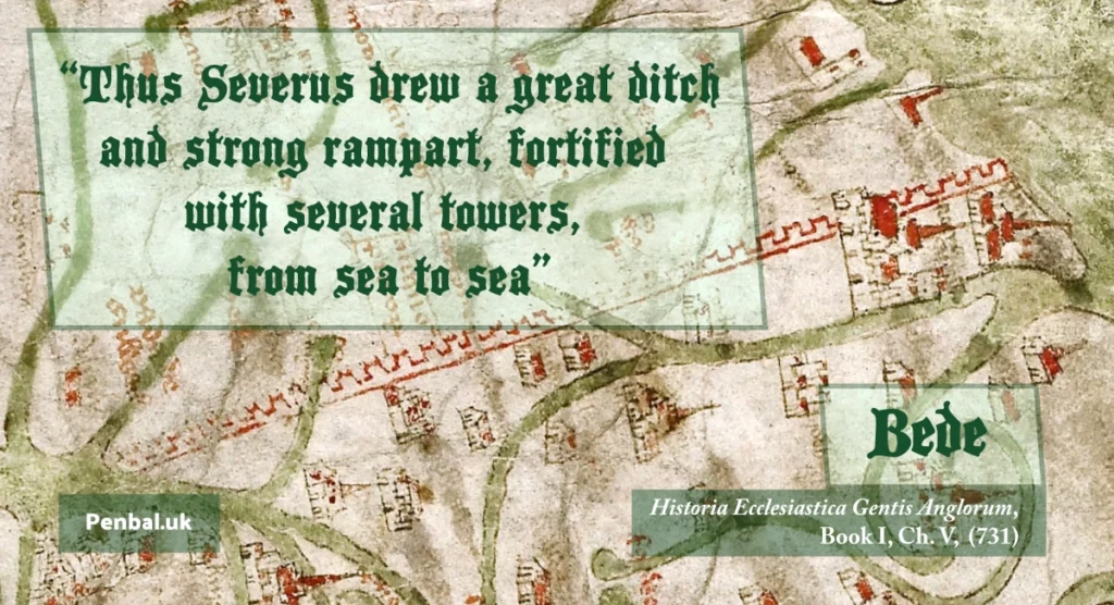
The old antiquarians: Leland, Camden, Brand, Hodgson and Bruce wrote of an earthen rampart and ridge called the Fosse that led east all the way to Penbal Crag and roughly corresponds with the line of the Metro today. The old antiquaranians also called the northern ditch of Hadrian’s Wall, the Fosse, while Hutton, Horsley and Leland also referred to this earthwork as Severus’ Ditch.
* Note that the stretch of road beside the route of Hadrian’s Wall between Walker and Byker is called the Fosseway (not to be confused with the other Roman road of the same name in the south of the country).
* For reference, ‘fosse’ or ffos in Welsh, is a Latin loanword that came into Old Welsh and simply means ‘ditch’. Related words are ‘fossil’, the Australian-English verb ‘to fossick’, i.e. beachcombing or prospecting for gold, and the word for ‘pit’ in French, fosse. The word ‘dig’, from a virtually unchanged Proto-Indo-European root, has given us the words ‘ditch’ and ‘dyke’ and in German, deich for pond. The semantic boundaries have always been blurred between throwing up dirt in a mound and the trench created by moving downwards in the soil.
Consider this:
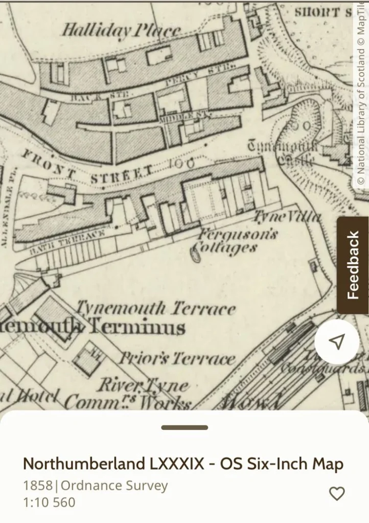
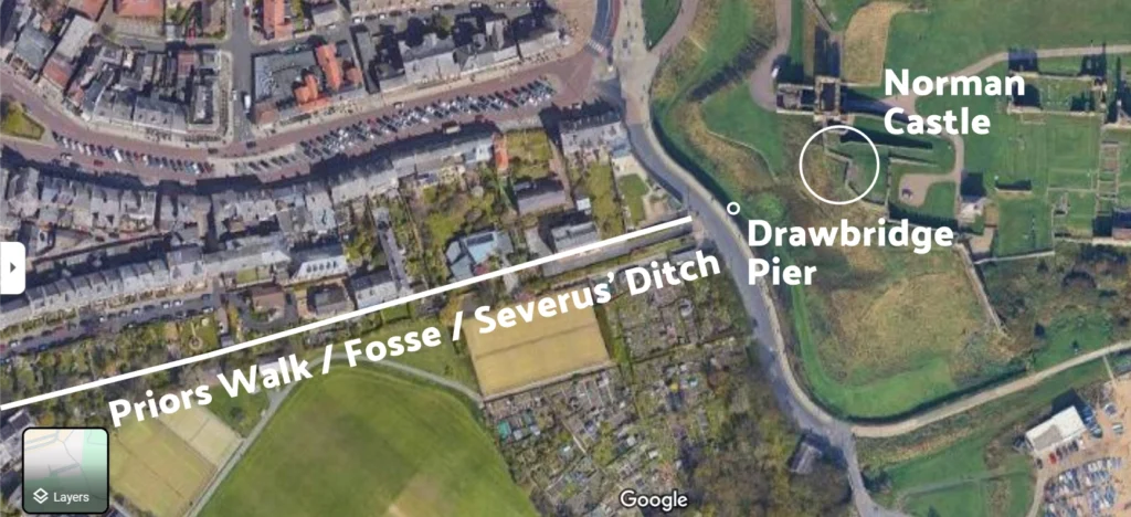
- If you look at this 1875 chart of the Tyne, and zoom into Penbal Crag you can see that the area on the south side of the Priory that was a ditch before being filled in to build the Pier Approach, is called the ‘Fosse’.
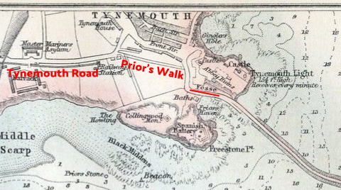
- Old maps show a drawbridge linking Tynemouth Castle and the early village, but it was further down the slope and appears more in-line with Bath Terrace than Front Street.
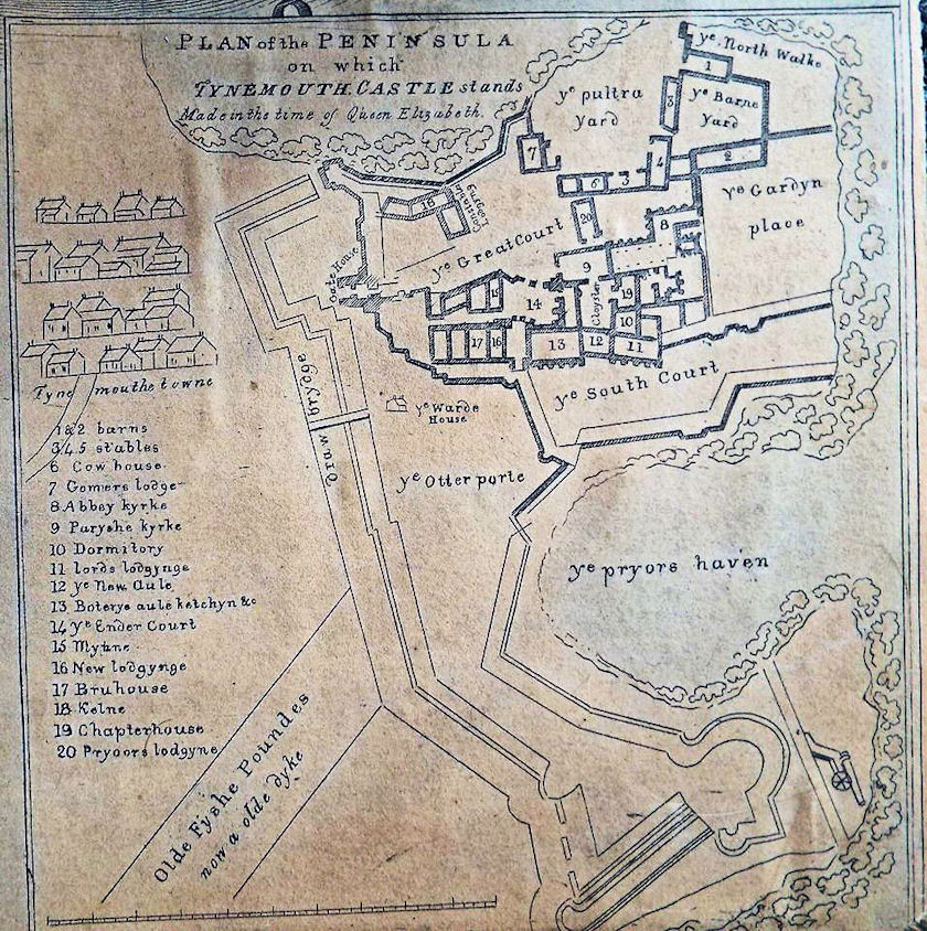
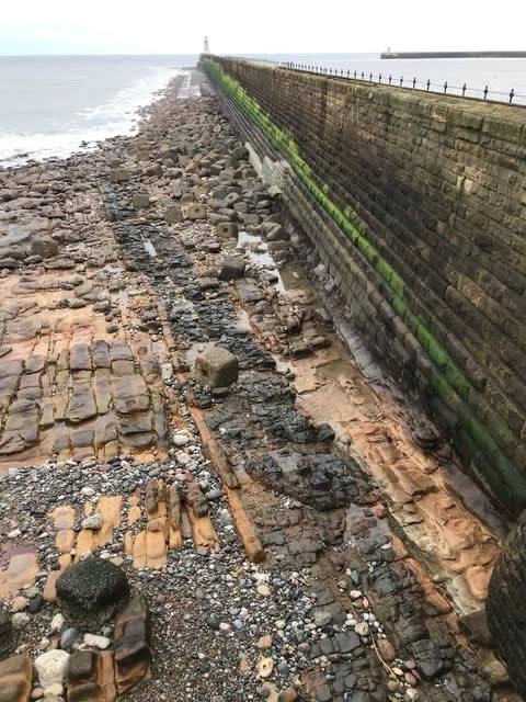
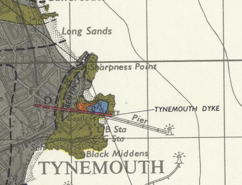
- Tynemouth Village straddles a ridge known as the Tynemouth Dyke in geological terms. The end point of this can be seen below the Pier observation platform. This is also visible along the south side of Penbal Crag on Pier Approach and follows the line of the area marked ‘Fosse’ on the 1875 chart.
The Tynemouth Dyke also manifests at the top of Manor Road where long ago the ravine in which lies Tynemouth Metro Station was the Kenners Dene Burn and this ran north to the middle of the Longsands.
A Medieval Boundary
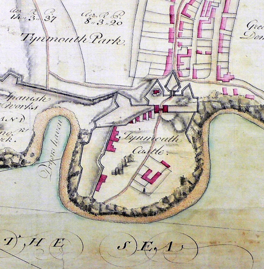
The monks of Tynemouth Priory farmed the land of what is now Prior’s Park and kept salmon in ponds in the gulley below it where the carpark is now. The township was allowed to grow to the north of the line of the Fosse which ran along the top of the land.
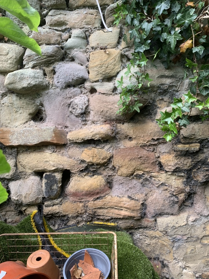
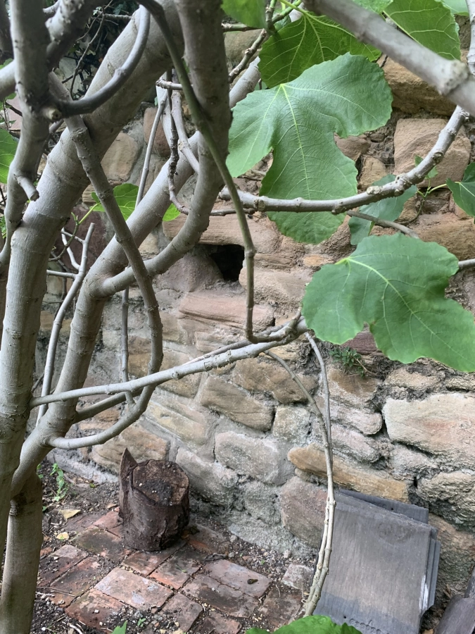
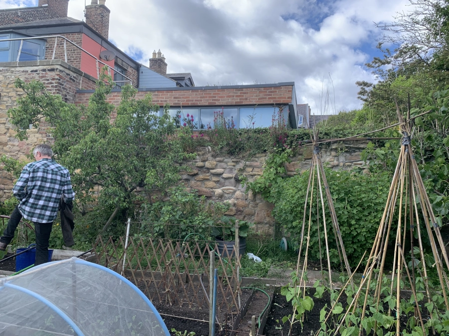
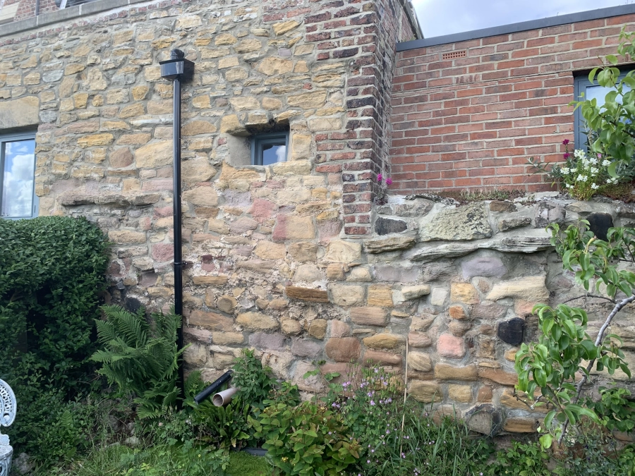
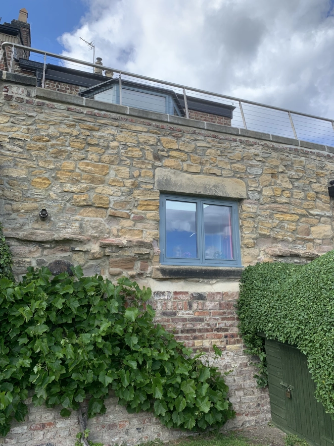
Possibly as early as the 14th century after the licence to crenallate was granted by Edward I, the monks built a thick wall and a broad walkway atop this wall to cordon off the church land and the fortified headlands from the common land of the village. This long boundary was known as Prior’s Walk and can be found today, although it is truncated since the building of Tynemouth Terrace and Tynemouth Place in the late 19th century.
Victorian Promenade
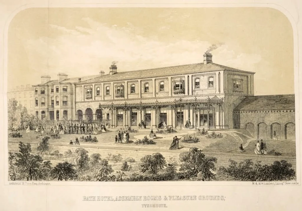
The Victorians who flocked to Tynemouth for the hot & cold saltwater baths on the Haven loved this walkway. Fashionable visitors typically lodged at the Bath Hotel and would stroll down to the beach via the promeneade.
A closer look
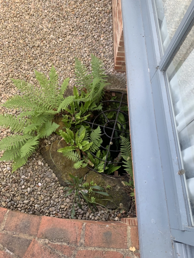
Thanks to Sam Gray, resident of The Grove to the rear of Front Street, we got to see how the houses at the bottom of the complex are built right onto this wall and walkway.
Penbal’s Theory
This wall and walkway appears to represent a very old route and boundary. I believe it sits atop the course of the Roman road into Tynemouth and onto Penbal Crag. This follows a straight line onto Tynemouth Road and ultimately all the way to Wallsend. Furhermore, I would not be surprised if the wall’s earliest foundations contain the evidence of this road that was built on the ridge of the Fosse.

Addendum: New Evidence Comes to Light
C. Hart, in Archaeologia Aeliana, Series 5, XXV, pp. 87-108 (1997) wrote:
“The Tynemouth Priory Chartulary of 1336 informs us of 117 properties set out in four rows; South Rawe, South Middle Raw, North Middle Raw, North Raw, and a further road called the Cause. The orientation of the latter is not obvious from this survey.”
A road called ‘the Cause’ indicates a causeway linking the village with the headland.
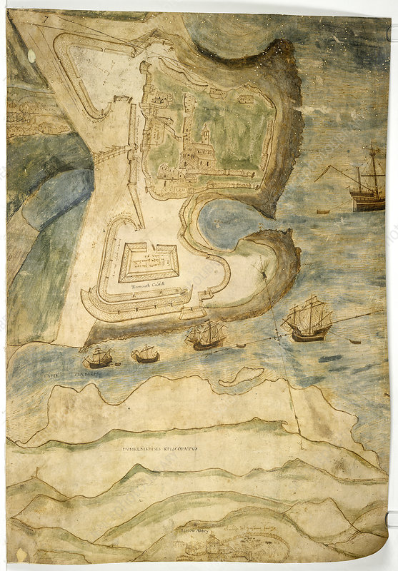
Referring to the 1580s Elizabethan Map, he continues:
“Based upon the position of the castle gatehouse and the street orientation, there appears to be a radical formalized change in a west-east alignment of the rows with the houses facing south-south-east. This means that the eastern end of Front Street was aligned on the stone gatehouse and its barbican, but not the drawbridge across the moat. It is noteworthy that the gatehouse is cut into the northern edge of the postulated early Norman motte of the post-conquest castle. (It is not certain if this earthwork is a motte or that it is part and parcel of a series of gun ramps, or even a sconce.)
The drawbridge lay to the south of this stone barbican and gatehouse, providing an entrance and exit from the castle and was aligned on the lane known locally as “The Monks Walk” and Windmill Lane. This runs today from Pier Road, along the boundary to the south of Our Lady and St. Oswin’s church. This lane in medieval times provided access to the fish ponds, Tynemouth windmill, and to Tynemouth’s traditional landing point (now known as Low Lights). It also provided access to the medieval spital situated near to Spittle Dene. From this evidence of major local links, the cartographic, and castle motte and drawbridge alignments, it can be postulated that this “Monks Walk/Windmill Lane” was the primary road to the castle, which only later became the south back lane, when Front Street was laid out. Further supporting evidence for The Monks Walk cum Windmill Lane being primary and that Front Street is secondary) comes in the form of the early cemetery finds from Front Street, with a single radio carbon date of AD 1100 ± 90 (Harwell 1870; 850 ± 90 B.P.) or, after calibration, A.D. 1170 (Harbottle, 1978).
Tynemouth’s primary medieval road and drawbridge went direct to the Norman castle, i.e. the mound south and east of the Gatehouse. What are the chances this follows the original Roman road?
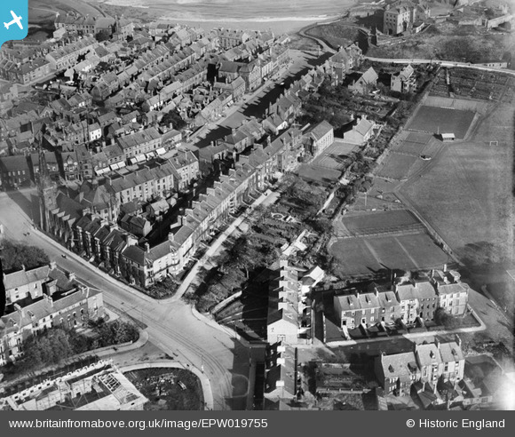
Splendid photos and ancient maps. I was brought up in Tynemouth, and your research enlarged and confirms much that I speculated. I particularly liked the 1927 Ariel photo, showing the town and the castle as it once was. The wall south from the Bath Assembly rooms, may have been in use when the kings visited, and then when foreign navy s threatened the Tyne.
The Roman presence, across 3+ centuries, must be taken as read.
“The wall south from the Bath Assembly rooms, may have been in use when the kings visited, and then when foreign navy s threatened the Tyne.”
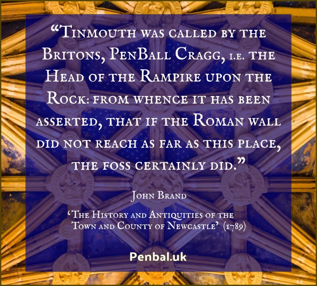
Exactly. It was a rampart. John Brand’s old translation of the word ‘Penbal Crag’, repeated by historians after him, is: ‘Head of the Rampart on the Rock’ and that is not inaccurate.
John Leland too stated in the 16th century that: “Penbalcrag, that is, head of the vallum cliff. This place is near the end of the vallum of Severus.” As mentioned, until the 19th century historians believed Hadrian’s Wall and its northern ditch were built by Severus.
Fascinating. Thank you