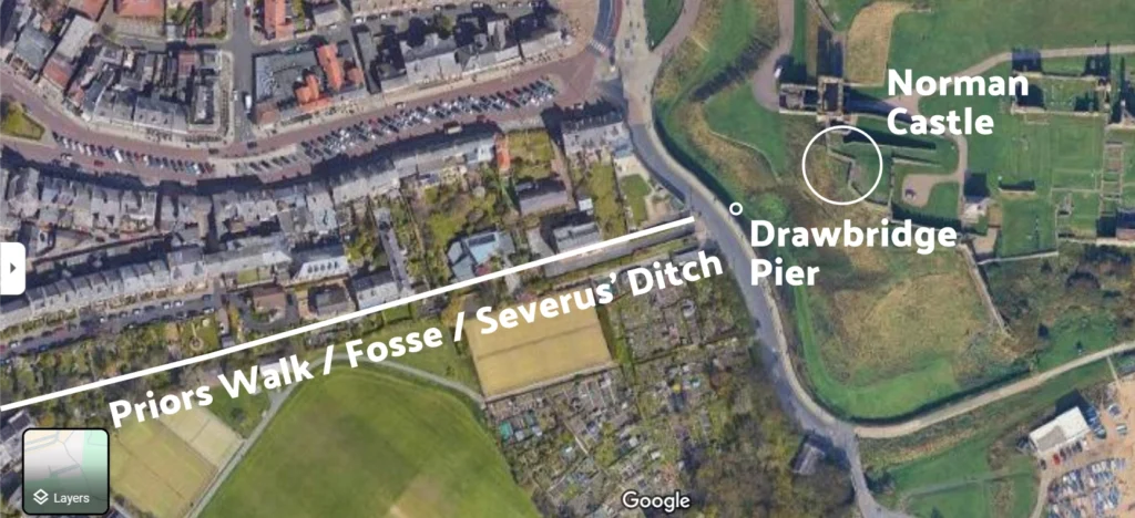
Is this slightly raised dry patch of land in the Moat the foundation of a pier for the medieval drawbridge?
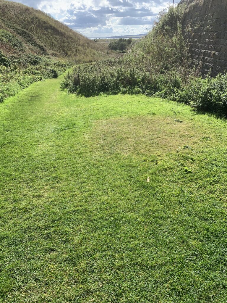
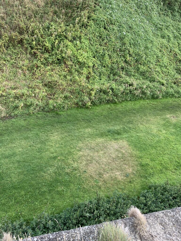
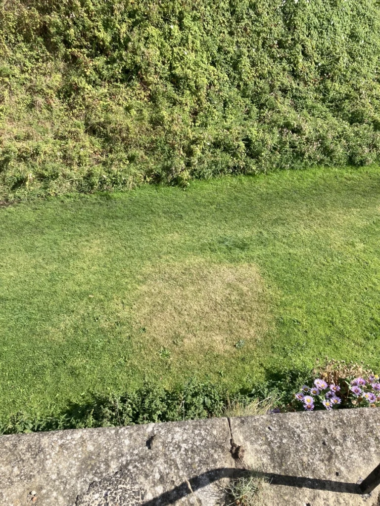

The dry mound in the moat is precisely in-line with this route and ancient path.
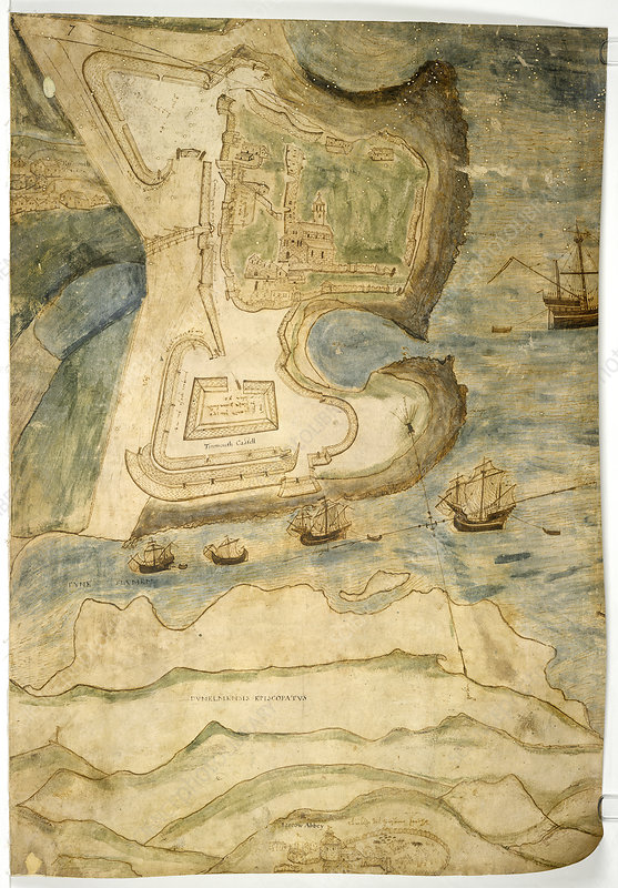
In this post from a couple of weeks ago I highlight two very old maps that show the drawbridge being further down the slope to the Haven than one might have thought, given the location of Front Street and the Village today. The actual crossing seemed to have connected with Prior’s Walk, recently uncovered to be the Fosse and Severus’ Ditch. The drawbridge, then, would have made landfall at the point where the long driveway for Pickering House begins.
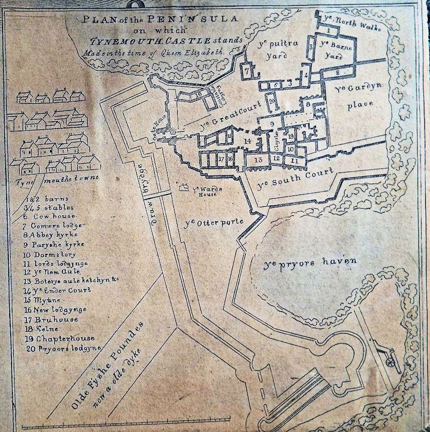
New Evidence: Confirmation of Drawbridge Site, Hart 1997
The Tynemouth Archaeological Strategy (2004) states:
“The position of the entrance to the early castle and the nature of its protective fortifications are unclear, but an early gatehouse/drawbridge may have been to the south of the fourteenth century barbican, a suggestion developed by Clive Hart (1997, 111). It may well be the case that later fortifications and landscaping have removed all evidence of the approach road and gateway into the headland.”
C. Hart, in Archaeologia Aeliana, Series 5, XXV, pp. 87-108 (1997) wrote:
“The Tynemouth Priory Chartulary of 1336 informs us of 117 properties set out in four rows; South Rawe, South Middle Raw, North Middle Raw, North Raw, and a further road called the Cause. The orientation of the latter is not obvious from this survey.”
A road called ‘the Cause’ indicates a causeway linking the village with the headland.
Referring to the 1580s Elizabethan Map, he continues:
“Based upon the position of the castle gatehouse and the street orientation, there appears to be a radical formalized change in a west-east alignment of the rows with the houses facing south-south-east. This means that the eastern end of Front Street was aligned on the stone gatehouse and its barbican, but not the drawbridge across the moat. It is noteworthy that the gatehouse is cut into the northern edge of the postulated early Norman motte of the post-conquest castle. (It is not certain if this earthwork is a motte or that it is part and parcel of a series of gun ramps, or even a sconce.)
The drawbridge lay to the south of this stone barbican and gatehouse, providing an entrance and exit from the castle and was aligned on the lane known locally as “The Monks Walk” and Windmill Lane. This runs today from Pier Road, along the boundary to the south of Our Lady and St. Oswin’s church. This lane in medieval times provided access to the fish ponds, Tynemouth windmill, and to Tynemouth’s traditional landing point (now known as Low Lights). It also provided access to the medieval spital situated near to Spittle Dene. From this evidence of major local links, the cartographic, and castle motte and drawbridge alignments, it can be postulated that this “Monks Walk/Windmill Lane” was the primary road to the castle, which only later became the south back lane, when Front Street was laid out. Further supporting evidence for The Monks Walk cum Windmill Lane being primary and that Front Street is secondary) comes in the form of the early cemetery finds from Front Street, with a single radio carbon date of AD 1100 ± 90 (Harwell 1870; 850 ± 90 B.P.) or, after calibration, A.D. 1170 (Harbottle, 1978).
This, then, appears conclusive that we have found the site of the drawbridge and that it did link to Prior’s Walk.
Tynemouth’s primary road and drawbridge originally went direct to the Norman castle, i.e. the mound south and east of the Gatehouse.
See also:
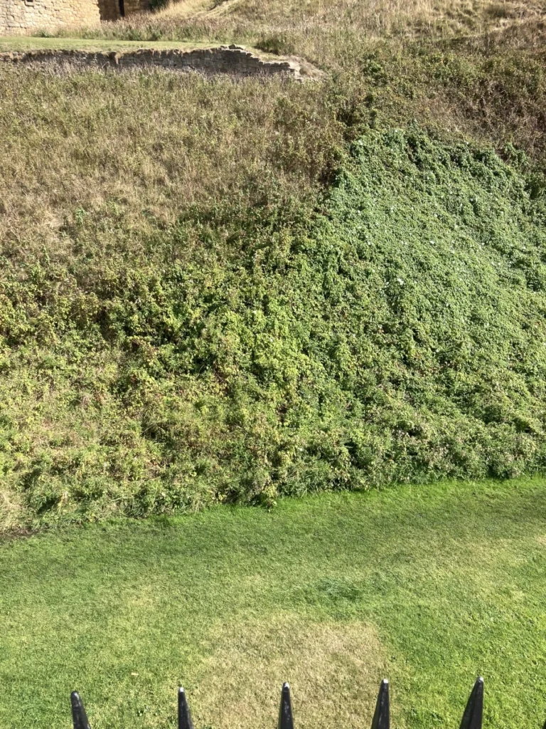
Four months ago the intense spell of dry weather also uncovered the line for old fortifications in the grass outside the Gatehouse, which we have shown here and correlated with maps: