
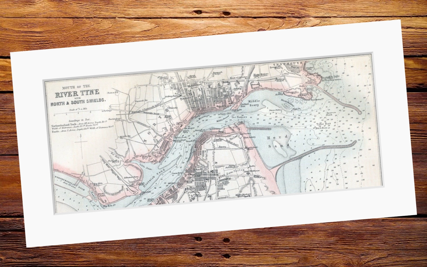
Mouth of the River Tyne — drawn and engraved by J Bartholomew (1875)
Overall Size: 20″x10″
Art size: 17″x7″
Printed on 350g matt texture paper.
Bright white mount has a border of 5.7cm.
- Tax included.
- Refunds & Returns.
£15.00
Victorian navigational chart of the entrance and reaches of the River Tyne with the early streets of North and South Shields. Published in The Imperial Gazeteer of England and Wales. The map displays some lesser known details of the area, including the original curved North Pier, Gingler’s Hole, the Fosse, the Howling and Peggy’s Hole.
Overall Size: 20″x10″
Art size: 17″x7″
Mouth of the River Tyne — drawn and engraved by J Bartholomew (1875)
Overall Size: 20″x10″
Art size: 17″x7″
Printed on 350g matt texture paper.
Bright white mount has a border of 5.7cm.

Reviews
There are no reviews yet.