By Gary Holland
When I was 16 years old I started my first job — working at John Lilley & Gillie Ltd on North Shields Quay. As well as selling navigational equipment, the business also had a chart department where I worked for around 2 years before leaving to join the Royal Navy. The chart department was essentially one of a small number of agents around the UK permitted to sell charts produced by the UK Hydrographic Office — essential items for ship navigation, although somewhat replaced these days by digital alternatives.
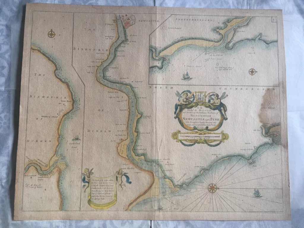
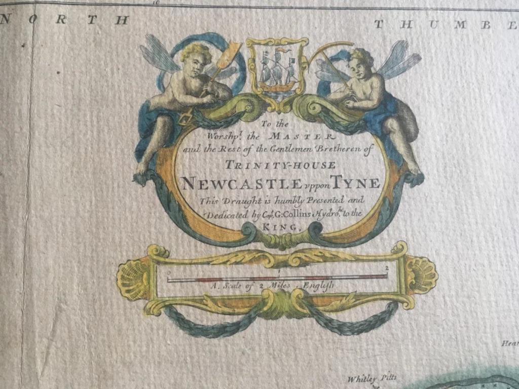
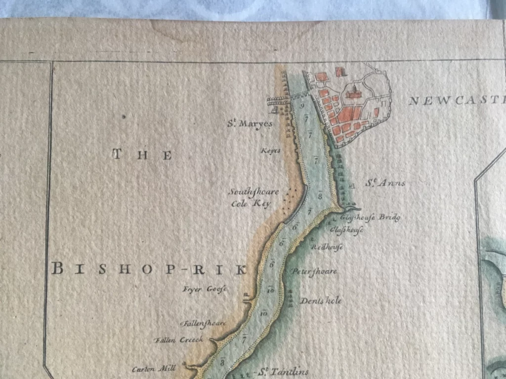
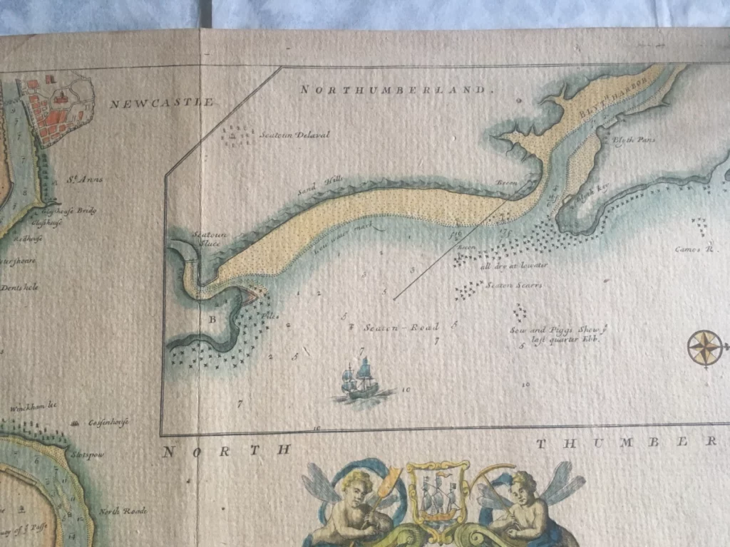
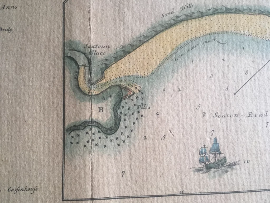
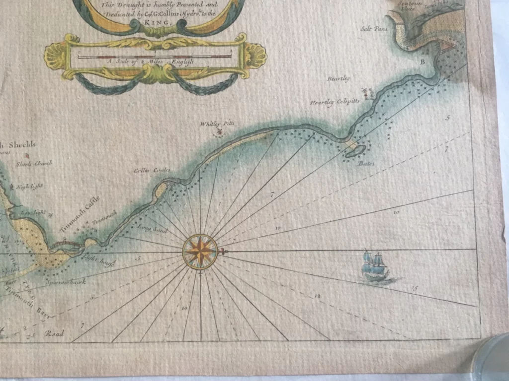
It’s fitting then, that this Penbal post relates to a beautiful sea chart, and at over 300 years old, one of the earliest documents that we have showing the River Tyne. It is one of a series of charts created by Captain Greenville Collins, who was hydrographer to King Charles II as well as an officer in the Royal Navy with a distinguished career earning him renown for his charting skills. He was the first person to conduct a truly comprehensive and accurate survey of the country’s coast and this was compiled in the folio, Great Britain’s Coasting Pilot (1693).
The three charts within this map were part of a series commissioned by the King in 1676, who was keen to promote navigational and scientific knowledge nationally. They were created under the direction of Samuel Pepys in conjunction with Trinity House. The map continued in print until, I believe, the early 1700s. As well as primarily the Tyne, it shows the rivers Wear and Blyth in addition to lots of little interesting details. The map would have been coloured by hand after printing and around the border it is still possible to see the imprint of the printing press. It is approximately 60cm x 50cm and printed on very thick paper with some slight water damage.
The Tyne chart shows the course of the river, long before the adjustments by the Tyne Improvement Commission and the Industrial Revolution, which would change the river forever. Details include landmarks and useful information such as:
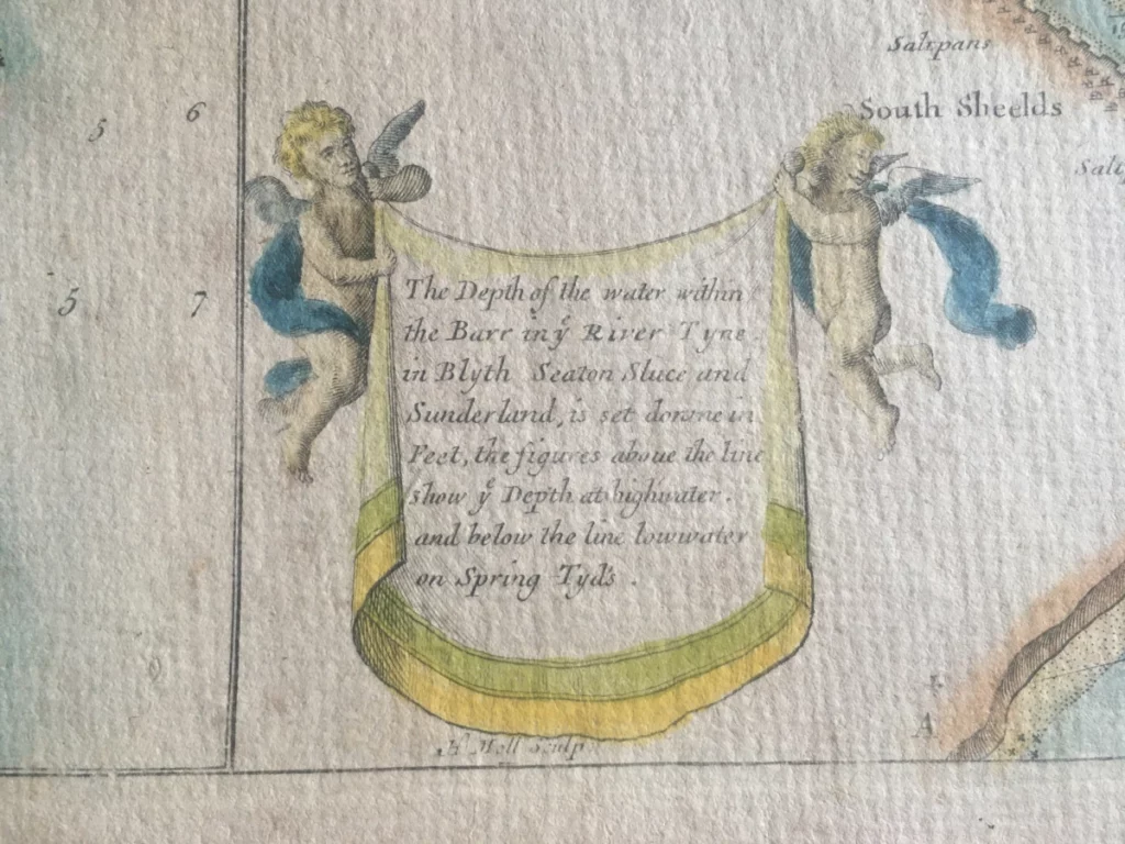
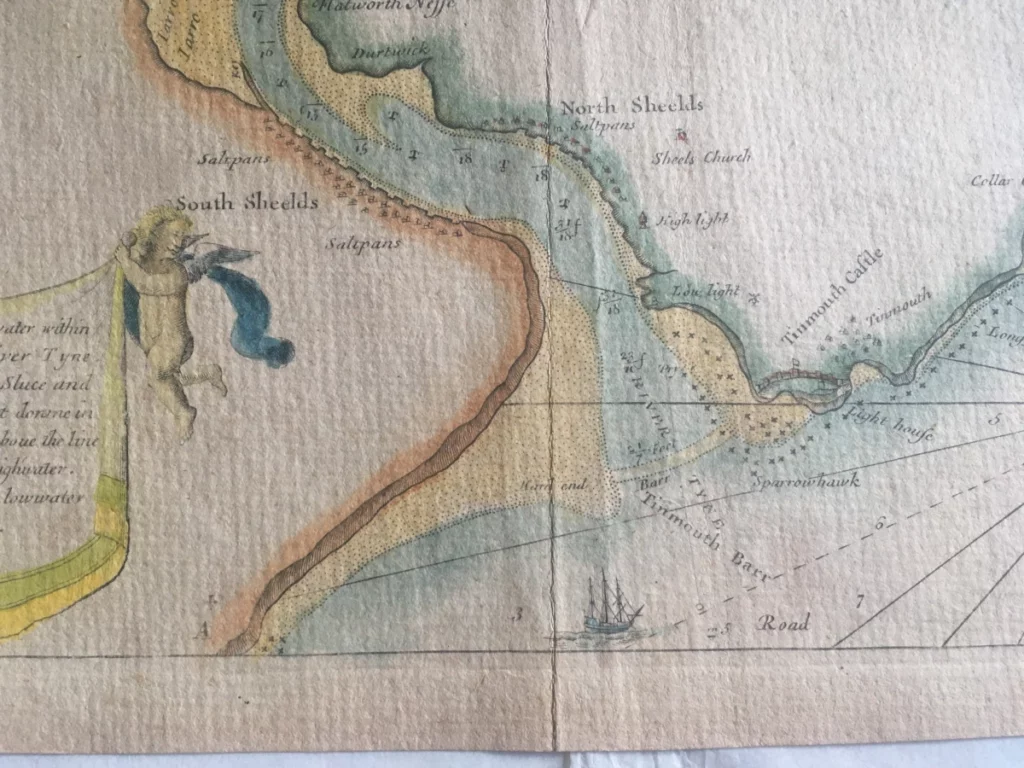
- Crucial nautical information such as water depths and areas of rocks and sand banks. Safe entrance to the Tyne with the high and low lights lined up is shown, but Clifford’s Fort, built a few years earlier is not shown.
- Cullercoats as ‘Collar Coates’ with the harbour shown as a construction in the bay.
- ‘Sheels Church’ — I presume the newly built Christ Church in North Shields which was consecrated just a few years earlier in 1668 as an alternative to the crumbling Priory in Tynemouth.
- Wallsend itself is not shown but ‘Cossen House’, often called Cousins House and later Carville Hall, is there. This was a famous building of the time, largely built of Roman stone but now demolished.
- ‘North Road’ is labelled, which is still a street in Wallsend, but at that time it formed the main turnpike road to Shields.
- Also mentioned in the Wallsend vicinity is ‘Stots Pow’ — a river that ran around Stotts Farm in Walker.
- Labelled in error on the map is the heading North Thumberland.
- Anyone local to Seaton Sluice may be interested in some information including ‘Sow and Piggs Show’.
- Noteable ‘keys’ at Jarrow, Howdon Ponds, Woolsington, Heburn, Winckham Lee (Wincomblee Road), and others at Newcastle.
- A ‘Halfe Way Tree’ is shown to mark the distance to Newcastle.
- ‘Buoy of Passe’ at a large sandbank near Wallsend
- ‘Fallen Creeck’ (Felling?)
- Fryer Goose
- Redhouse
- Glashouse Bridge (Ouseburn)
- Newcastle is shown with the surrounding city walls and bridge over the Tyne.
Here’s the map:
When was Wallsend named? Was it recent history? In which case it may have not been the end of the original build, but the remains of the existing ruin at that time.
Hi Robin, interesting comment. Without looking in detail I would have thought that the first mention of Wallsend was perhaps the late 1500s or early 1600s – essentially when people started to take note, value and record Roman history and the first mention of the wall in the area.