By Crasterfarian
There is a fantastic circular walk to be taken from Craster Quarry Car Park to Dunstan Square Farm, along to Dunstan Steads, then back along the south end of Embleton Bay, past Dunstanburgh Castle, Nova Scotia, up to the World War II Chain Home Low Station and back to the car park.

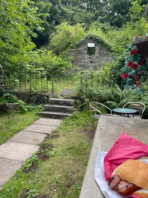
Best to park your car in the village car park at Craster Quarry then walk along the back of the North Hills. You can start off with a lovely breakfast sandwich from Andy Grant at Piper’s Pitch, I often call in for a kipper in a bun and a cuppa and have a craic with Andy, one of life’s true gentlemen. Howay man, ye can’t go to Craster without having a kipper.
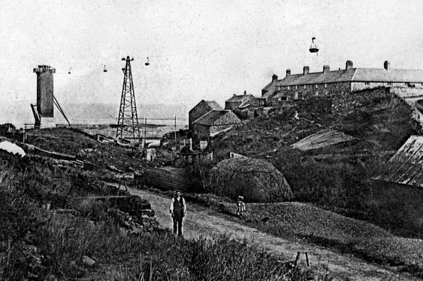
The building behind Andy’s van is known locally as ‘The White Buildings’ and is the remains of the engine house that powered the quarry crusher and the overhead cable system that took stone from the quarry to the end of the South Pier for export by ship. More of that later.
As you cross the road that goes into Craster, opposite the car park, and head through the gate into the little wood below Norwell Brow you are following an old road.
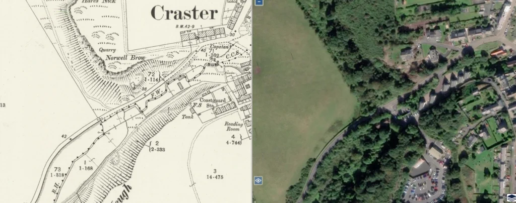
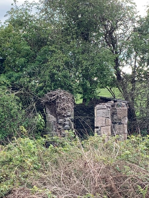
Note the old building on your left as you emerge for the wood. This was the gunpowder house for the sandstone quarry under Norwell Brow, where it is thought some of the stone for Dunstanburgh Castle came from. This road, viewed looking south back towards the way you came, was built to service the POW camp.
After the allies invaded Italy in 1943 many prisoners of war ended up seeing out the conflict at Craster. There was a POW camp just below the Chain Home Low Station. As you reach the old brick cess pit for the camp, look up the escarpment to the top of the cliff and you will see several terraces cut into the rocks below the summit. This was the location of the prisoners’ Nissen huts.
There was no water up there so the prisoners, accompanied by soldiers, both regulars stationed at Craster Tower and the Home Guard, escorted the POWs down into the village with a donkey carrying a water barrel on its back. Once there the barrel was filled, and the poor beast had to carry it all the way back up to the camp.
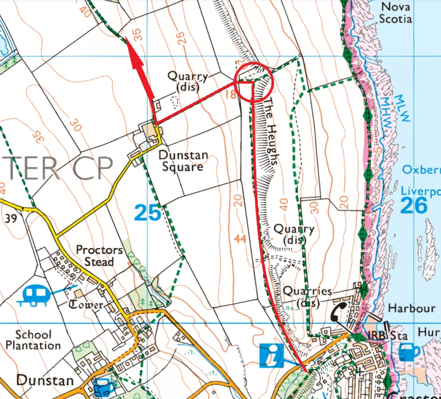
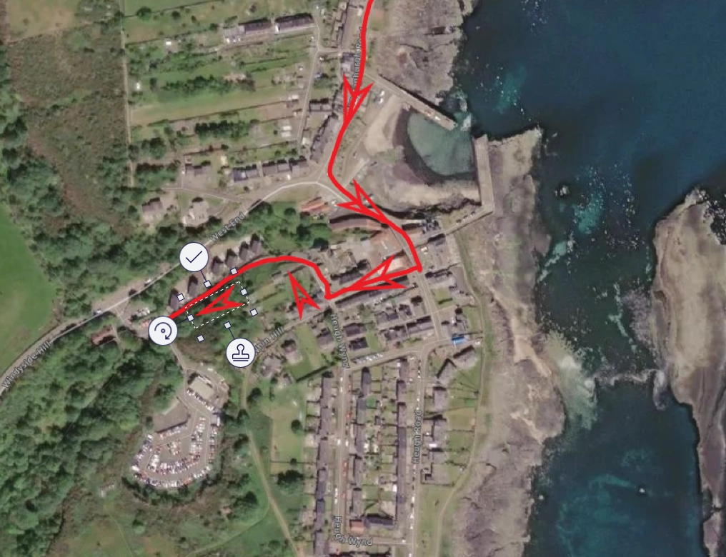
Once you reach the red circle, turn left and head up to Dunstan Square Farm, at the top of the hill turn right onto the bridle path to Dunstan Steads.
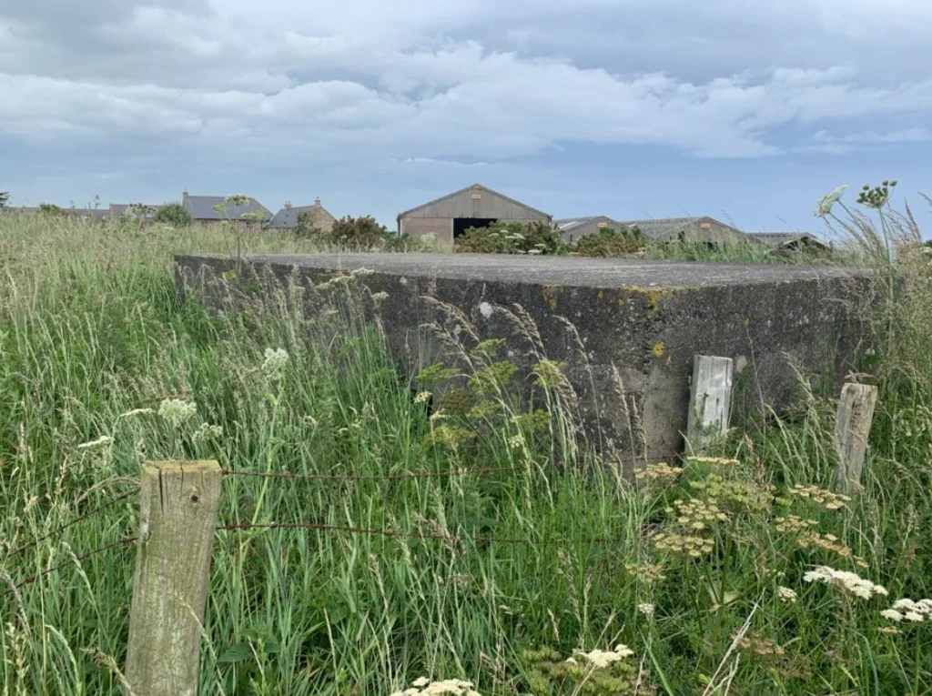
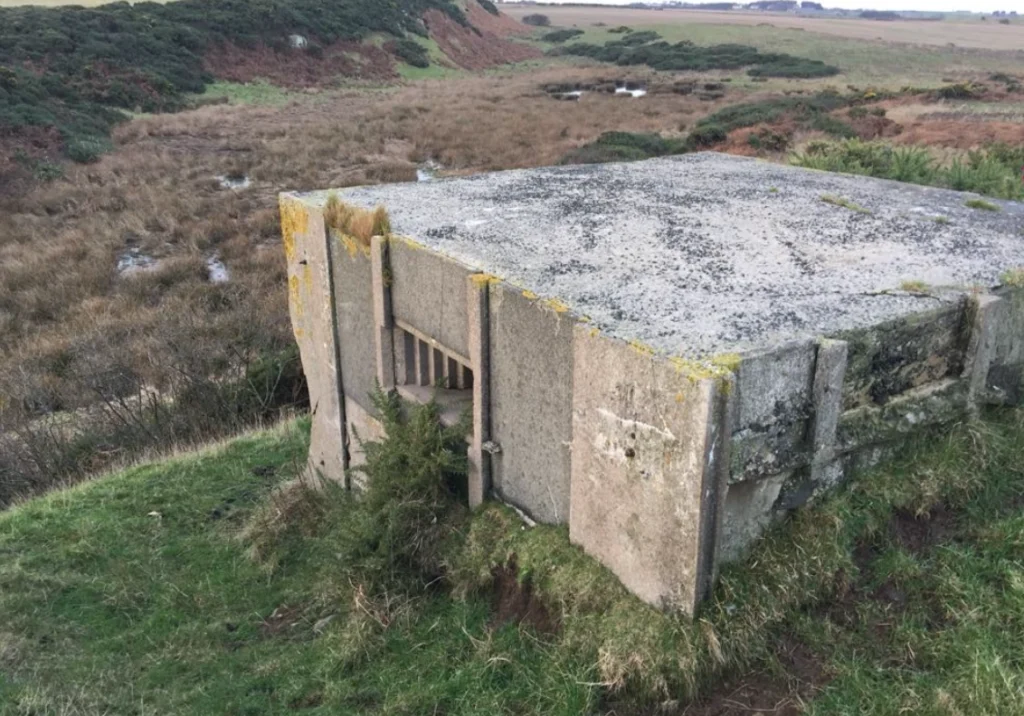
At this point you will see a sandbagged pill boxes. These are in an incredible state of preservation considering they were put there in those dark days on the run up to the outbreak of World War II more than 85 years ago. You will also notice that the first one you come to is facing inland. This is because it’s not protecting the coast from invasion but protecting the western flank of the Chain Home Low Radar Station that lies on the top of the Heughs.
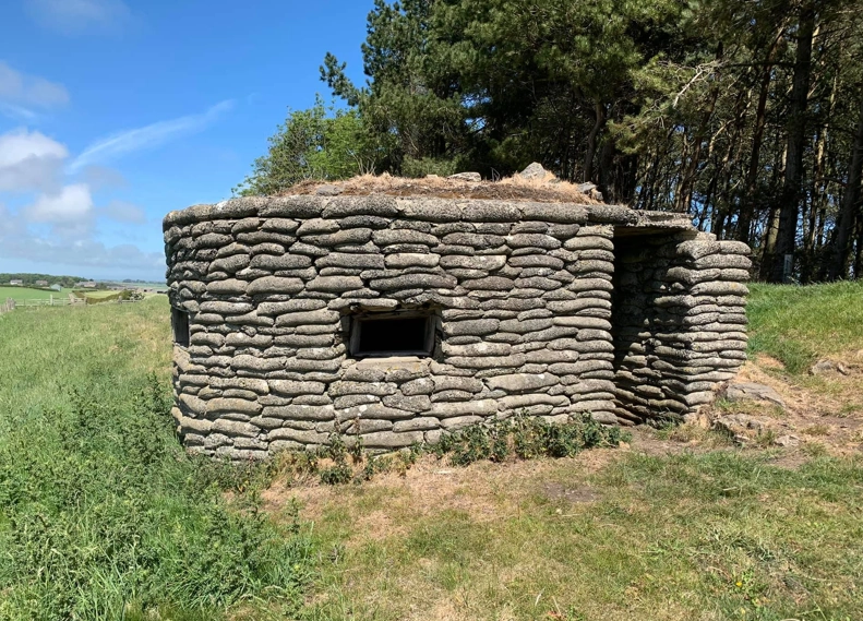
As you continue your walk north, if you look to the right, just past the copse of trees, you will see second pill box of the exact same design, this time pointing north, built to guard the approach up the bridlepath from Dunstan Steads Farm.
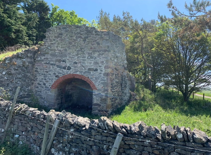
Slightly hidden in the trees to its rear is a lime kiln. These fiery furnaces were used from Roman times to render quicklime from limestone, initially for building mortar but then to be used as fertiliser. Landowners were obliged to have lime put on their fallow fields to maintain their fertility. A tenant of Bent Hall was bound by an agreement made in 1800 to spread on his fallow land four double cartloads of shell lime and 8 loads of small lime to every acre, but most of the lime was exported. A great example of that trade are the lime kilns at the harbour in Beadnell.
Not only was it used for fertiliser, but also for mortar, disinfectant and industrial processes. Which use dominated locally varied, with rural kilns often supported farming, while others supplied building trades or industry.
As you leave the lime kilns in your wake and begin to walk down the bridle path to Dunstan Steads Farm it’s easy to forget all your cares and be absorbed by your surroundings. Fields of wheat and rapeseed fill the air with their heady scents accompanied by the chorus of all manner of birds and insects.
This trackway has been used for centuries between Dunstan and Embleton and was viewed as a potential access road for any German invasion, so was heavily fortified.
As you reach Dunstan Steads Farm, look in the field to your right and you will see another pillbox in the rear corner of the farm right next to the bridle path.
As you walk down the lane towards Dunstanburgh Castle Golf Course you will see that the cottages that once housed farm workers and their familes are now all holiday homes. Sad for local people but an amazing place to stay should you want to be in the bosom of Dunstanburgh Castle and Embleton Bay.
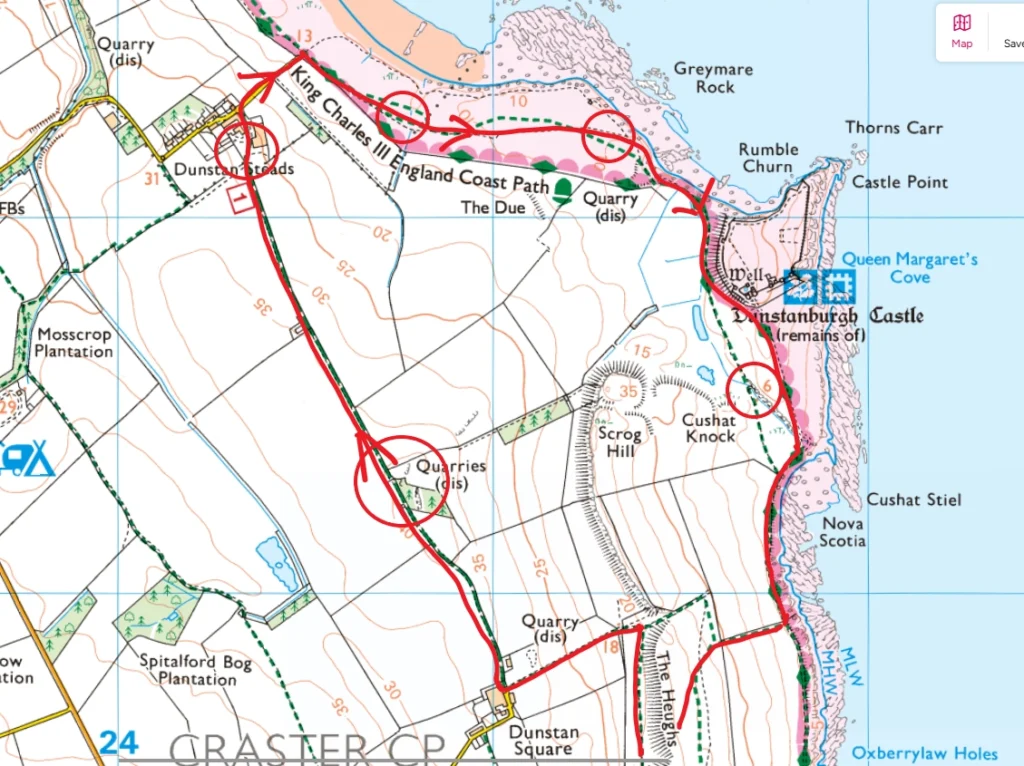
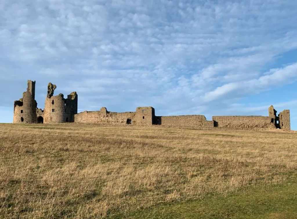
All the areas circled contain pillboxes that are still in their original position. They can be spied into through windows and doors if you’re adventurous. The one circled in the top-centre of the map was built under the instruction of a World War I veteran captain who survived the carnage of the Somme and became senior officer of Embleton Home Guard. At his request they modified the design. The pillbox nearest the Castle shows the stark contrast between 20th Century and 14th Century warfare.

Before we head up and around the base of Dunstanburgh Castle, look at the rock formation at the end of the golf course. It’s a geological fold and geologists from all over the world come to look and study its shape. It’s on the maps as Greymares Rock but its known locally as Saddle Rock.
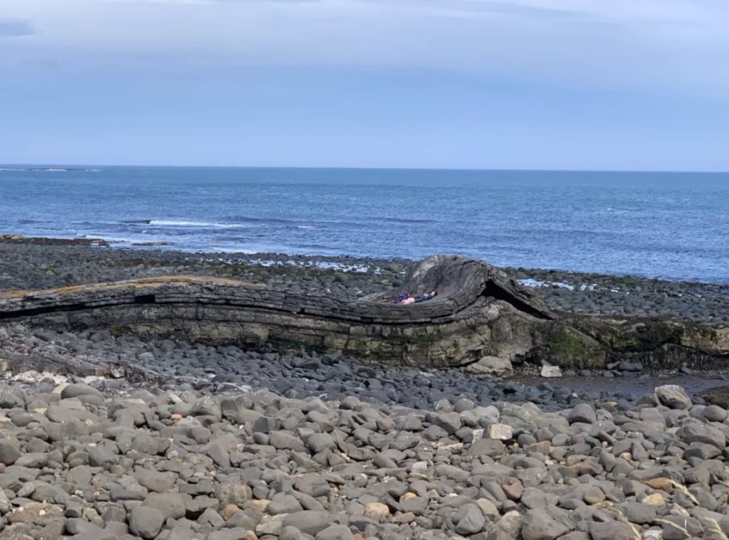
To its south and in the foreground of the picture is the boulder-strewn shoreline where the ferocious North Sea has torn rocks off the end of the Whin Sill and rolled them about making them precarious even on dry days. They get called Death Rocks these days by a lot of people but I’d never heard that term and I was born and brought up in Craster.
LJ Ross, the author, wrote a cracking tale as part of her DCI Ryan books named Death Rocks, it s great read so make sure you get a copy, or maybe start at the beginning of the book series. They are very good and relatable to anyone local.
We spent may hours of our summer holidays here collecting willicks for Robson’s at Craster. I can still remember the repurposed Silver Cross pram we pushed along, and the sackcloth bags. Alan Robson would go through them as he weighed them off to make sure there were no stones in there…
In front of you now is Gull Crag with the precipitous end to the Whin Sill below it. In the turmoil of the water those boulders have been worn into lenticular shapes by the pounding of the North Sea.
The area is called Rumble Churn and for good reason. In heavy seas you can hear the rocks being moved around like in some Argonauts’ story (those bloody skeletons from the Hydra’s teeth still make me shudder at 57).
We now walk to the base of the Castle. Looking up you can see the Lilburn Tower and the Castle’s postern gate. At the foot of the tower you can see some columnar stacks of whinstone. These are known as the Keepers of the Castle’ and their faces can be seen quite clearly in profile, keeping a weather eye to the north for any impending danger. If you venture into the Castle and peek out the postern gate, there they are, plain as day.
If you wish to visit the Castle then please do so. You can gain free entry if you are either a member of the National Trust or English Heritage. Sites where both heritage passes are valid for the same attraction are few and far between so make use of it.
I’ll fill you in on the history of the Castle but it’s a short and tumultuous one. Dunstanburgh Castle was built in 1313 by Thomas, Earl of Lancaster, a powerful noble and cousin to King Edward II. He chose the remote Northumberland Coast partly for defence and partly as a show of wealth and defiance. After Lancaster’s execution in 1322, the castle passed to the Crown. It was later strengthened in the 1380s by John of Gaunt, Duke of Lancaster, who added a barbican to the western side and strengthened the walls. During the Wars of the Roses, it changed hands multiple times and was damaged in sieges, particularly in the 1460s. It fell into ruin by the 16th century and was never restored.
Today, its dramatic coastal silhouette makes it one of the most iconic medieval ruins in the North East.
I don’t believe ghost stories but I will tell you this one.
Sir Guy the Seeker
While travelling through the area, Sir Guy was caught in a fierce storm and urgently sought shelter. Riding toward the only visible shelter—the ruins of the castle—he found every entrance barred. At last, he took refuge by an entrance beneath a lone yew tree and waited out the storm.
At midnight, lightning struck, and the door behind him creaked open. An ancient wizard appeared and beckoned Sir Guy inside, promising great reward for a true-hearted hero—or ruin for those who failed. Together, they ventured through twisting passages and staircases beneath the castle, surrounded by eerie sounds and strange visions.
Finally, they reached a richly adorned vault, at the centre of which lay a crystal tomb. Sleeping warriors surrounded the chamber. Within the tomb rested a beautiful, enchanted lady, suspended in eternal sleep. Flanking her were the giant skeletons of ancient kings—one clutching a sword, the other a shield. To free the lady, both were needed, but which should come first?
Sir Guy hesitated but laid his hand on the sword’s hilt. Doubt crept in, and instead, he lifted the horn and blew a single note. Instantly, the light vanished, and the voices of the waking warriors echoed mockingly around him as they advanced with swords and spears.
The wizard’s voice turned harsh:
“Now shame on the coward who sounded a horn,
When he might have unsheathed a sword!”
A poisonous mist filled the air, and Sir Guy lost consciousness. He awoke cold and stiff beside the closed doorway beneath the yew tree. Haunted by visions of the sleeping lady and the treasures within the vault, he was driven to try again.
Sir Guy spent the rest of his life searching the castle for a way back to the vault. After his death, it is said his spirit still roams, endlessly seeking.
Back on the trail, if you walk to the last circle on the map further up, you will see a different pillbox again. This one is a prefab one that was assembled IKEA style on site. Its position is critical, overlooking Scrogg Hill and Cushat Knock’ both of which were mined during World War II to protect the northern flank of the Chain Home Low Station on the Heugh. My mother can remember the signs and the strict instructions to KEEP OUT.
It overlooks a narrow cut between the outcrop the Castle stands on and Cushat Knock, a marshy boggy area once thought to have been tidal. Below this pillbox you will notice what looks like a track running towards the sea. What you are looking at is the original wharf for Dunstanburgh Castle back when the sea ran almost all the way round the headland nearly creating an island.
Larger vessels would have sought refuge inside the Cushat Stiel (pronounced ‘Cusha’ locally) while they were serviced by tenders. Remember, Craster was not in existence until the early 17th Century so this would have been the only safe anchorage, as we can see what the North Sea has done to the whinstone cliffs on the bay to the north. There is an old anecdotal tale I was always told as a kid that Herny VIII entire fleet tried to dock here at this inlet known as ‘Nova Scotia’ during a foggy voyage north. They thought it was Edinburgh…
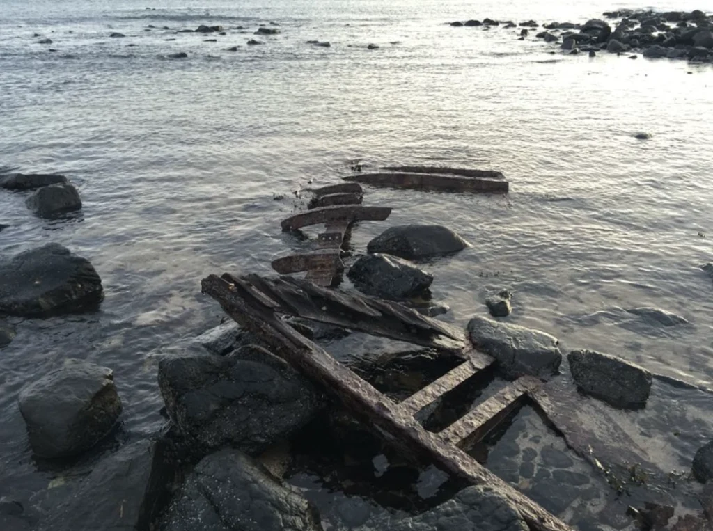
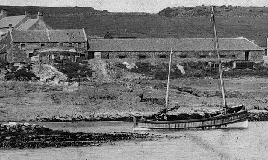
Lying, slowly decaying, in the middle of the inlet are the remains of Polish trawler GYD326. She ran aground on 28th August 1958. At the time we were embroiled in the Cold War’and the police turned up and arrested the stricken sailors until their identity could be confirmed and that they weren’t spies of Mother Russia (don’t forget how close this is spot to the Early Warning stations at Boulmer and Brizlee Wood).
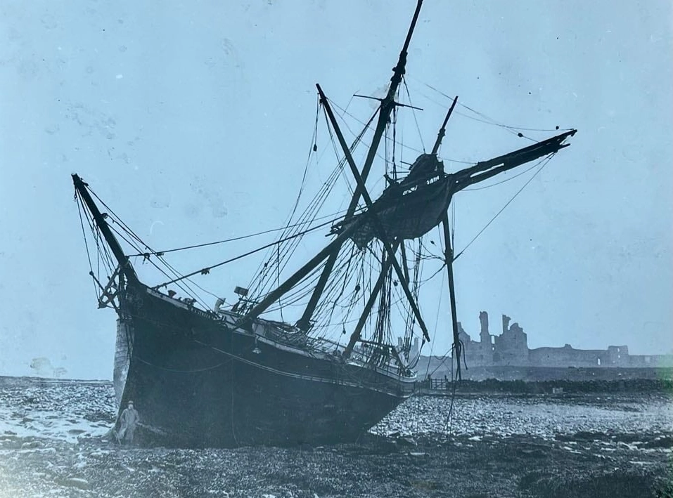
Before and after.
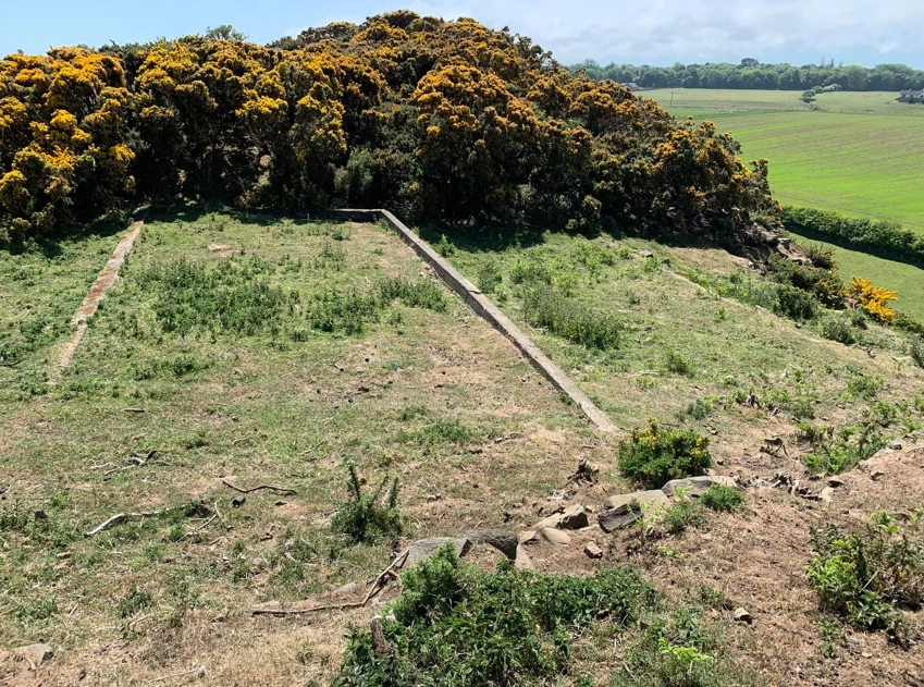
Walking south now, following the coastal footpath as shown on the OS map, we head towards the first big gate on that part of the route. If you cut up the hill just before the gate and follow the line drawn on the map you will come to another gate on the prow that leads to the Heugh and the site of the Chain Home Low Station and its prisoner of war camp.
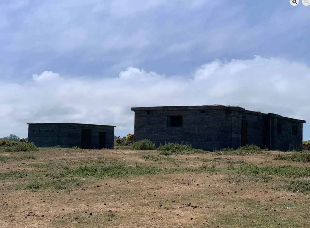
I’ve added an image of the radar array that would have sat on the roof of the most northerly building.
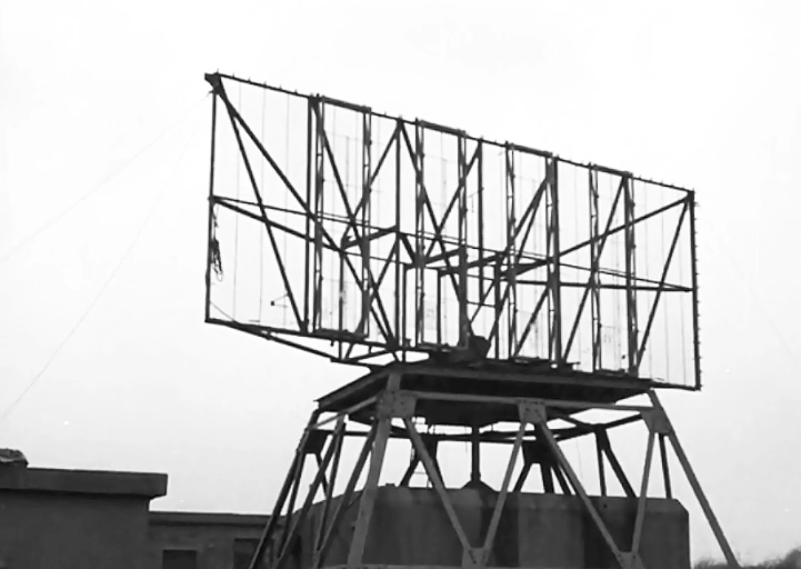
The radar site was top secret when being constructed and the two metal bins on Craster South Pier were removed as they caused interference. The story at the time was that they were a landmark for German bombers.
This entre site has one of the best views in Northumberland, with a huge vista. You can see from the Farne Islands down to the power station at Lynemouth.
From here you can skirt back down the hill to the gateway at the entrance to Craster and walk along Dunstanburgh Road. As you come through the gate, the 6 white properties to the right occupy the site of what was a kipper shed owned by the Archbold family.
As you will have read earlier, the whinstone from the quarry was carried buy overhead cables to the bins on the Pier where ships would come and take it away. London, it is said, is paved with the stone from Craster Quarry.
Well, we are almost back at the start of our journey, But howld ern, afore ye gan hyem, why not pop and get some kippers or maybe a pint in the Jolly.
The food is fantastic in the pub, as are the fish and chips from the van outside, but despite the modernisation, and the trappings of a gastropub, my old self still hankers for the days when it was a PROPER pub, full of fishermen, farmers and herring workers just rounding their days graft off with a pint, a bit craic (and mind, the craic was good in there) and maybe a game of darts,
In the village, as you aged, you migrated from the lounge into the mythical ‘little bar’, a place of wonder for mere mortals and especially tourists, a strange land of wisdom, old gadgies’ harsh words, riotous laughter and tab smoke.
From the Jolly you can walk up Whin Hill towards the Coastguard Cottages, turn right and follow the path along and down and back to the Quarry car park.
With Love from the Crasterfarian XX