By Crasterfarian
Tucked below the Great Keep and South Wall of Dunstanburgh Castle lies an inlet locals call Nova Scotia, the Castle’s little harbour.
Visitors’ eyes are drawn to the keep almost all the way from the village, growing larger as you approach along the coastal path. The last thing many notice is what’s literally in front of them.
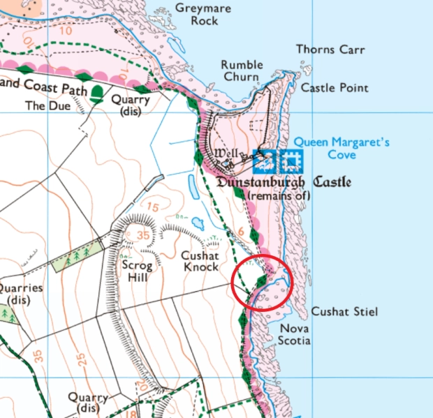
The setting does the engineering. Cushat Stiel, the whinstone rib on the north-east side, acts as a natural breakwater, creating a pocket of quieter water, sheltered from north-easterly gales and the heavy swells that career across Embleton Bay.
The whole headland was deliberately engineered to feel like an island. Medieval works created meres and a broad ditch that linked to the harbour, effectively isolating the promontory with water, a superb defensive position.
You can still pick out the boggier ground that forms a kind of extra moat around the site.
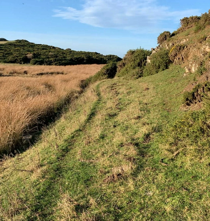
Historic sources describe a medieval harbour south of the castle; its basalt-boulder quay survives and was likely used first to land building stone and later for household traffic in good weather. That quay still exists and can be walked much like a small pier.
How it Worked
Larger coastal craft wouldn’t risk the shallows. They’d ride at anchor just inside the lee of Cushat Stiel, then tenders (lighters) ran the last yards to the quay with barrels, sacks, timber or lime, standard small-harbour practice on exposed coasts.
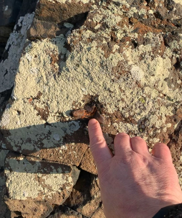
On the rock faces around the inlet you can see drilled sockets/holes where iron mooring pins or rings were fixed, handy anchor points for shorelines and tender warps. (They’re plainly visible on the whinstone today, though not itemised in the formal site summaries.)
Silting and the Sand Bar
From the 15th century the Castle slipped into ruin, and, without maintenance, the basin slowly silted.
A bar of sand and cobble crept across the inner approach, roughly where the access track runs now, choking what had been workable water.
That fits the wider picture of a harbour whose remains survive but whose everyday use faded with the Castle’s decline.
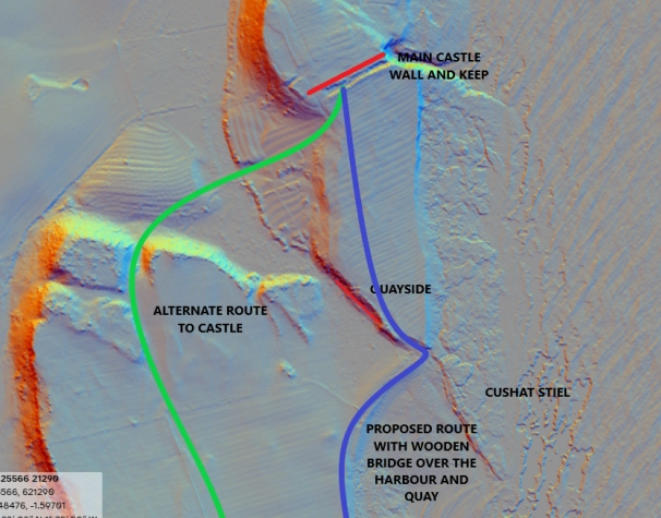
That leaves the sticky question of land access to the promontory. If the inlet was navigable water, how did people cross on foot?
Perhaps there was a timbered platform or bridge, high enough to let small tenders pass underneath to the quay, now long rotted away. Or people approached from the western side via the Heugh, coming down between Cushat Knock and Scrogg Hill (a route still used today).
It’s my view that Scrogg Hill was a hillfort or at least an enclosure from the Bronze or Iron Age. You can see where the hand of ancient man had dug the makings of a ditch across the headland
“Nova Scotia” and Later Memory
The name Nova (or Novia) Scotia appears in later records for a small settlement at the harbour site, often linked to Scottish incomers after the Castle’s turbulent medieval phase, long before Craster’s stone harbour (early 1900s) reshaped local sea-use further south.
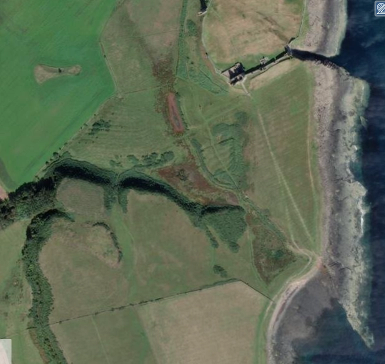
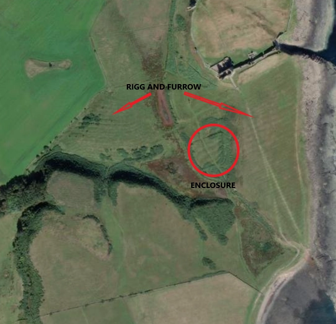
The remains of a rectangular enclosure and ridge-and-furrow can be seen on the approach to the Castle and in the lee of the plateau to the west.
These sites haven’t been fully excavated but suggest a farmstead and people living in the hollow below the Castle.
It would have been a hard life, but local memories even talk of children born in a house by the Castle in the 1700s.
Families likely supplemented farming with fishing and shellfish gathering. Preserving fish would have been vital for long winter nights and short days when fresh food was scarce. This could represent the earliest stirrings of what later became the fishing village at Craster and its famous herring industry
Roman Possibility
There was Romano-British activity on the promontory: finds include samian pottery and imported Rhenish millstones, showing people were active here long before the 14th-century castle. That doesn’t prove a Roman naval base, but the headland clearly sat within Roman-era coastal networks.
A Classis Britannica (the Roman fleet of Britain) call-in is possible, a fair-weather lee/landing — yet no published source confirms Roman harbour works or a scheduled Roman anchorage at Nova Scotia itself. Treat it as informed possibility, not established fact.
It’s also noted that three ships from Henry VIII’s navy are said (in local tradition) to have sheltered in the lee of the Cushat after Flodden (September 1513) though I haven’t found a solid documentary citation for that specific detail.
English Heritage’s early-2000s landscape survey maps Cushat Stiel, Nova Scotia and the medieval dock/fish trap, which nicely corroborates the harbour story and what you can see on the ground.
As with most historical places, we balance records with what the land is telling us.
With limited excavation, some questions may remain open, and that’s fine.
Theories grounded in what was practical at the time are worth exploring. Hope you’ve enjoyed this little wander round the playground of my childhood
With love from the Crasterfarian XX
Thanks, interesting thoughts.
Re the Roman presence, the castle site is excellently sited for a possible coastal signal station.