Caer Urfa: A Closer Look at Anglo-Saxon South Shields
Contents
The Late Empire at Arbeia
John Leland, The First Antiquarian
South Shields Razed
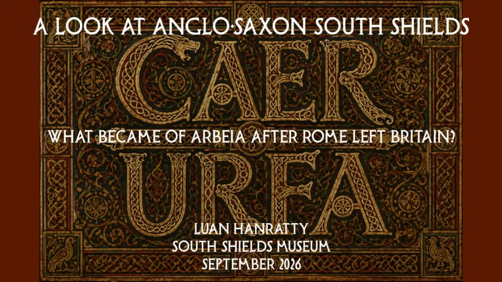
Understanding the Name, Caer Urfa
Anglo-Saxon Timeline at Caer Urfa
Spiritual and Temporal Power
The Whole is Greater than the Sum of its Parts
The Late Empire at Arbeia

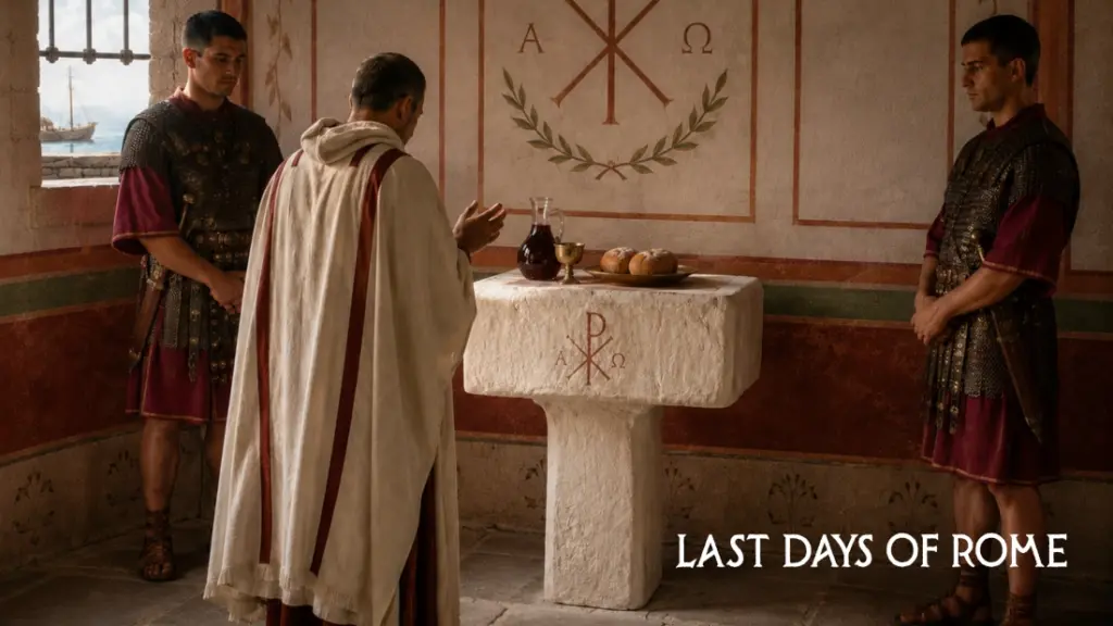
In the museum at Arbeia in South Shields is a truly remarkable object. It is the only Christian altar from the Roman period found in Britain. But what makes it so special is that it is a tangible marker of the transition from paganism to Christianity in the late 4th century.
Concurrent with this transition was a decline in the upkeep of the fort, and at this time, the fort’s headquarters (principia) probably transitioned into a church, mirroring the evolution of churches and basilicas throughout the Empire.
The principia was the religious and ceremonial centre of a Roman fort, and it seemed this role continued with the arrival of Christianity. Through the transition, we can see not just the strategic, but institutional significance of the fort surviving perhaps well after the Roman military that created it had disappeared.
We know rather more about the name, Arbeia, than about the name which interests me most as the subject of this essay, Caer Urfa. However, there is still some doubt about whether Arbeia was South Shields Roman fort. Here are 9 clues that support that theory:
- It’s well established, by Nick Hodgson (2005) in particular, that Arbeia meant ‘Place of the Arabs’ in Aramaic. It’s a straight transliteration of that word: Arbaya.
- There was a Palmyrene governor at South Shields, or at least he was a high status individual, called Barates.
- South Shields is the only place in Britain where an Aramaic inscription has been found.
- The order in which Arbeia appears in the list of Roman forts in the Notitia Dignitatum, next to the Wall forts, but above the smaller Durham and Yorkshire forts, points to South Shields.
- Specialist bargemen would have been especially needed in such terrain as the Tyne estuary.
- South Shields is one of the biggest, most significant forts in the country, it would have had a prominent place in the Notitia list, which Arbeia does.
- The altar is also unique and points to a perhaps more sophisticated practising of the Mass, imported from the East.
- Diocletian’s fort style was adopted at South Shields around the time he conquered the upper Tigris region in 289.
- The governor’s house at South Shields is built in an Eastern, rather than Mediterranean, architectural style.
As Hodgson outlined in his 2005 paper on the matter, Roman forts were often named after the unit or the homeland of the unit stationed there. In which case, there may also be some link with the city of Erbil in northern Mesopotamia, which was called Arbela in classical antiquity and was one of the two major centres of Eastern Christianity in Mesopotamia from around AD 180, along with Edessa, now known as Urfa… a most extraordinary coincidence.
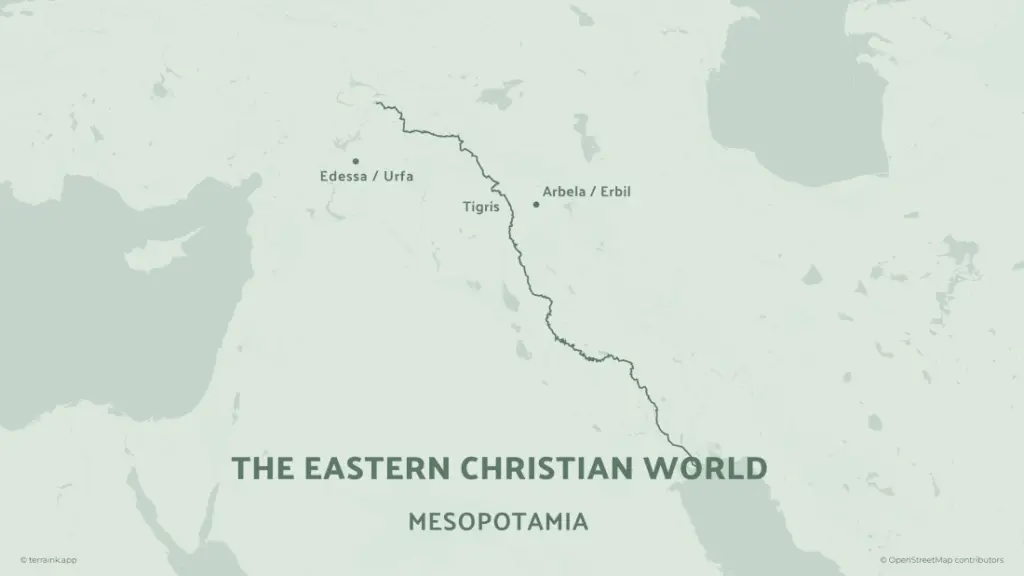
The Romans conquered northern Mesoptamia in 198 under Septimius Severus, and kept it as an Eastern outpost until 363.
Let’s look at what the Notitia Dignitatum actually says about Arbeia. It is the main document of the late Empire and is where we get such knowledge as the name, Segedunum.

Sub dispositione uiri spectabilis ducis Britanniarum: … Praefectus numeri barcariorum Tigrisiensium, Arbeia
Under the command of the Right Honourable Duke of the Britains: … Prefect of the unit of Tigris boatmen, Arbeia
It is at this point where Arbeia appears quite significant in the military infrastructure of the island. It is not merely a fort on the fringe anymore, but a base for a large company of troops from thousands of miles away. We can deduce that the numeri barcariorum was a large company of soldiers, as the barracks remodelled in the late 3rd century are especially extensive.
A bacarius was a type of flat-hulled lighter and coincidentally, these would have been perfect for use in the shallow River Tyne, particularly at the entrance with its numerous sand shoals and hazards. We can also theorise that there was a fair bit of boat building going on below the fort at that time.
Putting it all together
In my view, it’s safe to assume that the Arbeia altar was the property of the unit of Arab bargemen stationed at South Shields and that they brought their religion to Britain. Still today, in the hills of northern Iraq there are many ruined monasteries and traces of ancient Christianity that was well established for generations before the bargemen were recruited to Britain.
This was likely after 298, and possibly during the reign of Diocletian. He had reconquered the Tigris territory in 298, and South Shields fort appears to have been relaid according to his prescribed style, noticeable in other forts in the East such as Palmyra and Antioch, as well at his palace in Split. However, Diocletian was an intense persecutor of Christians, so to what extent the Tigris bargemen keep their faith covert during his rule, we can only guess.
It’s worth noting that Christianity had been established as a minority religion for decades in Britain too, but never has an altar been found.
Continuity
The Arbeia altar may well have been in use in King Oswin’s time in the first half of the 7th century. The altar may be the key link in the intervening 250 years between Roman rule and the Northumbrian Golden Age.
Could this idea of continuity even challenge the idea that Christianity arrived independently in Northumbria with Edwin and Paulinus in 627 or with Oswald and Aidan in 635?
We don’t know, but the fact is, a Christian object from the late Roman period has remained in situ at the site all the way through the archaeological record of the following centuries, until the place was completely abandoned following the late 9th century destruction referenced by Symeon of Durham and John Leland.
This degree of survival and possible continuity of use is fascinating to think about.
It also means Oswin and his father, Osric, were familiar with Christianity from the confines of their own palace, the altar being a fixture that was left untouched in the headquarters. This was well before they converted to Christianity, so that even as pagans, Christianity was not a new idea to them and therefore it was probably not a huge leap of faith when they finally did convert.
John Leland, The First Antiquarian
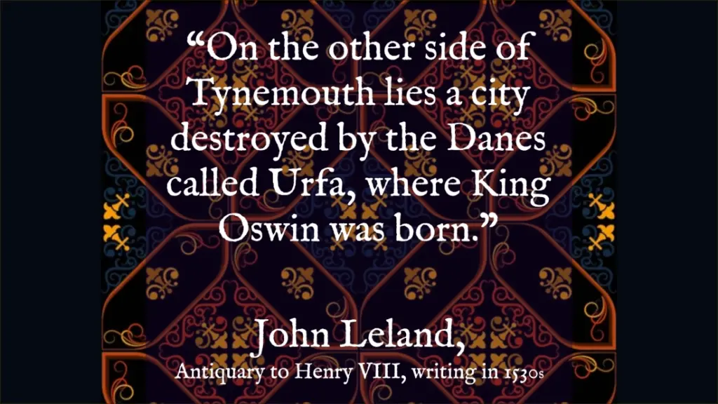


Why should we take Leland seriously with his enigmatic and esoteric fragments about this mysterious city of Caer Urfa at South Shields?
Some may say that we only have his two or three references for the name Caer Urfa, so that doesn’t count for much. Actually, we only have his references for the name Penbal Crag too – it’s in the very same passage. It is also Leland who tells us about the first chapel at Tynemouth built by Edwin in 627 and rebuilt in stone by Oswald in 634.
John Leland (1503-1552) was England’s first and probably greatest antiquarian. It is for good reason that he is known as “the father of local history”. Leland was extremely well-read and well-travelled for his time, and he provides us with some of the earliest detailed descriptions of the region. Leland wasn’t just a chronicler, he went out into the field and wrote about what he learned and saw. He represents the beginning of a tradition of observation and practical deduction in the compilation of the nation’s history.
Leland’s title was that of librarian to Henry VIII and in this role he was given authorisation by the King to examine and catalogue the libraries of every religious house in England.
The specific authority of Leland in the question of Caer Urfa, comes from the visit he made to Tynemouth prior to its dissolution in 1539, when the Prior of Tynemouth was removed from office, given a pension and sent to live in Benwell.
This is when Leland gleaned so much extraordinary information from the monks. With Tynemouth being known far and wide as the shrine of Saint Oswin, the monks must have possessed a cherished hagiography of the man and probably a large and ancient body of further tradition relating to him.
It was following Leland’s visit that Oswin’s shrine was destroyed and the monastic community that preserved this knowledge was dispersed.
Therefore, in the face of possible scepticism about Leland and his unique and scant references to Caer Urfa, I would contend that no one was better placed to save and communicate this arcane knowledge down to us, knowledge that subsequently vanished forever.
If we are going to seriously investigate the origin of South Shields, we have to take Leland seriously and treat his writings as precious. Many pieces of antiquarian knowledge survive precisely because one person happened to write them down before they were lost or destroyed. Sometimes a single surviving witness is all that history gives us and in this instance, it is not just any witness but a royal antiquary of the greatest eminence who witnessed the end of the medieval world.
South Shields Razed
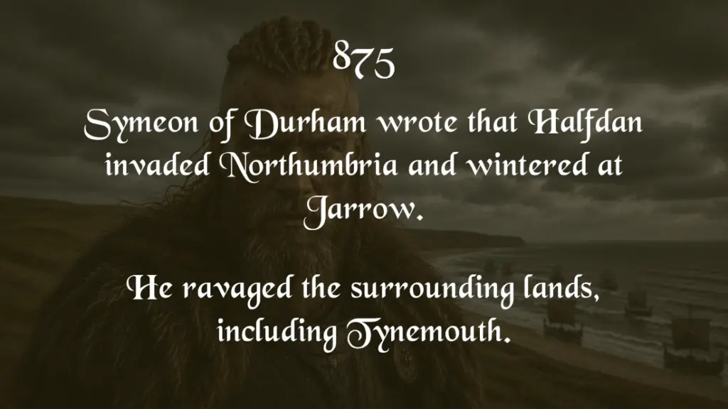
The event that Leland alludes to was probably Halfdan’s invasion and wintering at Jarrow Slake in 875, when he spent the time ravaging the surrounding region.
We know this from the writings of the foremost medieval chronicler of the region, Symeon of Durham, who lived in the 11th century.
According to Symeon, after this point the Danes went on to settle Northumbria. This is likely to be when Caer Urfa was abandoned for good.
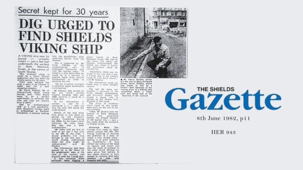
There happen to be two well-known and perhaps conflated instances of a Viking boat found in South Shields town centre, alongside the course of the long-dried up Mill Dam Creek. One was documented in the mid-19th century, another was unearthed on Denmark Street in 1910 (HER 843).
Also according to Symeon, several years after the ravaging of the region, the Vikings in Northumbria elected a King called Guthred from Jarrow, and crowned him on Oswiesdune, translated as the “Hill of Oswin”. Guthred then granted the neighbouring lands “between the Tyne and the Wear” back to the Church.
Surely South Shields Lawe is a prime candidate for this place…

Again, what we’re seeing here is a chain of evidence that points to an important medieval royal centre being at South Shields.
Let us return to Leland’s claim about the birthplace of Oswin being a royal palace at South Shields.
Oswin’s Father
Osric of Deira (d 633/634) was a cousin of Northumbria’s first Christian King, Edwin. Osric became King of Deira for around one year before his death. This was when Northumbria was thrown into chaos and devolved into its two constituent parts following Edwin’s death.
Bede wrote that Osric was a Christian who reverted to paganism on coming to power, just as his opposite number in Bernicia, Eanfrith, renounced the faith when coming to power at the same time.
Osric, then, likely became a Christian when Oswin was a teenage boy, but as stated, they may have been at least partly familiarised to the faith by the Roman altar in situ at their home at the Burgh.
What Was a Burgh?
Leland writes of the birthplace of Oswin as:
castro Burgh antiquitus
[meaning: “ancient Burgh castle”]
Burgh is simply an Old English word for Caer. They were fortified settlements built across Anglo-Saxon England. Typically, they acted as strongholds protecting a strategic point and controlling movement.
However, Caer Urfa is not listed as one of the administrative burghs that were at their height as a formal defensive system during the reign of Alfred the Great.
You can see from Leland’s writings, though, that he was trying to see where it fit into this network of ancient strongholds that were listed by Henry of Huntingdon in the 12th century, and which Huntingdon had partly inherited from lists circulated since the times of Nennius and Gildas.
Leland, in my reading of his notes and of his character, would have been deeply puzzled over this newly discovered Caer Urfa’s place, or lack of it, in the scheme of things nationally.
Understanding the Name, Caer Urfa

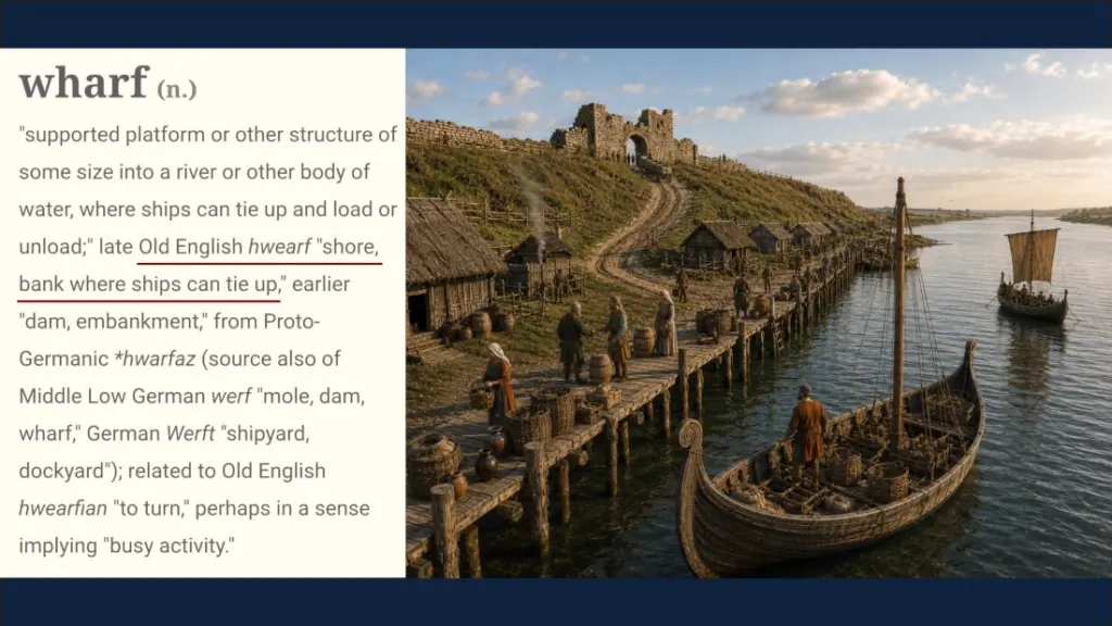
Occam’s razor comes into play for me in testing theories for the meaning of the name. In other words, it’s the simplest explanation that’s going to be the closest one.
Maybe by the time of the 7th century, the presumably extensive wharves were the only fully functioning, fully intact features of the place, hence the name. That may well have been what the area was primarily known for: being a port and a dock, well after the fort ceased being a bustling garrison.
There are other theories, but I haven’t heard one that is phonologically or semantically closer than ‘Shore Fort’. In other words, unlike alternative explanations for the name Caer Urfa, calling it the ‘Shore/Wharf Fort’ is based on a fact about the place, and actually sounds similar to the word ‘urfa’.
One honourable mention is the River Wharfe in Ilkley, Yorkshire, where Verbeia was the goddess of the dale. The Wharfe is thought to be called that because the river has so many bends in it. Interestingly, the Roman fort at Ilkley is sometimes presumed to be Morbio, listed next to Arbeia in the Notitia Dignitatum.
Then a further theory comes from the Old English word, weorf, meaning cattle. Could the abandoned fort have transitioned into a stockade and livestock enclosure, where it became the ‘Cattle Fort’?
I’m going to stick with Occam’s razor here.
Anglo-Saxon Timeline at Caer Urfa
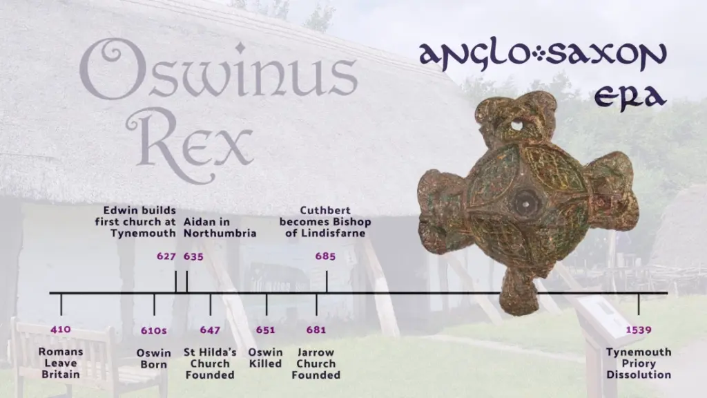
The sparsity of Anglo-Saxon finds at Arbeia is the one slightly frustrating aspect of this study. Summarised on Historic Environment Record entry 915, the archaeological evidence for medieval occupation is quite scant. But, there is also a massive caveat on this point:
- Large parts of the fort remain unexcavated, including the south-west quadrant, which is nearest the vicus (civilian settlement), where we know the ditch was extended and refortified.
- The vast area surrounding the fort is unexcavated, including the vicus, which could have been a thriving spot in the Anglo-Saxon era.
Main Objects, 7th-9th Centuries:
- gilded harness fitting or clasp, created in the Irish style, possibly 8th century
- stylus
- 2 gaming pieces
- die, possibly 5th century
- spur
- copper and bone dress pins
- pin beater
- bead
- spearhead (HER 938)
Building Changes
- Crude paving was laid down in the governor’s house in the south-east quadrant in late 4th or early 5th century. Similar to 5th century Birdoswald fort.
- Two late 4th century skeletons of people who were murdered then left exposed and much later buried inside the governor’s courtyard in the early 5th century. They were buried alongside dogs and sheep indicating a ritual burial. This burial marks the end of Roman use of the courtyard buildings.
- A new ditch was dug around the south-west corner of the fort and the West Gate. The stone arch of the gate was replaced with a more modest timber doorway.
- At least two 5th century burials (HER 916) lie in the approach road to the West Gate. This is an odd place to site graves and it marks the disuse of the road.
Some conclusions:
- It appears the Romano-British occupants were vulnerable to attack from presumably Brigante or Anglian warbands.
- Presumably, a timber hall was constructed, perhaps on the unexcavated quadrant next to governor’s house.
- The evidence, despite the lack of it, does show that the site remained in use from the time the Romans left up until the 9th century, which fits with the documentary evidence outlined above.
A More Detailed Timeline
- 610s – Oswin born
- 627 – Tynemouth chapel of Edwin
- 633 – Battle of Heavenfield, Oswald unites Northumbria
- 634 – Tynemouth chapel rebuilt in stone by Oswald
- 635 – Aidan arrives in Northumbria, Lindisfarne church founded and use of the Farnes as refuge
- 644 – Oswin becomes King of Deira following a break with Oswy after Oswald’s death
- 647 – Hilda’s church near Caer Urfa founded by Aidan & Hilda. Oswin must’ve been involved given his close friendship with Aidan
- 651 – Aidan’s death, then Oswin’s murder
- 674 – St Peter’s, Monkwearmouth, founded
- 681 – St Paul’s, Jarrow, founded
The point of this timeline is to illustrate the flurry of events that surround Oswin’s rise and reassociation with Deira and South Shields in particular, the site of the royal palace and place of his birth.
It’s interesting to note that according to Bede, Cuthbert as a young lad, witnessed the building of St Hilda’s at Caer Urfa.
Spiritual and Temporal Power

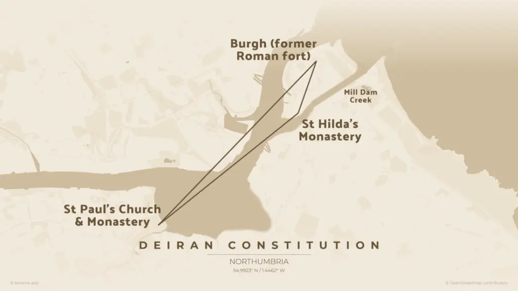
Another interesting thing is that South Shields is as close to Jarrow, at 3 miles, as Bamburgh is to Lindisfarne.
Maybe this was intentional. Maybe these early Anglian kings felt that the spiritual centre should be within sight of the political and temporal power centre and within easy reach by water.
We almost always find the earliest Anglian churches in Northumbria to be next to streams.
At that time, Jarrow was in plain view from South Shields Lawe. In between them, close by the seat of royalty at the Burgh, you have a third point: the earlier religious centre of St Hilda’s Monastery, which lies under the site of St Hilda’s Church today.
Again, this was about keeping religion close to power. And again, this is what we see with the monastic refuge on the Inner Farne island, just off the coast of Bamburgh.
So you have one religious cell for separation and contemplation, essentially Benedictine, as in St Hilda’s and Inner Farne. Then on the other hand, a little further away, there’s a religious centre for learning and engagement with the world, essentially mendicant orders, as in Lindisfarne and Jarrow.
This gives us a triangulation and ‘holy trinity’ and it seems to be a deliberate parallel, pattern and a constitutional arrangement: one in Deira, one in Bernicia.
Timeframe of Oswin’s Rule
Oswin was crowned in 644, just 3 years before Hilda’s church was founded by his close friend and ally Aidan, whom he was patron.
It is fair to assume Oswin still used the site of his birth as a royal seat when he came to power, and it is fair to assume he was involved in the founding of Hilda’s church.
This is absolutely key to proving Leland’s claim that Caer Urfa was at South Shields.
Enmity and Affinity Behind Caer Urfa as a Base
Oswin’s enmity with Oswy is key to the need for a parallel power structure in Deira.
Oswin had a long-held affinity with South Shields, enough for him to found one of Northumbria’s earliest churches and monasteries there, shortly after coming to power.
Was South of the Tyne, Deira? 7 Reasons It Was:
- The Deiran frontier was fluid. Symeon of Durham, the most important medieval chronicler in this area, claims that Deira went as far north as the Tyne.
- This makes sense because at the time of Oswin, for instance, the Deirans needed a presence as far north as possible because Oswy couldn’t be trusted not to usurp lands directly to the south of him.
- Other chroniclers have said that the Wear was Deira’s limit. The area between the Tyne and the Wear was for many centuries a buffer zone (later becoming known as Haliwerfolc as a result of Guthred’s granting of the land to the Church). At any rate, the exact boundary is somewhat a moot point because it all got united under Edwin, then properly under Oswald, then again under Oswy. Northumbria was the greater political entity.
- South Shields, if it was in Bernicia, was clearly important enough to have a royal seat, potentially in competition with Bamburgh. But then Oswin was a Deiran King…
- It’s worth bearing in mind that the Celtic kingdom of Bryneich, that is, the land of the Votadini that preceded Bernicia, didn’t reach south of the Tyne, which was Brigantian territory.
- The Tyne corridor was a contested zone, making South Shields a Deiran outpost and frontier fort. It was perfectly placed and ready-made to counter Bernician power.
- Finally, there is no bigger boundary in the region that the Tyne. It was always going to be nigh on impossible for a king in the far north of Northumberland to control what happened beyond it.
The Whole is Greater than the Sum of its Parts
Placenames
We actually have 7 potential placenames for ancient South Shields:
- Lugudunum — the supposed original name for the Roman fort
- Arbeia — the Roman fort from the late 3rd century
- Caer Urfa — the name Leland learned from the monks at Tynemouth
- The Burgh — another name Leland gleaned
- Oswiesdune — a mysterious mound for the crowning of kings
- The Lawe — an Old English name for raised mound
- The Heugh — an Old English name for a raised outcrop by water
Philology
Drawing from:
- Archaic Welsh — Caer, Penbal
- Latin — Notitia Dignitatum, Leland’s Itinerary
- Aramaic — Arbeia, Regina’s tombstone
- Old English — Urfa derived from hwearf, meaning ‘shore’ and ‘wharf’
Archaeology
So much archaeology lies undiscovered. Nevertheless, we do have some matters of interest:
- Roman altar, the only of its kind in Britain
- A handful of Anglo-Saxon finds, albeit from a later time. These finds must only scratch the surface of what lies beneath the streets and what lies beneath the fort still.
Written Sources
2 medieval and 2 Roman:
- John Leland
- Symeon of Durham
- Notitia Dignitatum
- Inscriptions — Regina’s tombstone (RIB: 1065), Barates of Palmyra epitaph (RIB: 1165)
All of this points to the natural importance of the place and so much having happened there over so many centuries.
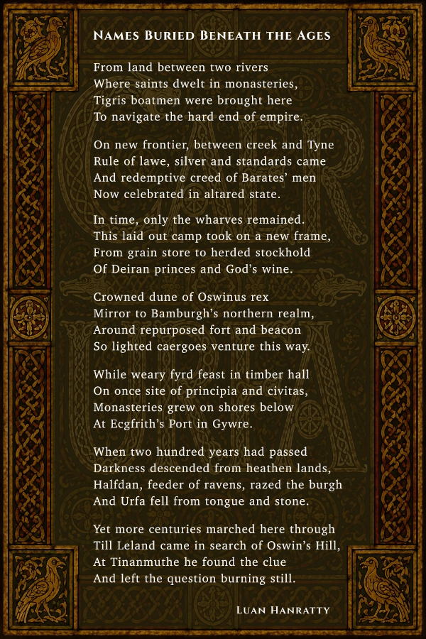
And hopefully, given everything covered in this topic, this poem makes a bit of sense…

Never miss an article. Enter your email or give our FB page a like