River names are vital to linguists in piecing together extinct languages, which in turn provides a glimpse into ancient societies. As massive geographical barriers, but also as the lifelines of civilisations, rivers represent the most deep-rooted place names. Tynemouth is no exception to this, being protected and provided for since time immemorial by these two waterways.

The Pow Burn
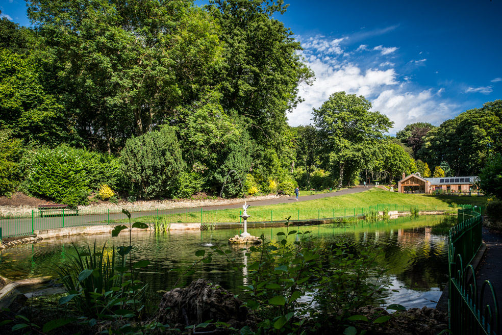
This old stream entered the Tyne at the eastern point of North Shields. It flowed through Spittal Dene, straddling today’s golf course and park, then ran below what is now Tanners Bank, through the site of Pow Dene industrial estate and emptied into the Fish Quay Gut.
The name is not unique. There are several powburns in Scotland and the word ‘pow’ comes from the Gaelic ‘poll’ meaning essentially ‘swamp’ or at best a very sluggish waterway. We can compare this with the Welsh for ‘pond’ being ‘pwll’, hence the word ‘pool’.
I imagine that the Pow Burn basin at high tides would have filled up to create a large pool, just as the nearby Willington Quay Gut does.
* Note, that the word ‘gut’ originates from the Proto-Indo-European *ǵʰewd-, ‘to pour’. **Note that a Mesolithic axehead was found in Willington Quay in the 1930s. *** Willington Quay/Low Howdon has been heavily built on and covered with massive ballast dumps, indicating that, similar to North Shields, the gut of the Wallsend Burn would have been a good deal wider in the past.
In modern times, the Fish Quay was repeatedly built over and industrialised and the Pow Burn became culverted and pushed below ground, so that today nothing really remains of this once useful and undoubtedly pretty stream.

The Tyne
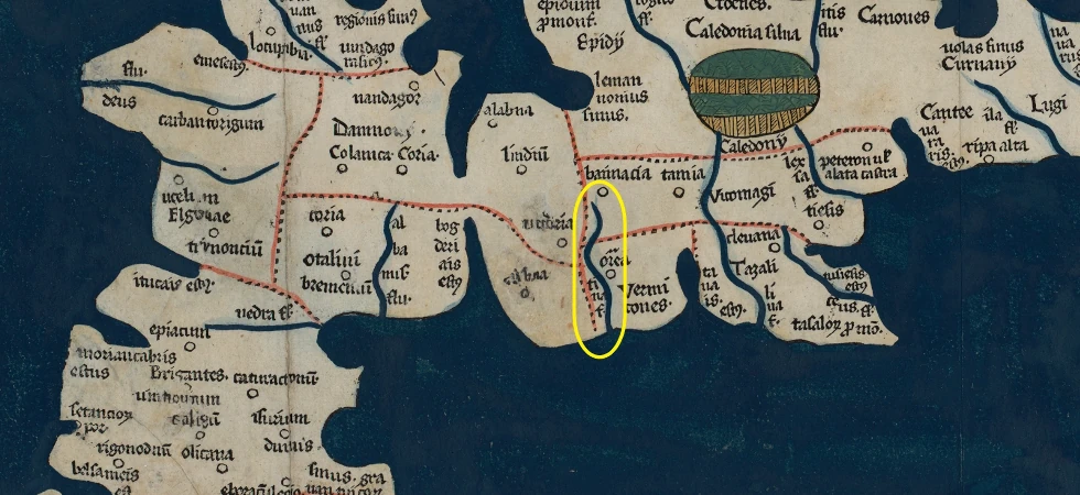
Ptolemy’s map, from around 150AD, marks a river called Tína, though this is a bit more likely to have been in Scotland. Later maps, such as the Ravenna Cosmography from 700AD, reiterate this puzzling name.
Like the powburns, there are a few tynes around and they tend to be associated with harbour estuaries, especially with prominent headlands. With this topographical observation in mind and the river’s snake-like quality, one theory from the fascinating romaneranames.uk provides a Latin origin: tinea —a gnawing worm.
There may, though, be a more prosaic translation of Tyne. Here are the four other candidates for its root meaning:
- *teh2–
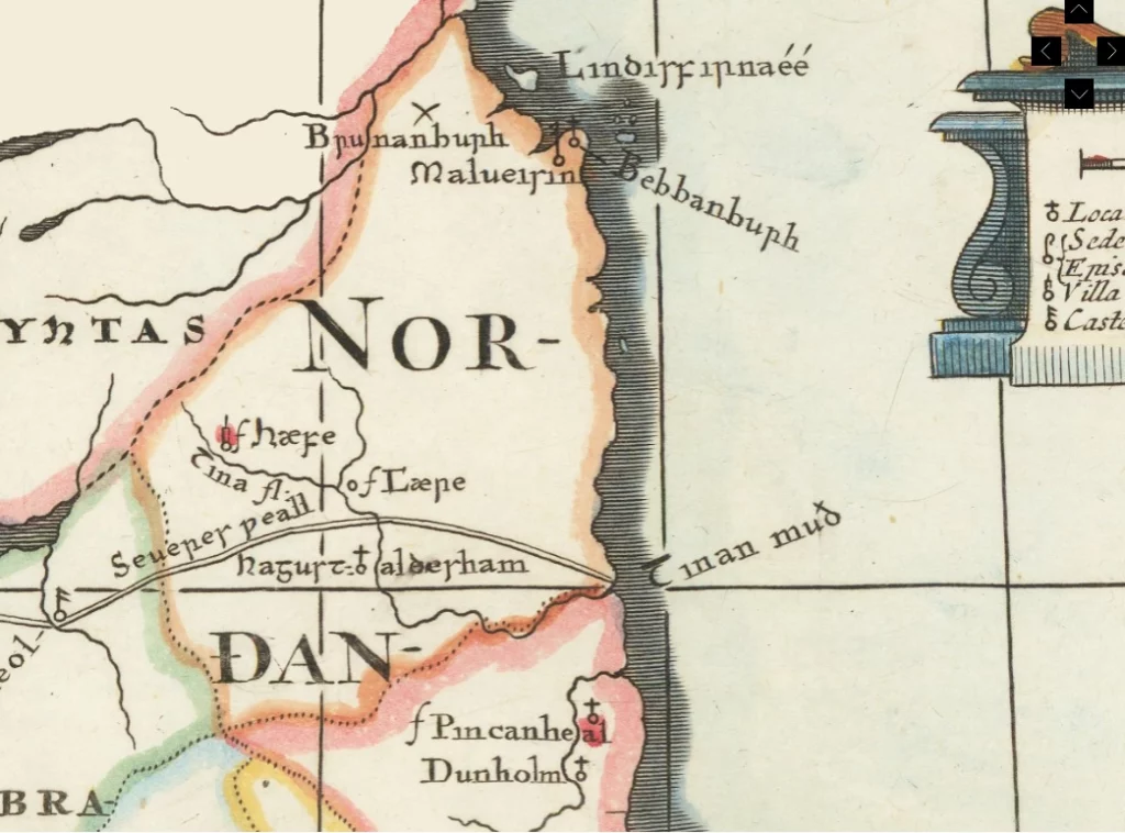
Like the hydronym ‘gut’ mentioned above, ‘tyne’ may have started out as a verb. *Teh₂- is the Proto-Indo-European for ‘flow’, ‘stream’, and ‘melt’, with the Proto-Celtic root being *tīn and the Old English name for the Tyne on a 17th century map of Saxon place names being Tīnan (dative case—i.e. ‘that which flows/washes’).
A likely cognate here is the Tenna River in the Italian Marches (Latin:Tinna).
- *teng1–
A close semantic relation to the above, is this PIE verb for ‘wet’, ‘soak’ and ‘dunk’, which gives us the words ‘tinge’, ‘stain’ and ‘taint’ coming from Old English þān.
- *teihx
‘muck’ (excrement) found in Welsh, Cornish and Breton as ‘tail’. Does the Black Middens ultimately reference this? Maybe it’s a stretch, not in terms of salience, but phonology.
- *ten-
‘to pull/stretch’. See Welsh ‘tyn’. This root also gives us the English words ‘thin’, ‘tendon’, ‘tenacious’ and ‘tenure’.
Interestingly, the Old English rǣċan (‘to reach’) originates as the reach of a river and this ultimately derives from PIE *hreyǵ- ‘to stretch’ or ’straighten’.
My own view is that the first of these PIE roots meaning ‘flow’ is the correct one. This is because I believe the local inhabitants, as a matter of course, contrasted the Tyne with the Pow, as the Pow is by definition, sluggish, short and small, while the Tyne has length, breadth, power and above all, a constant flow.
References: James, Alan – Brittonic Language in the Old North (2022). https://www.romaneranames.uk/ https://lrc.la.utexas.edu/lex/master/1992
Local Society
We can almost start to build a picture of Tynemouth during the Iron Age. The sandy spit of land where the Pow Burn and the Tyne met, really is a place of optimal geography. This is why it eventually provided the starting point for what became North Shields. The confluence of these rivers at the Narrows of the harbour, with the silting up of the inner bar, made it the shortest and shallowest crossing point for miles. The inlet is south facing and the flow of water would have washed away their refuse, keeping their environment generally clean. The tidal pool would have been an excellent salmon trap and perfect for mooring boats. As well as all this, it is right next to a big expanse of tidal rocks from which they could harvest large amounts of shellfish, which Jobey’s excavation of the Priory in 1967 shows that they ate in huge quantities.
We know people have been living in the Pow Dene a long time because neolithic stones have been found there, including an axehead in the allotments on Mariners Lane. The dene would have provided shelter from the elements, while the Pow Burn must have yielded healthy drinking water, as in medieval times it was salubrious enough to serve the leper hospital there. The people who dwelt there all the way up to the settlement at Marden (a high point locally) would have hunted off the land and foraged off the river banks and bays. The Pow Burn and the Tyne were central not just to their survival, but their identity.
The Tyne would have also served as a highway, making them not just mobile, but important people in the wider area and even across the Old North. “Strong Rock Head”, discussed in the previous post, would have functioned as their lookout, grazing area, stockade, and possibly as a minor seat of power, as well as a place of ceremony.
These ever-flowing rivers both supplied and protected the early culture at Tynemouth and it was not unusual for rivers to be venerated and associated with particular gods and goddesses. It’s likely, then, that the Tyne was honoured in this way and talked about with as much reverence and fondness as it is today.
Third local linguistics post next week featuring two forts and a fosse…
Never miss an article. Enter your email or give our FB page a like

Great read keep them coming.