Wood frame has a 3cm face width. Printed on 350g matt texture paper and shipped ready to hang.
Artwork size: 16”x12”.
Glass cover.
Bright white mount has a border of 5.7cm.
Overall Dimensions: 22″x18″
- Tax included.
- Refunds & Returns.
£29.00
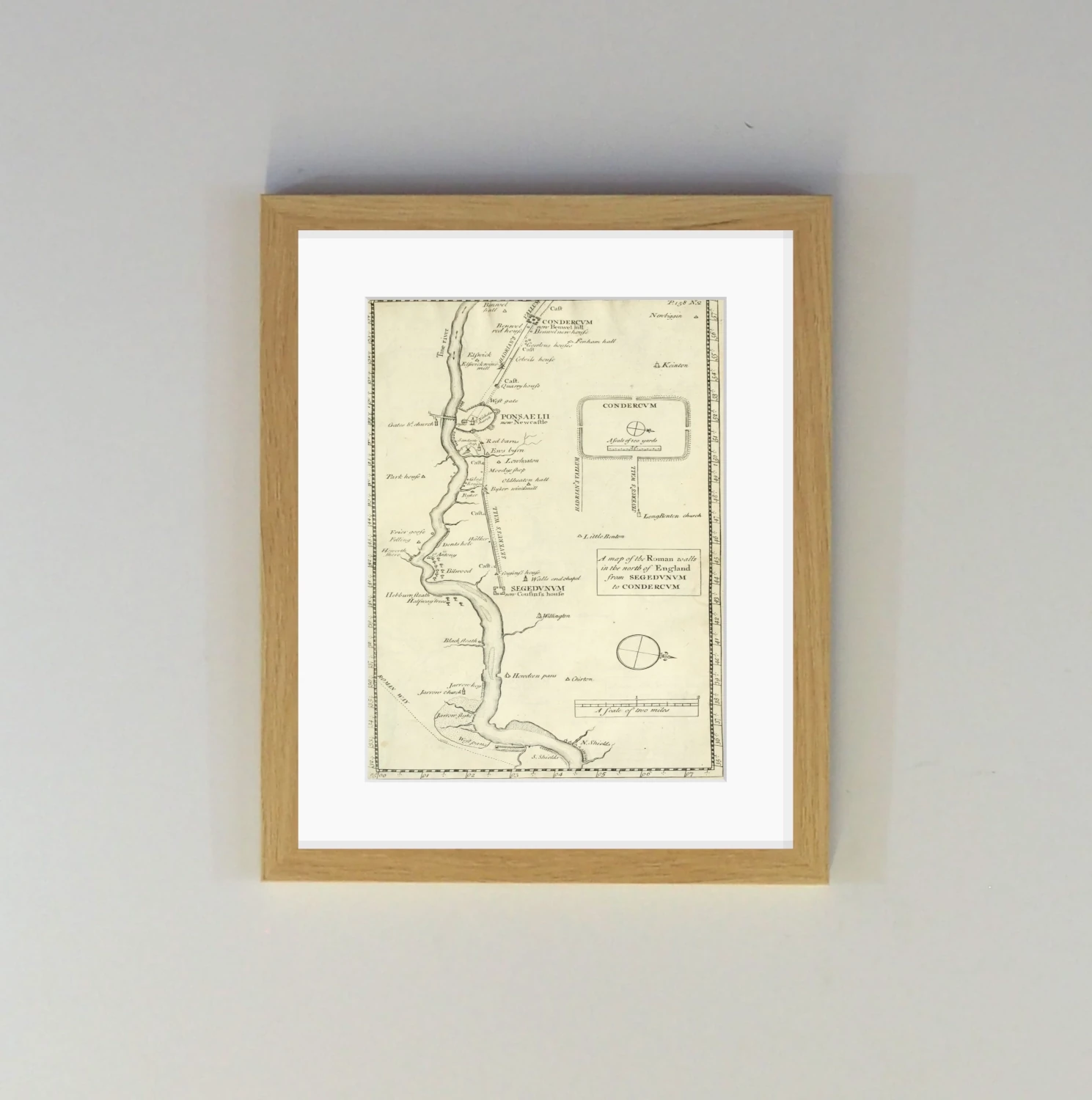
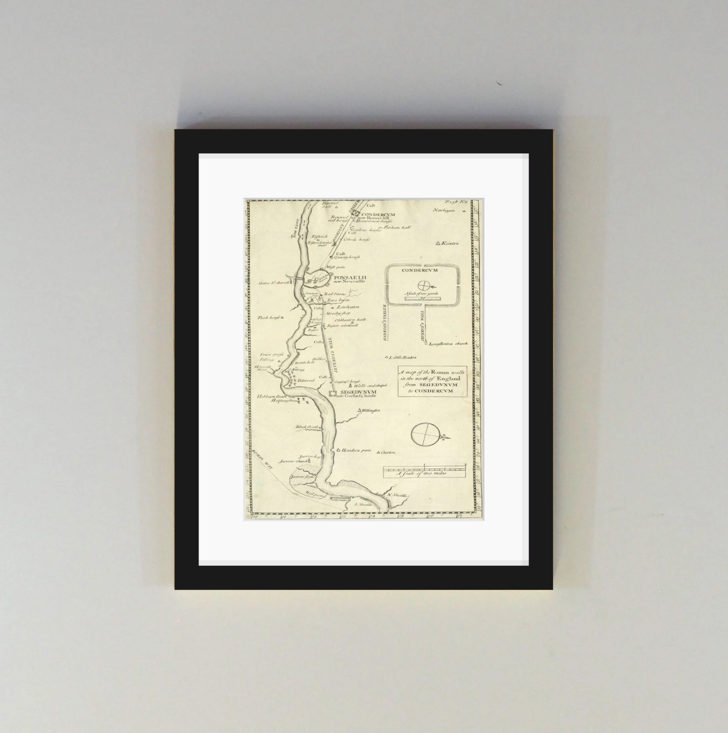
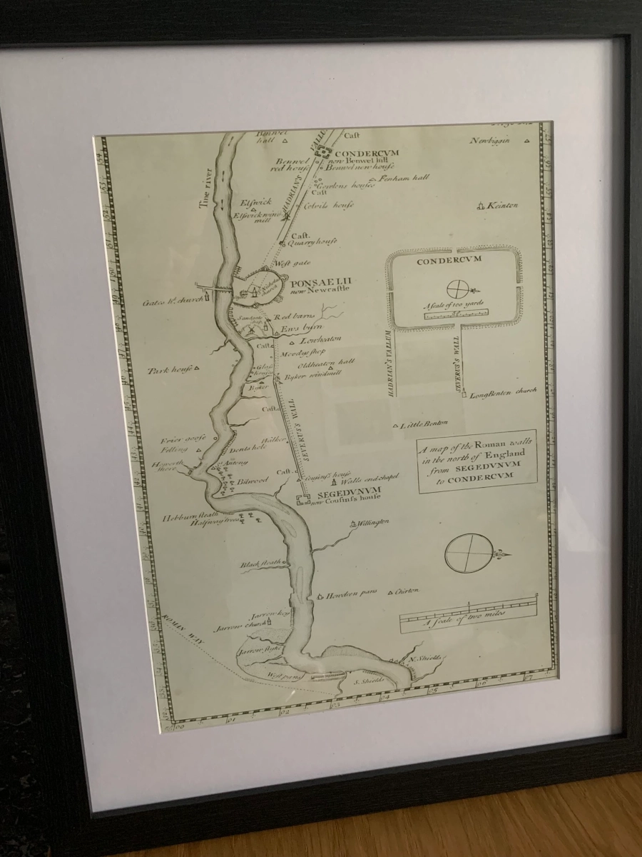
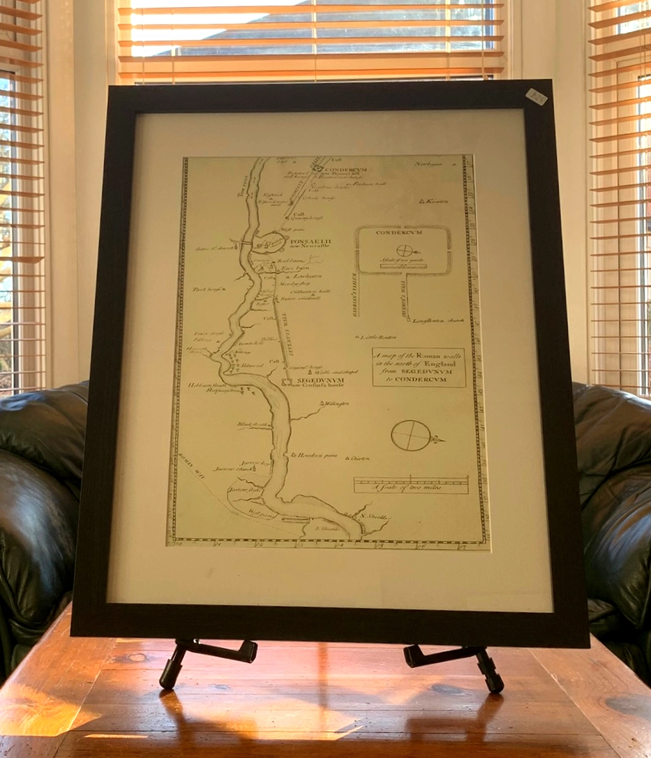
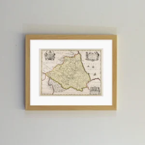
This map is contained in antiquarian John Horsley’s great work, Britannia Romana, in which he catalogued every extant Roman find in the country, forming the forerunner to the encyclopaedic, Roman Inscriptions of Britain.
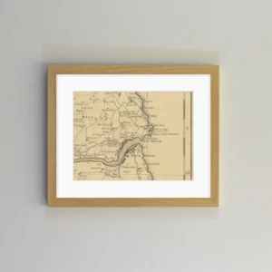
Titled “From Segedunum to Condercum”, this section depicts the Tyne, from the Pow Burn and Sikket Burn in North Shields all the way to Benwell Hall, labelled “Bennel hall”, which was knocked down in 1982.
In Town, the map shows Hadrian’s Wall terminating at the area between the Castle and St Nicholas’ Church, that is, the start of the Side/Amen Corner. As the area is built up by this time, the course is marked by a dotted line. The line becomes full from Milecastle 5 at the Big Lamp on Westgate Hill.
Alongside the main map is a plan of Condercum Fort (Benwell), with both “Severus’s Wall” and “Hadrian’s Vallum” intersecting the fort (at this time no one knew that the entire Wall was the work of Hadrian). The Vallum runs around the line of the fort’s south wall, indicating it was dug just after the foundations were laid. Condercum is the only Wall fort where this happens, so we can infer that the forts were probably started around the same time as the Vallum, but the building of them accelerated ahead of the digging (from east to west).
East of Newcastle, the Ouseburn and Byker are shown as fledgling areas of industry. Down river, a large sandbank sits off Wallsend at the mouth of Stott’s Pow. There are two more big shoals in the Long Reach, being Cock Raw Sand at Hebburn and Howdon Sand. West of North Shields, Dortwick Sand at the bottom of Coble Dene is shown. The smaller Walker Sand and St Peter’s Sand in the Bill Reach also appear. These important navigational hazards are drawn clearly, but not named.
At the bottom of the map around South Shields, we see the “Roman Way”, or Wrekendyke, that skirted past Jarrow Slake, from which three tributaries enter the Tyne. In South Shields, the Mill Dam Creek is marked, with the ancient road stopping short of crossing the stream.
North Shields’ two long-since culverted rivers are displayed.* The Pow Burn ran alongside Tanners Bank, under Union Road and into the Gut, while the Sikket Burn flowed down Bedford Street to form a pool known as Dogger Letch which was crossed by the old Wooden Bridge above the Haddock Shop Dock.
* A widely shared version of this map shows an incorrect annotation here.
Wood frame has a 3cm face width. Printed on 350g matt texture paper and shipped ready to hang.
Artwork size: 16”x12”.
Glass cover.
Bright white mount has a border of 5.7cm.
Overall Dimensions: 22″x18″
| Weight | 0.57 kg |
|---|---|
| Frame Colour | Black, Light Oak |

Reviews
There are no reviews yet.